Open ledger · AOD.EU.ZERMATT.V00 · ORIGINALClose ledger · AOD.EU.ZERMATT.V00
Ledger AOD.EU.ZERMATT.V00
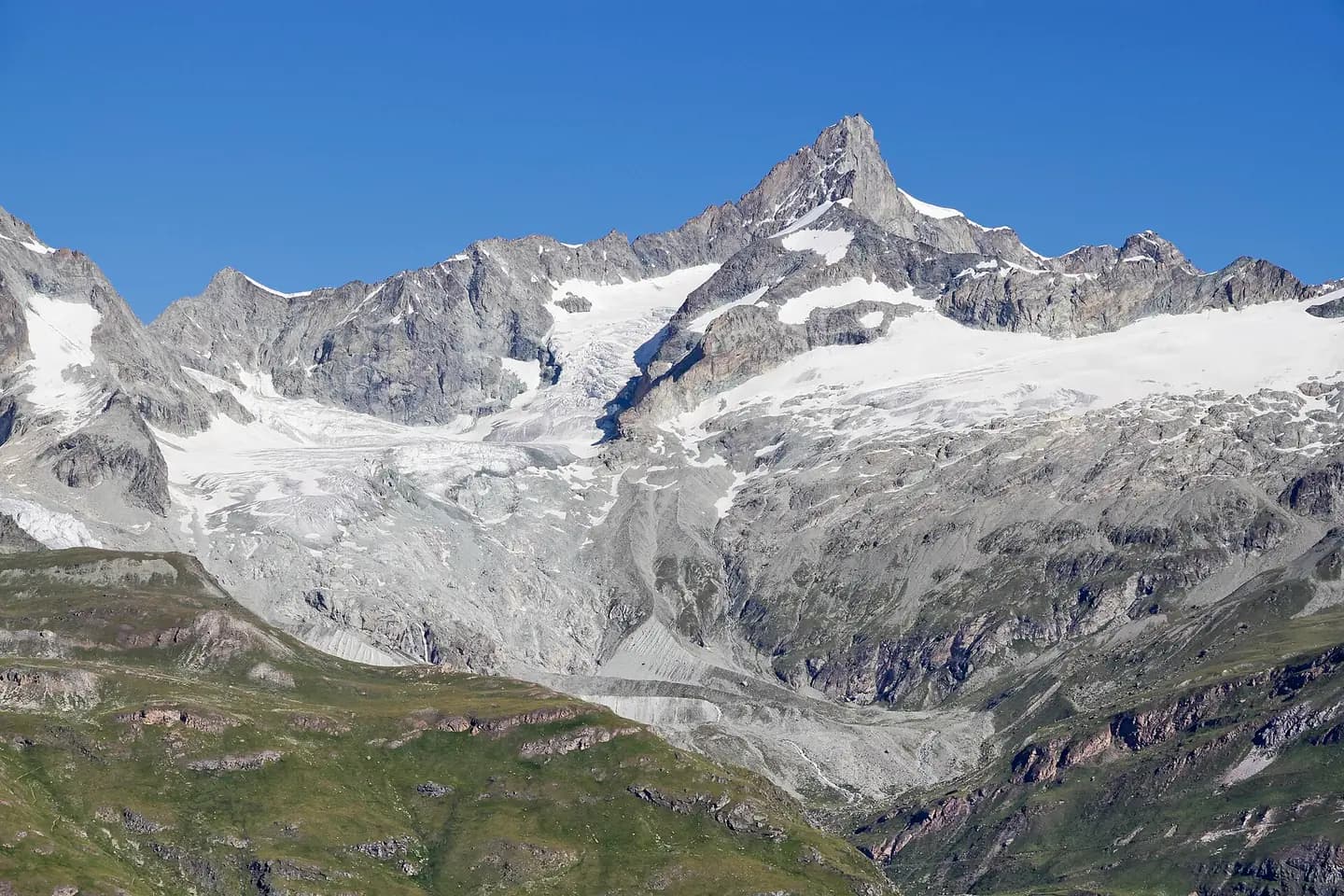
Zinalrothorn from mountain side between Zermatt and Gornergrat, Wallis, Switzerland, 2012 August
A view to Zinalrothorn from a mountain side between Zermatt and Gornergrat in Wallis, Switzerland in 2012 August. Glacier Triftgletscher and Rothorngletscher. This photograph is used as a geographic witness to the place, not as evidence of the historical date shown in the chapter.
- Visual description
- A view to Zinalrothorn from a mountain side between Zermatt and Gornergrat in Wallis, Switzerland in 2012 August. Glacier Triftgletscher and Rothorngletscher
- Nature
- original
- Medium
- Open-licence photograph
- Source
- Wikimedia Commons · CC BY-SA 4.0
BEFORE MODERN SPORT
Zermatt
How settlement, access and winter sport shaped Zermatt.
Scroll to read the contour through time
Zermatt is a municipality in the district of Visp in the German-speaking section of the canton of Valais in Switzerland.
Sources for this chapter
BEFORE TOURISM
Work and settlement beneath the snowline
Praborno or Prato Borno (Prato also means meadow) are the older names of Zermatt; they appear in the ancient maps as early as the thirteenth century.
Sources for this chapter
2006
A route reaches Zermatt
From here there is access to Schwarzsee via a gondola to the right, a cable car that leads on to the Trockener Steg midstation (and then on to the Klein Matterhorn); and a new gondola, opened on 18 December 2006, links Furi to Riffelberg on the Gornergrat mountain.
Sources for this chapter
Open ledger · AOD.EU.ZERMATT.V01 · ORIGINALClose ledger · AOD.EU.ZERMATT.V01
Ledger AOD.EU.ZERMATT.V01
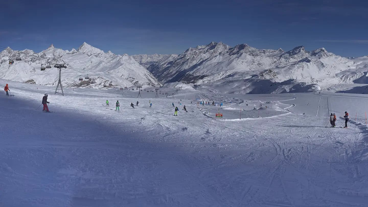
Skiing in Switzerland
Trockener Steg, Zermatt, Canton of Valais, Switzerland. This photograph is used as a geographic witness to the place, not as evidence of the historical date shown in the chapter.
- Visual description
- Trockener Steg, Zermatt, Canton of Valais, Switzerland
- Nature
- original
- Medium
- Open-licence photograph
- Source
- Wikimedia Commons · CC BY-SA 4.0
ORGANISED SPORT
Winter becomes organised
Zermatt is famed as a mountaineering and ski resort of the Swiss Alps.
Sources for this chapter
THE LIVING MAP
The mapped place
Zermatt is recorded at 46.021° N, 7.749° E. Its catalogue reference reaches 3,883 metres. A modern resort map compresses terrain, exposure and access into a diagram. This exhibition keeps the underlying contour visible so the place does not become only a list of facilities.
Sources for this chapter
Open ledger · AOD.EU.ZERMATT.V00 · ORIGINALClose ledger · AOD.EU.ZERMATT.V00
Ledger AOD.EU.ZERMATT.V00
Zinalrothorn from mountain side between Zermatt and Gornergrat, Wallis, Switzerland, 2012 August
A view to Zinalrothorn from a mountain side between Zermatt and Gornergrat in Wallis, Switzerland in 2012 August. Glacier Triftgletscher and Rothorngletscher. This photograph is used as a geographic witness to the place, not as evidence of the historical date shown in the chapter.
- Visual description
- A view to Zinalrothorn from a mountain side between Zermatt and Gornergrat in Wallis, Switzerland in 2012 August. Glacier Triftgletscher and Rothorngletscher
- Nature
- original
- Medium
- Open-licence photograph
- Source
- Wikimedia Commons · CC BY-SA 4.0
TODAY
Zermatt now
Passenger vehicles operating within Zermatt include small electric shuttles provided by hotels to carry visitors from the main train station (or the taxi transfer point just outside town) to the hotel properties, "electro" taxis operated by four major Zermatt families, and "electro" buses, which serve two routes: one between the major hotel areas and the stations of the various ski-lifts, and the other following a similar route but also serving the more rural "suburb" of Winkelmatten.
Sources for this chapter
THE LEDGER
Sources and credits
This exhibition is built from local, institutional and sporting records. The source ledger keeps the claims visible and leaves space for correction as further local evidence emerges.
Sources for this chapter
Artefacts in order of appearance
Zinalrothorn from mountain side between Zermatt and Gornergrat, Wallis, Switzerland, 2012 August
AOD.EU.ZERMATT.V00 · original · Wikimedia Commons · CC BY-SA 4.0
Skiing in Switzerland
AOD.EU.ZERMATT.V01 · original · Wikimedia Commons · CC BY-SA 4.0
Editorial record
Full European Beta edition. Place evidence is adapted from the linked Zermatt overview under CC BY-SA 4.0 and remains subject to named historical and local review. Cartography is generated from the PeakWave location catalogue.