
Open ledger · AOD.EU.ZELL-AM-SEE.V00 · ORIGINALClose ledger · AOD.EU.ZELL-AM-SEE.V00
Ledger AOD.EU.ZELL-AM-SEE.V00
Approaching Kaprun
The walk to Kaprun from Zell am See. Kaprun is in the distance. This photograph is used as a geographic witness to the place, not as evidence of the historical date shown in the chapter.
- Visual description
- The walk to Kaprun from Zell am See. Kaprun is in the distance
- Nature
- original
- Medium
- Open-licence photograph
- Source
- Wikimedia Commons · CC BY 2.0
BEFORE MODERN SPORT
Zell am See/Kaprun
How settlement, access and winter sport shaped Zell am See/Kaprun.
Scroll to read the contour through time
Zell am See is the administrative capital of the Zell am See District in the Austrian state of Salzburg.
Sources for this chapter
BEFORE TOURISM
Work and settlement beneath the snowline
The historic centre of Zell am See is located on the western shore of the 68 m-deep (223 ft) Lake Zell, with the villages of Thumersbach to the east, Erlberg to the southeast, and Schüttdorf directly to the south.
Sources for this chapter
2019
A route reaches Zell am See/Kaprun
In the 2019-20 ski season, the Zell am See Express 1 gondola was opened, which allows access to the Zell am See Express 2 gondola at the base of piste 21 from Viehhofen.
Sources for this chapter
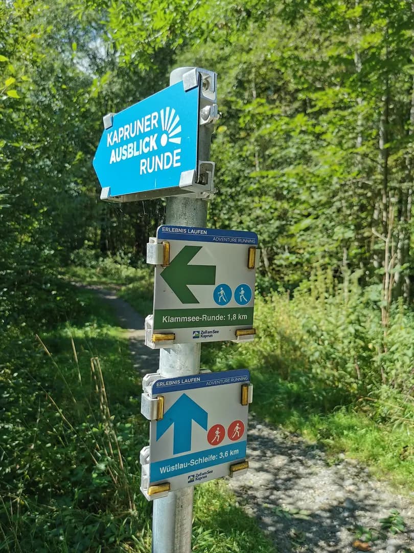
Open ledger · AOD.EU.ZELL-AM-SEE.V01 · ORIGINALClose ledger · AOD.EU.ZELL-AM-SEE.V01
Ledger AOD.EU.ZELL-AM-SEE.V01
AUT ; Land Salzburg ; Bezirk Zell am See ; Kaprun ; Kesselfallstraße (Klammspeicher, Schilder) 2021
Klammspeicher (Schilder für Fußgänger, Ski-Langläufer und Jogger). This photograph is used as a geographic witness to the place, not as evidence of the historical date shown in the chapter.
- Visual description
- Klammspeicher (Schilder für Fußgänger, Ski-Langläufer und Jogger)
- Nature
- original
- Medium
- Open-licence photograph
- Source
- Wikimedia Commons · CC BY-SA 4.0
2017
Winter becomes organised
In 2017, Zell am See announced a potential merger with Saalbach-Hinterglemm ski resort.
Sources for this chapter
THE LIVING MAP
The mapped place
Zell am See/Kaprun is recorded at 47.323° N, 12.796° E. Its catalogue reference reaches 3,029 metres. A modern resort map compresses terrain, exposure and access into a diagram. This exhibition keeps the underlying contour visible so the place does not become only a list of facilities.
Sources for this chapter
Open ledger · AOD.EU.ZELL-AM-SEE.V00 · ORIGINALClose ledger · AOD.EU.ZELL-AM-SEE.V00
Ledger AOD.EU.ZELL-AM-SEE.V00
Approaching Kaprun
The walk to Kaprun from Zell am See. Kaprun is in the distance. This photograph is used as a geographic witness to the place, not as evidence of the historical date shown in the chapter.
- Visual description
- The walk to Kaprun from Zell am See. Kaprun is in the distance
- Nature
- original
- Medium
- Open-licence photograph
- Source
- Wikimedia Commons · CC BY 2.0
TODAY
Zell am See/Kaprun now
Notable ski pistes in the resort include: The Trassabfahrt (14), which is the steepest piste in the region reaching an incline gradient up to 75%, the Standardabfahrt (13), which is another valley run reaching an incline gradient of 60%, and the recently reopened Tannwaldabfahrt (21), a ski-racing piste in the 1930s, and is well known for being consistently icy, and having a high steepness-width ratio in some sections of the piste.
Sources for this chapter
THE LEDGER
Sources and credits
This exhibition is built from local, institutional and sporting records. The source ledger keeps the claims visible and leaves space for correction as further local evidence emerges.
Sources for this chapter
Artefacts in order of appearance
Approaching Kaprun
AOD.EU.ZELL-AM-SEE.V00 · original · Wikimedia Commons · CC BY 2.0
AUT ; Land Salzburg ; Bezirk Zell am See ; Kaprun ; Kesselfallstraße (Klammspeicher, Schilder) 2021
AOD.EU.ZELL-AM-SEE.V01 · original · Wikimedia Commons · CC BY-SA 4.0
Editorial record
Full European Beta edition. Place evidence is adapted from the linked Zell am See overview under CC BY-SA 4.0 and remains subject to named historical and local review. Cartography is generated from the PeakWave location catalogue.