Open ledger · AOD.EU.ZAKOPANE.V00 · ORIGINALClose ledger · AOD.EU.ZAKOPANE.V00
Ledger AOD.EU.ZAKOPANE.V00
Zakopane Kuznice dolna stacja 2
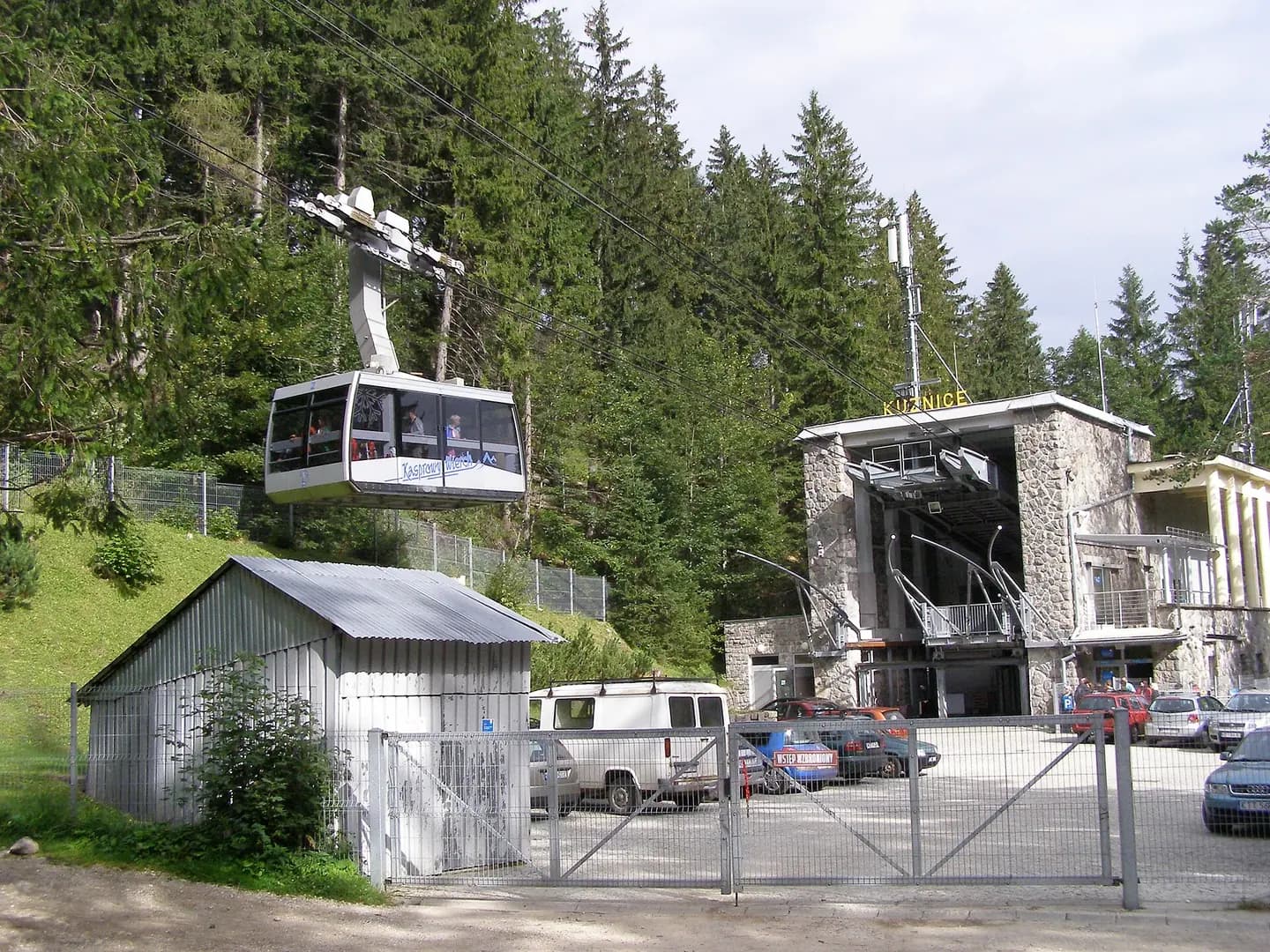
Zakopane - Kuźnice - the Kasprowy Wierch cable car lower station. This photograph is used as a geographic witness to the place, not as evidence of the historical date shown in the chapter.
- Visual description
- Zakopane - Kuźnice - the Kasprowy Wierch cable car lower station
- Nature
- original
- Medium
- Open-licence photograph
- Source
- Wikimedia Commons · CC BY-SA 3.0
BEFORE MODERN SPORT
Zakopane/Kasprowy Wierch
How settlement, access and winter sport shaped Zakopane/Kasprowy Wierch.
Scroll to read the contour through time
Zakopane (Podhale Goral: Zokopane) is a town in the south of Poland, in the southern part of the Podhale region at the foot of the Tatra Mountains.
Sources for this chapter
BEFORE TOURISM
Work and settlement beneath the snowline
Immediately after the war, a children's Home for Holocaust Survivors was established in Zakopane.
Sources for this chapter
ACCESS CHANGES
A route reaches Zakopane/Kasprowy Wierch
In the late 1800s, Zakopane constructed a road that went to the town of Nowy Targ and had railways that came from Chabówka.
Sources for this chapter
Open ledger · AOD.EU.ZAKOPANE.V01 · ORIGINALClose ledger · AOD.EU.ZAKOPANE.V01
Ledger AOD.EU.ZAKOPANE.V01
Kasprowy Gąsienicowa trasa narciarska
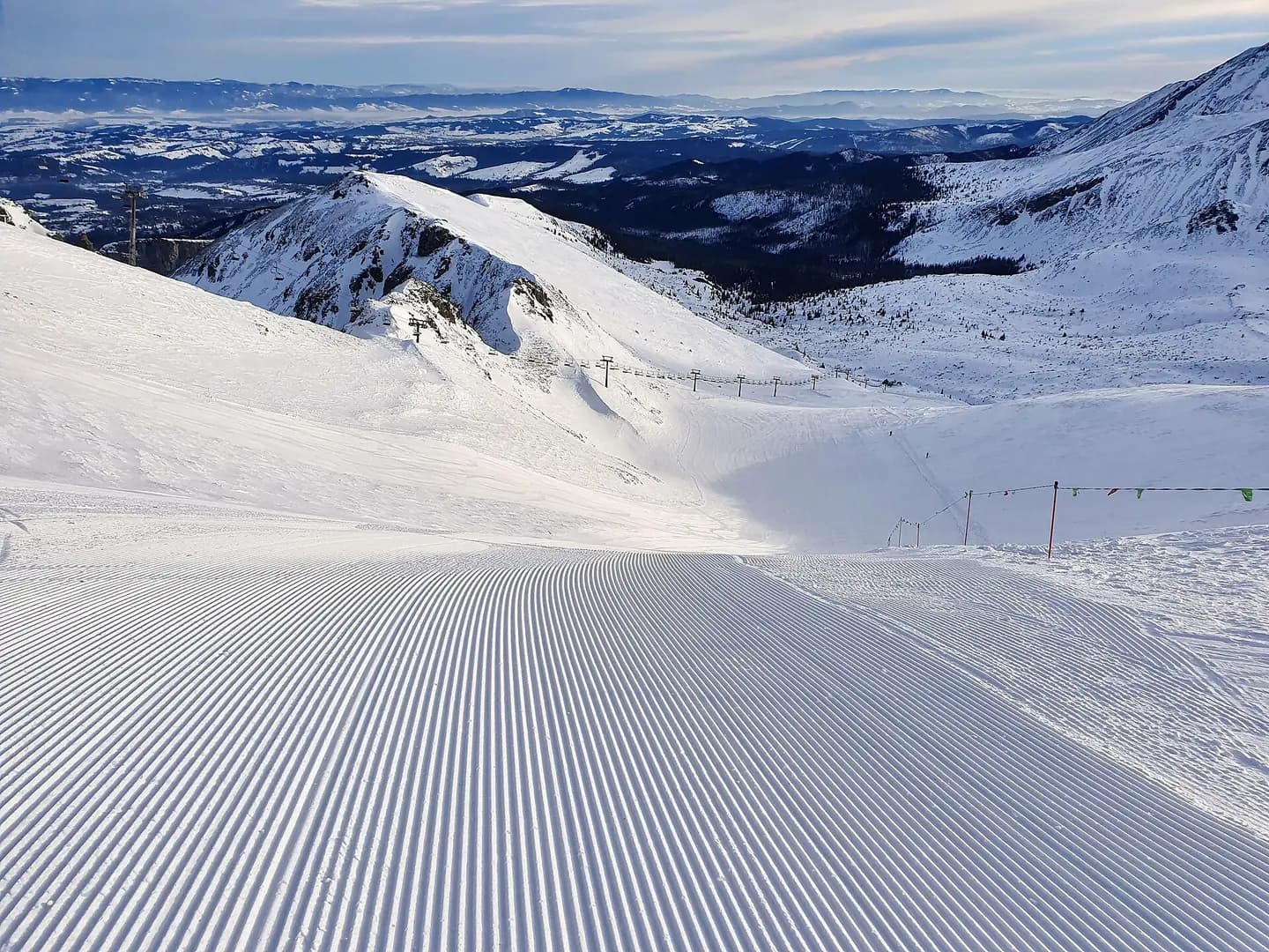
Beginning of the ski run (black) Kasprowy Wierch, Gąsienicowa. This photograph is used as a geographic witness to the place, not as evidence of the historical date shown in the chapter.
- Visual description
- Beginning of the ski run (black) Kasprowy Wierch, Gąsienicowa
- Nature
- original
- Medium
- Open-licence photograph
- Source
- Wikimedia Commons · CC BY-SA 4.0
1930
Winter becomes organised
Because of Zakopane's popular ski mountains, the town gained popularity which made the number of tourists increase to about 60,000 people by 1930.
Sources for this chapter
THE LIVING MAP
The mapped place
Zakopane/Kasprowy Wierch is recorded at 49.232° N, 19.981° E. Its catalogue reference reaches 1,987 metres. A modern resort map compresses terrain, exposure and access into a diagram. This exhibition keeps the underlying contour visible so the place does not become only a list of facilities.
Sources for this chapter
Open ledger · AOD.EU.ZAKOPANE.V00 · ORIGINALClose ledger · AOD.EU.ZAKOPANE.V00
Ledger AOD.EU.ZAKOPANE.V00
Zakopane Kuznice dolna stacja 2
Zakopane - Kuźnice - the Kasprowy Wierch cable car lower station. This photograph is used as a geographic witness to the place, not as evidence of the historical date shown in the chapter.
- Visual description
- Zakopane - Kuźnice - the Kasprowy Wierch cable car lower station
- Nature
- original
- Medium
- Open-licence photograph
- Source
- Wikimedia Commons · CC BY-SA 3.0
TODAY
Zakopane/Kasprowy Wierch now
Snow is normally abundant, particularly in the higher altitudes, which makes Zakopane among the most popular ski resorts in Poland.
Sources for this chapter
THE LEDGER
Sources and credits
This exhibition is built from local, institutional and sporting records. The source ledger keeps the claims visible and leaves space for correction as further local evidence emerges.
Sources for this chapter
Artefacts in order of appearance
Zakopane Kuznice dolna stacja 2
AOD.EU.ZAKOPANE.V00 · original · Wikimedia Commons · CC BY-SA 3.0
Kasprowy Gąsienicowa trasa narciarska
AOD.EU.ZAKOPANE.V01 · original · Wikimedia Commons · CC BY-SA 4.0
Editorial record
Full European Beta edition. Place evidence is adapted from the linked Zakopane overview under CC BY-SA 4.0 and remains subject to named historical and local review. Cartography is generated from the PeakWave location catalogue.