Open ledger · AOD.UK.WOOLACOMBE.V00 · ORIGINALClose ledger · AOD.UK.WOOLACOMBE.V00
Ledger AOD.UK.WOOLACOMBE.V00
Woolacombe beach-2
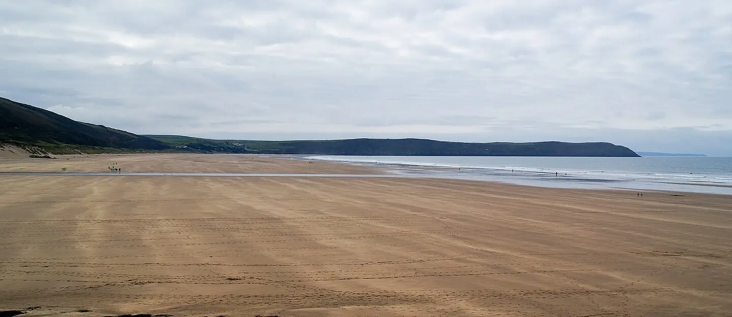
Woolacombe beach in North Devon coast, UK. The beach is a little over 3 km wide to give a sense of scale. This photograph is used as a geographic witness to the place, not as evidence of the historical date shown in the chapter.
- Visual description
- Woolacombe beach in North Devon coast, UK. The beach is a little over 3 km wide to give a sense of scale
- Nature
- original
- Medium
- Open-licence photograph
- Source
- Wikimedia Commons · CC BY-SA 4.0
- Reviewed
- Josh Wildman
THE BAY
Woolacombe
A Domesday settlement, early holiday beach and one of the oldest recorded surf coasts in Britain.
Scroll to follow the shoreline through time
Woolacombe Sands stretches between Morte Point and Baggy Point.
The long beach receives Atlantic swell across many banks, while each end changes the wind and wave shape.
Sources for this chapter
DOMESDAY–19th CENTURY
Wolves Valley becomes a seaside place
Woolacombe appears in the Domesday record as Wolmecoma, commonly read as Wolves Valley.
Visitors began arriving in the early nineteenth century, adding tourism to an older rural and coastal economy.
Sources for this chapter
1904–1930
Surfing before the modern board
North Devon has records of wave riding from the early 1900s.
By the 1920s surf bathing was fashionable enough for visitors including Agatha Christie to take part on this coast.
Sources for this chapter
Open ledger · AOD.UK.WOOLACOMBE.V01 · ORIGINALClose ledger · AOD.UK.WOOLACOMBE.V01
Ledger AOD.UK.WOOLACOMBE.V01
Lone Surfer at Woolacombe Beach
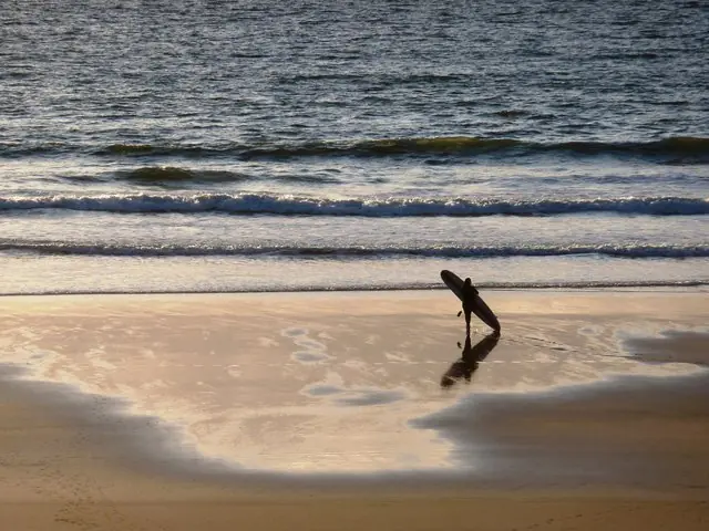
Lone Surfer at Woolacombe Beach. This photograph is used as a geographic witness to the place, not as evidence of the historical date shown in the chapter.
- Visual description
- Lone Surfer at Woolacombe Beach
- Nature
- original
- Medium
- Open-licence photograph
- Source
- Wikimedia Commons / Geograph · CC BY-SA 2.0
- Reviewed
- Josh Wildman
1960–1975
A regional industry grows
Fibreglass boards, wetsuits and workshops around Braunton transformed occasional summer riding into a year-round scene.
Woolacombe became one of the linked beaches supporting Britain’s early surf industry.
Sources for this chapter
THE LIVING MAP
The mapped place
Woolacombe is recorded at 51.170° N, 4.210° W. A surf map fixes a name to one stretch of moving water, but the place changes with tide, swell direction, wind and the shape of the seabed.
Sources for this chapter
Open ledger · AOD.UK.WOOLACOMBE.V00 · ORIGINALClose ledger · AOD.UK.WOOLACOMBE.V00
Ledger AOD.UK.WOOLACOMBE.V00
Woolacombe beach-2
Woolacombe beach in North Devon coast, UK. The beach is a little over 3 km wide to give a sense of scale. This photograph is used as a geographic witness to the place, not as evidence of the historical date shown in the chapter.
- Visual description
- Woolacombe beach in North Devon coast, UK. The beach is a little over 3 km wide to give a sense of scale
- Nature
- original
- Medium
- Open-licence photograph
- Source
- Wikimedia Commons · CC BY-SA 4.0
- Reviewed
- Josh Wildman
TODAY
A busy beach with a long memory
Woolacombe now combines mass tourism, surf schools and experienced local surfing within the North Devon World Surfing Reserve.
Its significance begins before the 1960s and continues beyond the summer season.
Sources for this chapter
THE LEDGER
Sources and credits
This exhibition is built from local, institutional and sporting records. The source ledger keeps the claims visible and leaves space for correction as further local evidence emerges.
Sources for this chapter
- OpenStreetMap location record
- National Trust, Woolacombe and Baggy Point
- North Devon Council, surfing beaches economic plan
- Museum of British Surfing, records of surfing in North Devon
- National Trust, Woolacombe surfing
- Museum of British Surfing, North Devon history
- Museum of British Surfing, North Devon pioneers
- North Devon World Surfing Reserve
Artefacts in order of appearance
Woolacombe beach-2
AOD.UK.WOOLACOMBE.V00 · original · Wikimedia Commons · CC BY-SA 4.0
Lone Surfer at Woolacombe Beach
AOD.UK.WOOLACOMBE.V01 · original · Wikimedia Commons / Geograph · CC BY-SA 2.0
Editorial record
Full UK edition. Historical claims are linked to the local, public and sporting records used to write the exhibition. Cartography is generated from the PeakWave location catalogue.