Open ledger · AOD.EU.WINTERBERG.V00 · ORIGINALClose ledger · AOD.EU.WINTERBERG.V00
Ledger AOD.EU.WINTERBERG.V00
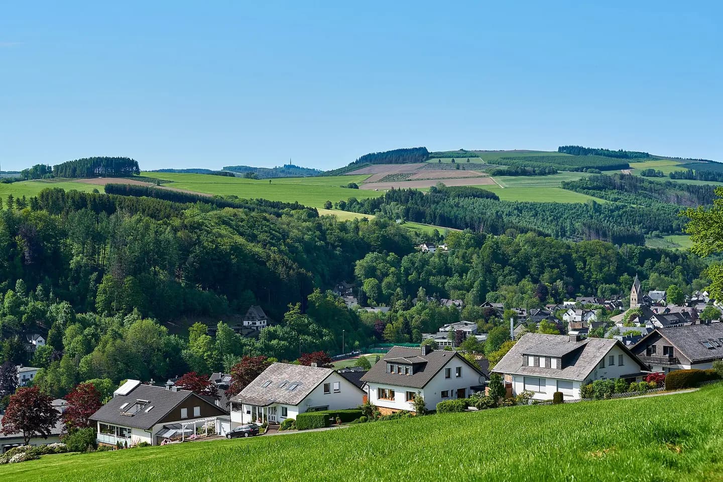
Winterberg (DE), Siedlinghausen -- 2023 -- 0024
Winterberg (DE), Siedlinghausen -- 2023 -- 0024. This photograph is used as a geographic witness to the place, not as evidence of the historical date shown in the chapter.
- Visual description
- Winterberg (DE), Siedlinghausen -- 2023 -- 0024
- Nature
- original
- Medium
- Open-licence photograph
- Source
- Wikimedia Commons · CC BY-SA 4.0
BEFORE MODERN SPORT
Winterberg
How settlement, access and winter sport shaped Winterberg.
Scroll to read the contour through time
Winterberg is a town in the Hochsauerland district of North Rhine-Westphalia, central Germany and a major winter sport resort of the Wintersport Arena Sauerland.
Sources for this chapter
BEFORE TOURISM
Work and settlement beneath the snowline
The town was in the middle of two trade roads, Heidenstrasse between Cologne and Kassel and Heerstrasse between Frankfurt am Main and Soest.
Sources for this chapter
ACCESS CHANGES
A route reaches Winterberg
The nearest airports to Winterberg is Paderborn Lippstadt Airport (68 km away) and Dortmund Airport (97 km away).
Sources for this chapter
Open ledger · AOD.EU.WINTERBERG.V01 · ORIGINALClose ledger · AOD.EU.WINTERBERG.V01
Ledger AOD.EU.WINTERBERG.V01
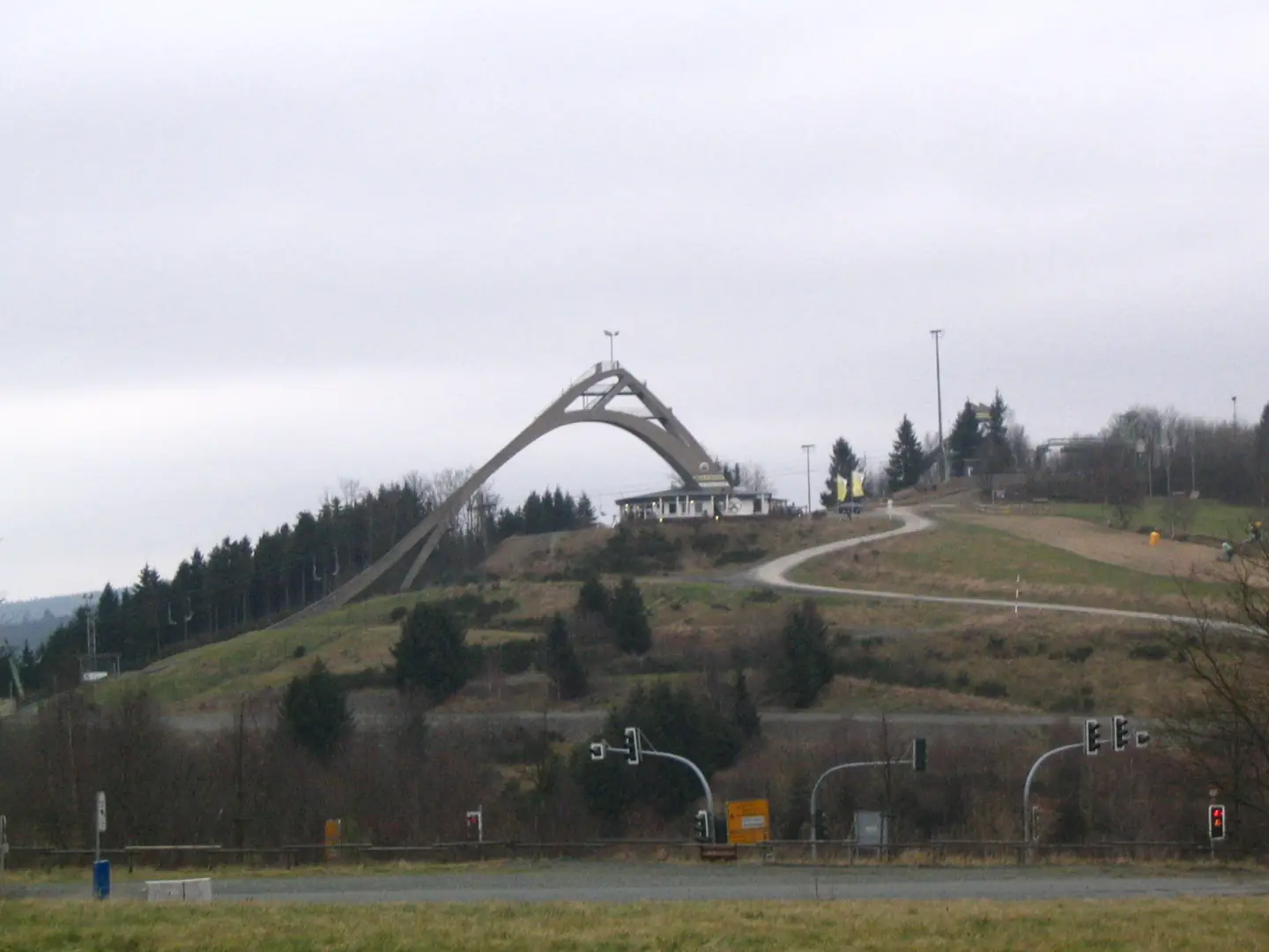
St Georg Schanze Winterberg GER
Tower of the ski jumping venue "St. Georg Schanze" in Winterberg, Germany. This photograph is used as a geographic witness to the place, not as evidence of the historical date shown in the chapter.
- Visual description
- Tower of the ski jumping venue "St. Georg Schanze" in Winterberg, Germany
- Nature
- original
- Medium
- Open-licence photograph
- Source
- Wikimedia Commons · CC BY 2.0
ORGANISED SPORT
Winter becomes organised
Winterberg is part of PeakWave's skiing catalogue.
The local record used here does not support a single founding date for the sport, so the exhibition treats its sporting identity as an accumulation of use, access and organisation.
Sources for this chapter
THE LIVING MAP
The mapped place
Winterberg is recorded at 51.194° N, 8.531° E. Its catalogue reference reaches 842 metres. A modern resort map compresses terrain, exposure and access into a diagram. This exhibition keeps the underlying contour visible so the place does not become only a list of facilities.
Sources for this chapter
Open ledger · AOD.EU.WINTERBERG.V00 · ORIGINALClose ledger · AOD.EU.WINTERBERG.V00
Ledger AOD.EU.WINTERBERG.V00
Winterberg (DE), Siedlinghausen -- 2023 -- 0024
Winterberg (DE), Siedlinghausen -- 2023 -- 0024. This photograph is used as a geographic witness to the place, not as evidence of the historical date shown in the chapter.
- Visual description
- Winterberg (DE), Siedlinghausen -- 2023 -- 0024
- Nature
- original
- Medium
- Open-licence photograph
- Source
- Wikimedia Commons · CC BY-SA 4.0
TODAY
Winterberg now
Both towns thereby had to register big population losses.
Sources for this chapter
THE LEDGER
Sources and credits
This exhibition is built from local, institutional and sporting records. The source ledger keeps the claims visible and leaves space for correction as further local evidence emerges.
Sources for this chapter
Artefacts in order of appearance
Winterberg (DE), Siedlinghausen -- 2023 -- 0024
AOD.EU.WINTERBERG.V00 · original · Wikimedia Commons · CC BY-SA 4.0
St Georg Schanze Winterberg GER
AOD.EU.WINTERBERG.V01 · original · Wikimedia Commons · CC BY 2.0
Editorial record
Full European Beta edition. Place evidence is adapted from the linked Winterberg overview under CC BY-SA 4.0 and remains subject to named historical and local review. Cartography is generated from the PeakWave location catalogue.