Open ledger · AOD.UK.WIDEMOUTH-BAY.V00 · ORIGINALClose ledger · AOD.UK.WIDEMOUTH-BAY.V00
Ledger AOD.UK.WIDEMOUTH-BAY.V00
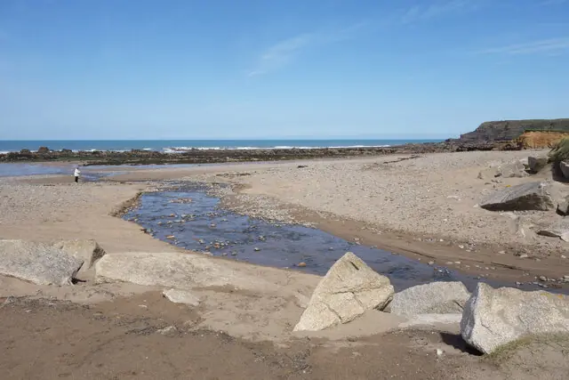
Stream on the beach, Widemouth Bay
Stream on the beach, Widemouth Bay. This photograph is used as a geographic witness to the place, not as evidence of the historical date shown in the chapter.
- Visual description
- Stream on the beach, Widemouth Bay
- Nature
- original
- Medium
- Open-licence photograph
- Source
- Wikimedia Commons / Geograph · CC BY-SA 2.0
- Reviewed
- Josh Wildman
THE OPEN BAY
Widemouth Bay
A wide Atlantic bay tied to Bude’s farming hinterland and modern surf culture.
Scroll to follow the shoreline through time
Widemouth is a broad sandy bay south of Bude with rocky ends and Black Rock rising from the southern shore.
Its exposure makes it responsive to swell but offers little of the harbour shelter found at Summerleaze.
Sources for this chapter
THE CANAL CENTURY
The wider coast served farms inland
This coast belonged to a farming hinterland that used lime-rich sea sand as fertiliser.
Bude’s canal and horse railway moved that material inland, connecting Atlantic beaches to agricultural improvement.
Sources for this chapter
THE ROAD COAST
The coastal road made the long bay legible
Road access and the coast path connected Widemouth directly to Bude, turning a dispersed rural shore into a named beach destination.
Different ends of the bay could now be used according to tide and conditions.
Sources for this chapter
Open ledger · AOD.UK.WIDEMOUTH-BAY.V01 · ORIGINALClose ledger · AOD.UK.WIDEMOUTH-BAY.V01
Ledger AOD.UK.WIDEMOUTH-BAY.V01
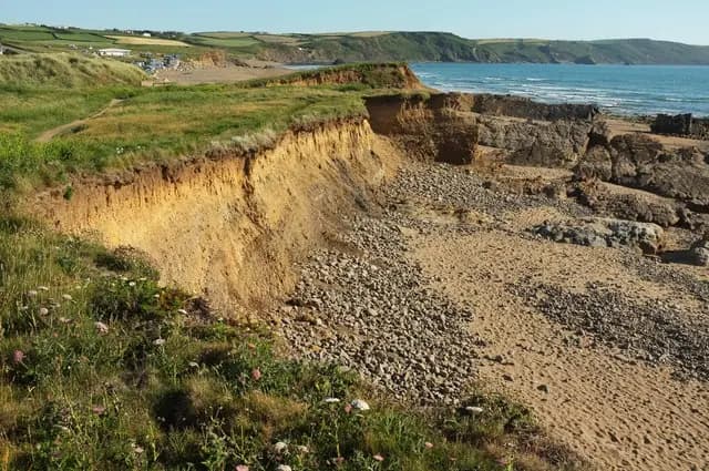
Coastline north of Widemouth Bay
Coastline north of Widemouth Bay. This photograph is used as a geographic witness to the place, not as evidence of the historical date shown in the chapter.
- Visual description
- Coastline north of Widemouth Bay
- Nature
- original
- Medium
- Open-licence photograph
- Source
- Wikimedia Commons / Geograph · CC BY-SA 2.0
- Reviewed
- Josh Wildman
THE SURF YEARS
Exposure became the attraction
Modern boards and wetsuits made Widemouth one of Bude’s main surf beaches.
Its size provides several banks and room for teaching, while the open Atlantic also produces strong currents and larger days.
Sources for this chapter
THE LIVING MAP
The mapped place
Widemouth Bay is recorded at 50.784° N, 4.555° W. A surf map fixes a name to one stretch of moving water, but the place changes with tide, swell direction, wind and the shape of the seabed.
Sources for this chapter
Open ledger · AOD.UK.WIDEMOUTH-BAY.V00 · ORIGINALClose ledger · AOD.UK.WIDEMOUTH-BAY.V00
Ledger AOD.UK.WIDEMOUTH-BAY.V00
Stream on the beach, Widemouth Bay
Stream on the beach, Widemouth Bay. This photograph is used as a geographic witness to the place, not as evidence of the historical date shown in the chapter.
- Visual description
- Stream on the beach, Widemouth Bay
- Nature
- original
- Medium
- Open-licence photograph
- Source
- Wikimedia Commons / Geograph · CC BY-SA 2.0
- Reviewed
- Josh Wildman
TODAY
A surf beach within an adapting coast
Widemouth now supports surfing, bodyboarding, walking and seasonal lifeguarding.
Its wide horizon is the appeal, but the same exposure means that safety and changing coastal conditions remain central to how it is used.
Sources for this chapter
THE LEDGER
Sources and credits
This exhibition is built from local, institutional and sporting records. The source ledger keeps the claims visible and leaves space for correction as further local evidence emerges.
Sources for this chapter
Artefacts in order of appearance
Stream on the beach, Widemouth Bay
AOD.UK.WIDEMOUTH-BAY.V00 · original · Wikimedia Commons / Geograph · CC BY-SA 2.0
Coastline north of Widemouth Bay
AOD.UK.WIDEMOUTH-BAY.V01 · original · Wikimedia Commons / Geograph · CC BY-SA 2.0
Editorial record
Full UK edition. Historical claims are linked to the local, public and sporting records used to write the exhibition. Cartography is generated from the PeakWave location catalogue.