Open ledger · AOD.UK.WHITESANDS.V00 · ORIGINALClose ledger · AOD.UK.WHITESANDS.V00
Ledger AOD.UK.WHITESANDS.V00
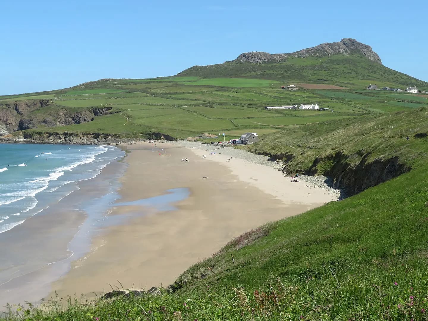
Porth Mawr (Whitesands Bay) near Tyddewi (St David's), Sir Benfro, Cymru, Wales 12
Porth Mawr (Whitesands Bay) near Tyddewi (St David's), Sir Benfro, Cymru, Wales. This photograph is used as a geographic witness to the place, not as evidence of the historical date shown in the chapter.
- Visual description
- Porth Mawr (Whitesands Bay) near Tyddewi (St David's), Sir Benfro, Cymru, Wales
- Nature
- original
- Medium
- Open-licence photograph
- Source
- Wikimedia Commons · CC BY-SA 4.0
- Reviewed
- Josh Wildman
THE SUBMERGED SHORE
Whitesands Bay
Submerged forest, saints’ stories and modern shortboard surfing beside St Davids.
Scroll to follow the shoreline through time
Whitesands can reveal the remains of a Mesolithic submerged forest after rough seas.
The beach’s first history is therefore a coastline in motion, with former land now within the intertidal zone.
Sources for this chapter
TRADITION AND PILGRIMAGE
A departure point in the land of saints
St Patrick’s Chapel stands in the dunes.
Tradition says Patrick departed for Ireland from this shore, a story carried as local religious memory rather than a securely dated voyage.
Sources for this chapter
1833–1945
Wrecks and wartime closure
Several recorded wrecks lie beneath or near the sand.
During the Second World War the beach was restricted by mines and dune sand was taken for the nearby St Davids airfield.
Sources for this chapter
Open ledger · AOD.UK.WHITESANDS.V01 · ORIGINALClose ledger · AOD.UK.WHITESANDS.V01
Ledger AOD.UK.WHITESANDS.V01
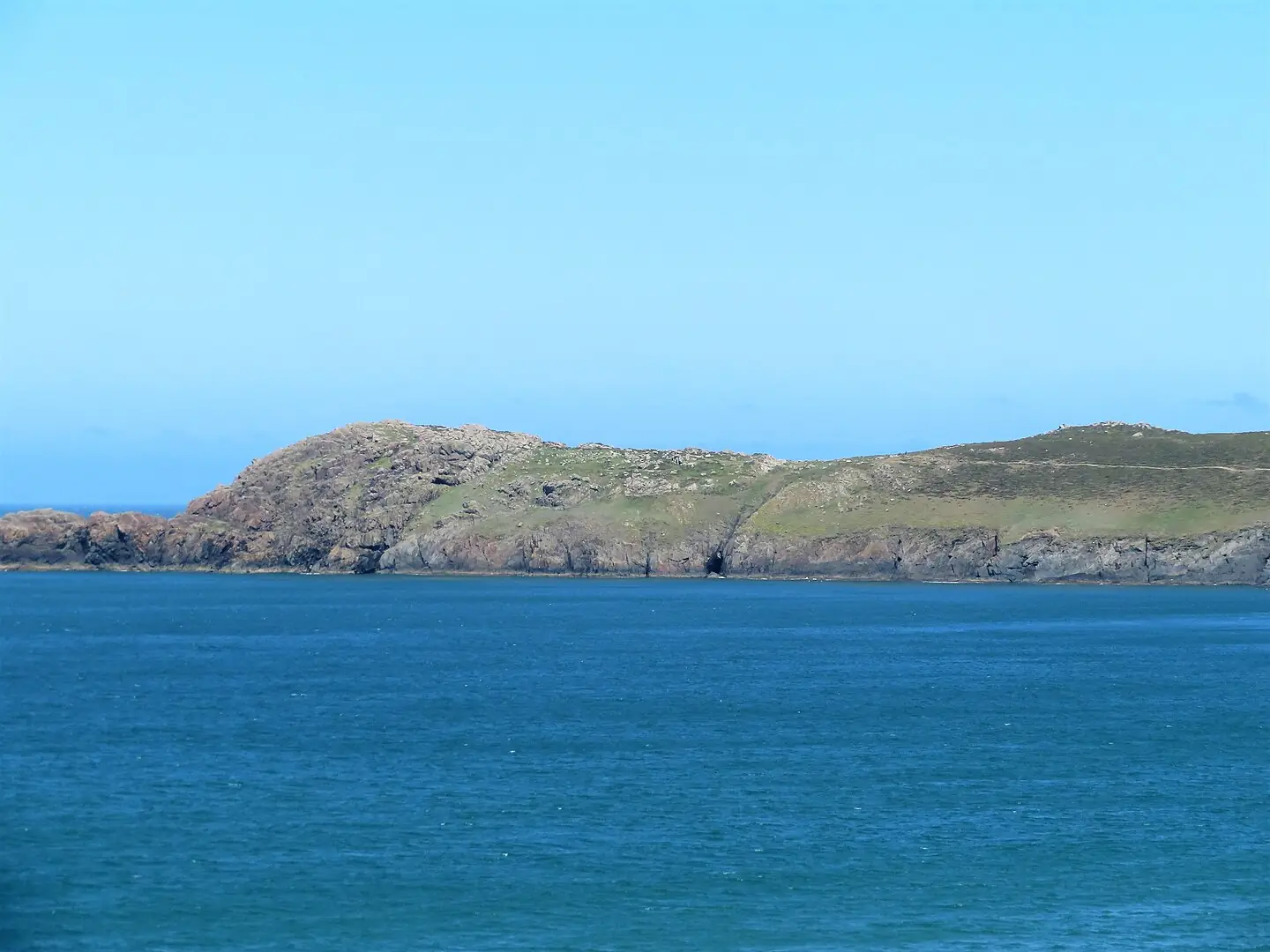
Penmaen Dewi (St David's Head) from Porth Mawr (Whitesands Bay) near Tyddewi (St David's), Sir Benfro, Cymru, Wales 13
Penmaen Dewi (St David's Head) from Porth Mawr (Whitesands Bay) near Tyddewi (St David's), Sir Benfro, Cymru, Wales. This photograph is used as a geographic witness to the place, not as evidence of the historical date shown in the chapter.
- Visual description
- Penmaen Dewi (St David's Head) from Porth Mawr (Whitesands Bay) near Tyddewi (St David's), Sir Benfro, Cymru, Wales
- Nature
- original
- Medium
- Open-licence photograph
- Source
- Wikimedia Commons · CC BY-SA 4.0
- Reviewed
- Josh Wildman
THE SURF YEARS
Porth Mawr enters Welsh competition
With reliable sandbanks and clean Atlantic exposure, Whitesands became one of Pembrokeshire’s main surfing beaches.
Its shaped peaks supported shortboard progression and a strong local competitive generation.
Sources for this chapter
THE LIVING MAP
The mapped place
Whitesands Bay is recorded at 51.893° N, 5.303° W. A surf map fixes a name to one stretch of moving water, but the place changes with tide, swell direction, wind and the shape of the seabed.
Sources for this chapter
Open ledger · AOD.UK.WHITESANDS.V00 · ORIGINALClose ledger · AOD.UK.WHITESANDS.V00
Ledger AOD.UK.WHITESANDS.V00
Porth Mawr (Whitesands Bay) near Tyddewi (St David's), Sir Benfro, Cymru, Wales 12
Porth Mawr (Whitesands Bay) near Tyddewi (St David's), Sir Benfro, Cymru, Wales. This photograph is used as a geographic witness to the place, not as evidence of the historical date shown in the chapter.
- Visual description
- Porth Mawr (Whitesands Bay) near Tyddewi (St David's), Sir Benfro, Cymru, Wales
- Nature
- original
- Medium
- Open-licence photograph
- Source
- Wikimedia Commons · CC BY-SA 4.0
- Reviewed
- Josh Wildman
TODAY
A city beach without a city shore
Whitesands is the principal beach for nearby St Davids, with lifeguarding, bus access and a seasonal visitor economy.
Beneath that modern apparatus, storms still uncover older landscapes and wrecks.
Sources for this chapter
THE LEDGER
Sources and credits
This exhibition is built from local, institutional and sporting records. The source ledger keeps the claims visible and leaves space for correction as further local evidence emerges.
Sources for this chapter
Artefacts in order of appearance
Porth Mawr (Whitesands Bay) near Tyddewi (St David's), Sir Benfro, Cymru, Wales 12
AOD.UK.WHITESANDS.V00 · original · Wikimedia Commons · CC BY-SA 4.0
Penmaen Dewi (St David's Head) from Porth Mawr (Whitesands Bay) near Tyddewi (St David's), Sir Benfro, Cymru, Wales 13
AOD.UK.WHITESANDS.V01 · original · Wikimedia Commons · CC BY-SA 4.0
Editorial record
Full UK edition. Historical claims are linked to the local, public and sporting records used to write the exhibition. Cartography is generated from the PeakWave location catalogue.