Open ledger · AOD.EU.WENGEN-GRINDELWALD.V00 · ORIGINALClose ledger · AOD.EU.WENGEN-GRINDELWALD.V00
Ledger AOD.EU.WENGEN-GRINDELWALD.V00
00 1383 Grindelwald (CH) - Männlichen
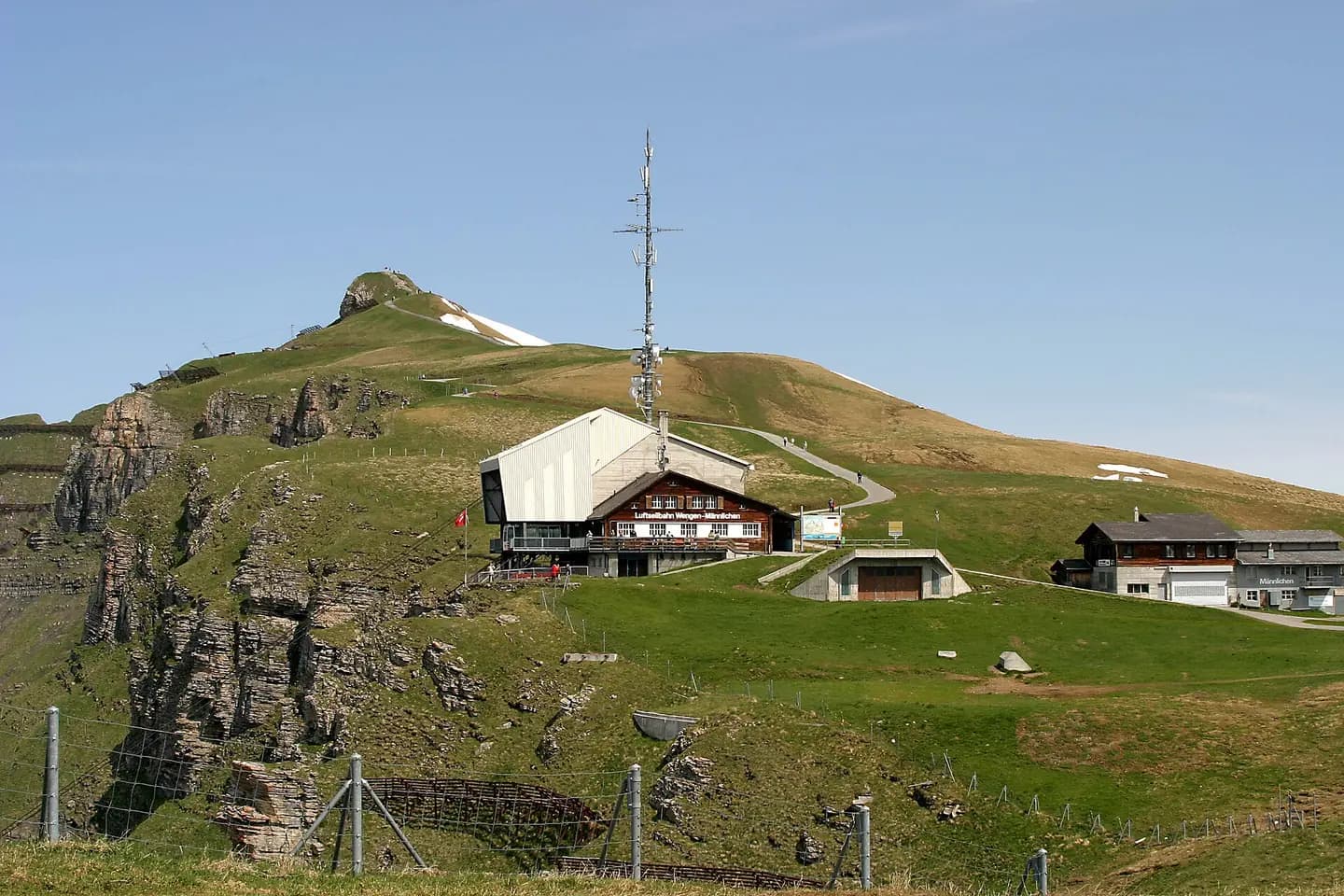
Mountain station Männlichen of the Gondelbahn Grindelwald - Männlichen. The Männlichen (2342 meters above sea level) is a summit in the Bernese Pre-Alps with a good view of the mountain massif Eiger, Mönch and Jungfrau. This photograph is used as a geographic witness to the place, not as evidence of the historical date shown in the chapter.
- Visual description
- Mountain station Männlichen of the Gondelbahn Grindelwald - Männlichen. The Männlichen (2342 meters above sea level) is a summit in the Bernese Pre-Alps with a good view of the mountain massif Eiger, Mönch and Jungfrau
- Nature
- original
- Medium
- Open-licence photograph
- Source
- Wikimedia Commons · CC BY-SA 4.0
BEFORE MODERN SPORT
Wengen-Grindelwald
How settlement, access and winter sport shaped Wengen-Grindelwald.
Scroll to read the contour through time
Grindelwald is a village and municipality in the Interlaken-Oberhasli administrative district in the canton of Berne.
Sources for this chapter
1938
Work and settlement beneath the snowline
The ascent of the north face of the Eiger, in 1938, was also a milestone in mountaineering history.
Sources for this chapter
1860
A route reaches Wengen-Grindelwald
The Grindelwald road was built in 1860–72, and the Bernese Oberland railway reached the village in 1890, both of which transformed an arduous journey into a simple trip and allowed tourists to flood into the village.
Sources for this chapter
Open ledger · AOD.EU.WENGEN-GRINDELWALD.V01 · ORIGINALClose ledger · AOD.EU.WENGEN-GRINDELWALD.V01
Ledger AOD.EU.WENGEN-GRINDELWALD.V01
A day in the Grindelwald area - descending into Wengen
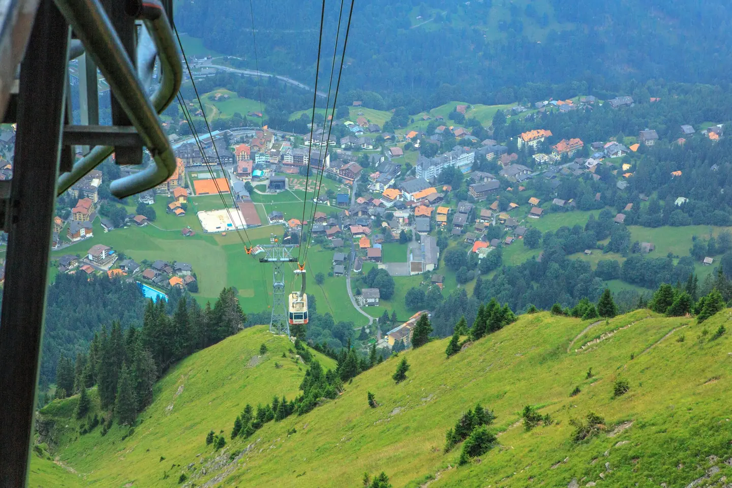
a day in the Grindelwald area...descending into Wengen. This photograph is used as a geographic witness to the place, not as evidence of the historical date shown in the chapter.
- Visual description
- a day in the Grindelwald area...descending into Wengen
- Nature
- original
- Medium
- Open-licence photograph
- Source
- Wikimedia Commons · CC BY-SA 2.0
1881
Winter becomes organised
The first person to ski there was Englishman, Gerald Fox (who lived at Tone Dale House) who put his skis on in his hotel bedroom in 1881 and walked out through the hotel bar to the slopes wearing them.
Sources for this chapter
THE LIVING MAP
The mapped place
Wengen-Grindelwald is recorded at 46.609° N, 7.923° E. Its catalogue reference reaches 2,970 metres. A modern resort map compresses terrain, exposure and access into a diagram. This exhibition keeps the underlying contour visible so the place does not become only a list of facilities.
Sources for this chapter
Open ledger · AOD.EU.WENGEN-GRINDELWALD.V00 · ORIGINALClose ledger · AOD.EU.WENGEN-GRINDELWALD.V00
Ledger AOD.EU.WENGEN-GRINDELWALD.V00
00 1383 Grindelwald (CH) - Männlichen
Mountain station Männlichen of the Gondelbahn Grindelwald - Männlichen. The Männlichen (2342 meters above sea level) is a summit in the Bernese Pre-Alps with a good view of the mountain massif Eiger, Mönch and Jungfrau. This photograph is used as a geographic witness to the place, not as evidence of the historical date shown in the chapter.
- Visual description
- Mountain station Männlichen of the Gondelbahn Grindelwald - Männlichen. The Männlichen (2342 meters above sea level) is a summit in the Bernese Pre-Alps with a good view of the mountain massif Eiger, Mönch and Jungfrau
- Nature
- original
- Medium
- Open-licence photograph
- Source
- Wikimedia Commons · CC BY-SA 4.0
TODAY
Wengen-Grindelwald now
Numerous ski lifts, cable cars, hiking trails and alpine huts were built in the late 19th and 20th centuries to allow tourists to explore the mountains, notably the Wetterhorn Elevator, one of the first modern aerial tramways.
Sources for this chapter
THE LEDGER
Sources and credits
This exhibition is built from local, institutional and sporting records. The source ledger keeps the claims visible and leaves space for correction as further local evidence emerges.
Sources for this chapter
Artefacts in order of appearance
00 1383 Grindelwald (CH) - Männlichen
AOD.EU.WENGEN-GRINDELWALD.V00 · original · Wikimedia Commons · CC BY-SA 4.0
A day in the Grindelwald area - descending into Wengen
AOD.EU.WENGEN-GRINDELWALD.V01 · original · Wikimedia Commons · CC BY-SA 2.0
Editorial record
Full European Beta edition. Place evidence is adapted from the linked Grindelwald overview under CC BY-SA 4.0 and remains subject to named historical and local review. Cartography is generated from the PeakWave location catalogue.