Open ledger · AOD.EU.VAL-DISERE.V00 · ORIGINALClose ledger · AOD.EU.VAL-DISERE.V00
Ledger AOD.EU.VAL-DISERE.V00
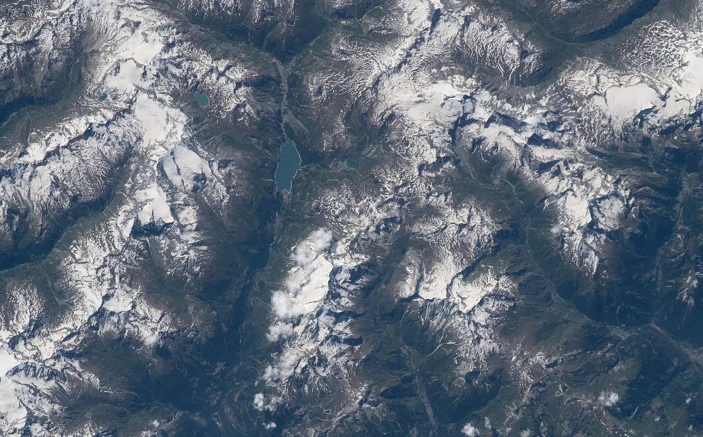
ISS069 (iss069e025220) - View of France - Lac du Chevril - Val-d'Isère - Tignes - Vanoise massif - Mont Pourri - Le Grand Bec - Grande Motte - Vallon de la Leisse - Aiguille de la Grande Sassière - Lac de la Sassière
ISS069 (iss069e025220) - View of France - Lac du Chevril - Val-d'Isère - Tignes - Vanoise massif - Mont Pourri - Le Grand Bec - Grande Motte - Vallon de la Leisse - Aiguille de la Grande Sassière - Lac de la Sassière. This photograph is used as a geographic witness to the place, not as evidence of the historical date shown in the chapter.
- Visual description
- ISS069 (iss069e025220) - View of France - Lac du Chevril - Val-d'Isère - Tignes - Vanoise massif - Mont Pourri - Le Grand Bec - Grande Motte - Vallon de la Leisse - Aiguille de la Grande Sassière - Lac de la Sassière
- Nature
- original
- Medium
- Open-licence photograph
- Source
- Wikimedia Commons · Public domain
BEFORE MODERN SPORT
Val d'Isère
How settlement, access and winter sport shaped Val d'Isère.
Scroll to read the contour through time
Val-d'Isère is a commune of the Tarentaise Valley, in the Savoie department (Auvergne-Rhône-Alpes region) in southeastern France.
Sources for this chapter
1944
Work and settlement beneath the snowline
114–7.
(in English and French) Val d'Isère Tourist Office Val d'Isère history WW2 Val d'Isère Tragedy - Allied POWs died at the Colle Galisia in 1944 (http://www.skiline.co.uk/blog/tignes-or-val-d-isere
Sources for this chapter
ACCESS CHANGES
A route reaches Val d'Isère
Skiing in Val d'Isère has its roots in the 1930s when a drag lift was built on the slopes of the Solaise.
Sources for this chapter
Open ledger · AOD.EU.VAL-DISERE.V01 · ORIGINALClose ledger · AOD.EU.VAL-DISERE.V01
Ledger AOD.EU.VAL-DISERE.V01
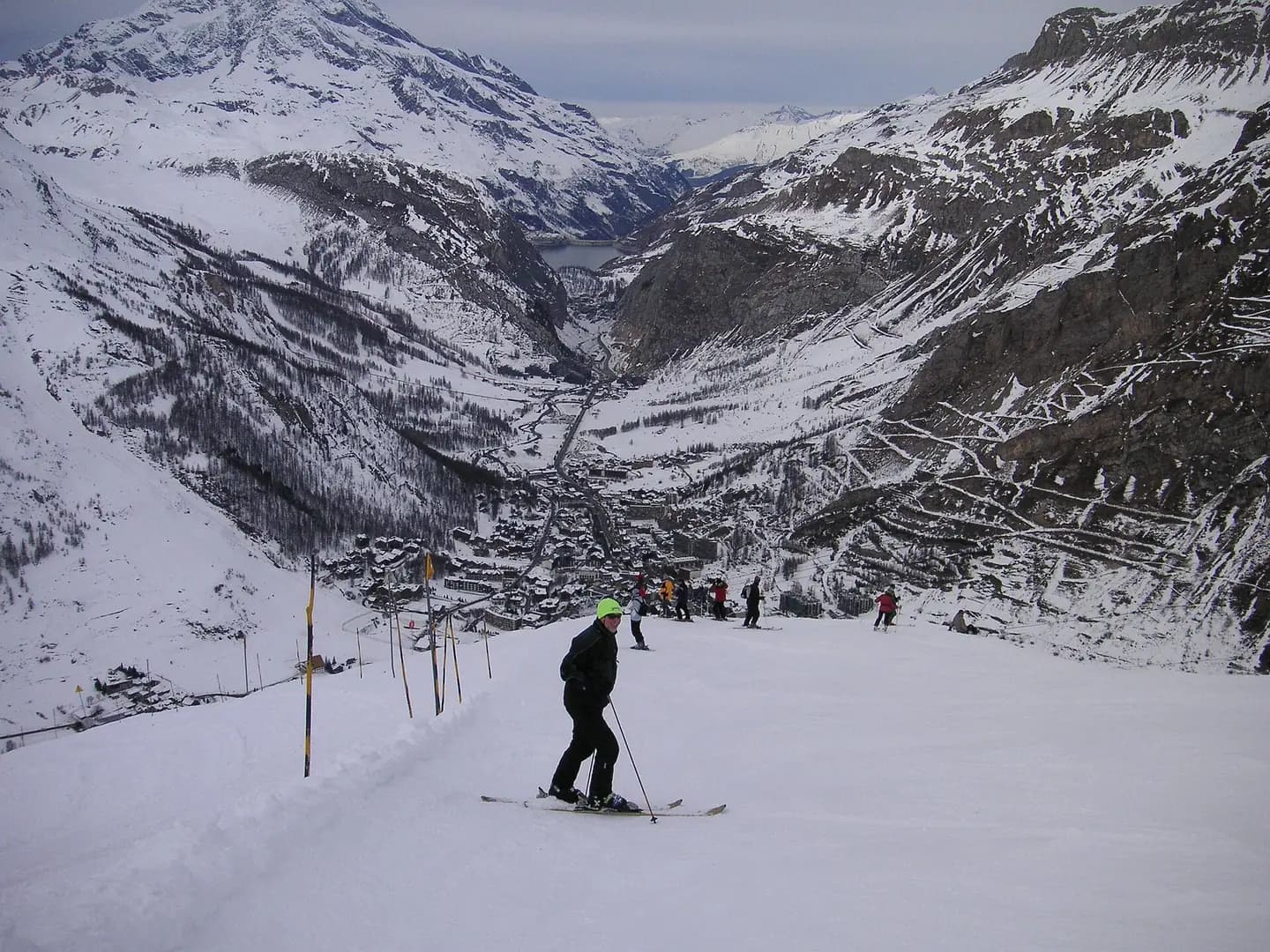
Skiing down to Val DIsere (8631756299)
Skiing down to Val D'Isere. This photograph is used as a geographic witness to the place, not as evidence of the historical date shown in the chapter.
- Visual description
- Skiing down to Val D'Isere
- Nature
- original
- Medium
- Open-licence photograph
- Source
- Wikimedia Commons · CC BY 2.0
ORGANISED SPORT
Winter becomes organised
The resort hosts every year a round of the FIS Alpine Ski World Cup for both men and women.
Sources for this chapter
THE LIVING MAP
The mapped place
Val d'Isère is recorded at 45.448° N, 6.981° E. Its catalogue reference reaches 2,827 metres. A modern resort map compresses terrain, exposure and access into a diagram. This exhibition keeps the underlying contour visible so the place does not become only a list of facilities.
Sources for this chapter
Open ledger · AOD.EU.VAL-DISERE.V00 · ORIGINALClose ledger · AOD.EU.VAL-DISERE.V00
Ledger AOD.EU.VAL-DISERE.V00
ISS069 (iss069e025220) - View of France - Lac du Chevril - Val-d'Isère - Tignes - Vanoise massif - Mont Pourri - Le Grand Bec - Grande Motte - Vallon de la Leisse - Aiguille de la Grande Sassière - Lac de la Sassière
ISS069 (iss069e025220) - View of France - Lac du Chevril - Val-d'Isère - Tignes - Vanoise massif - Mont Pourri - Le Grand Bec - Grande Motte - Vallon de la Leisse - Aiguille de la Grande Sassière - Lac de la Sassière. This photograph is used as a geographic witness to the place, not as evidence of the historical date shown in the chapter.
- Visual description
- ISS069 (iss069e025220) - View of France - Lac du Chevril - Val-d'Isère - Tignes - Vanoise massif - Mont Pourri - Le Grand Bec - Grande Motte - Vallon de la Leisse - Aiguille de la Grande Sassière - Lac de la Sassière
- Nature
- original
- Medium
- Open-licence photograph
- Source
- Wikimedia Commons · Public domain
TODAY
Val d'Isère now
The Tarentaise Valley has the largest concentration of world-class ski resorts in the world.
Sources for this chapter
THE LEDGER
Sources and credits
This exhibition is built from local, institutional and sporting records. The source ledger keeps the claims visible and leaves space for correction as further local evidence emerges.
Sources for this chapter
Artefacts in order of appearance
ISS069 (iss069e025220) - View of France - Lac du Chevril - Val-d'Isère - Tignes - Vanoise massif - Mont Pourri - Le Grand Bec - Grande Motte - Vallon de la Leisse - Aiguille de la Grande Sassière - Lac de la Sassière
AOD.EU.VAL-DISERE.V00 · original · Wikimedia Commons · Public domain
Skiing down to Val DIsere (8631756299)
AOD.EU.VAL-DISERE.V01 · original · Wikimedia Commons · CC BY 2.0
Editorial record
Full European Beta edition. Place evidence is adapted from the linked Val-d'Isère overview under CC BY-SA 4.0 and remains subject to named historical and local review. Cartography is generated from the PeakWave location catalogue.