
Open ledger · AOD.EU.VAL-DI-FIEMME.V00 · ORIGINALClose ledger · AOD.EU.VAL-DI-FIEMME.V00
Ledger AOD.EU.VAL-DI-FIEMME.V00
Val di Fiemme da Cavalese
The Fiemme valley, seen upstream from (Trentino, Italy). This photograph is used as a geographic witness to the place, not as evidence of the historical date shown in the chapter.
- Visual description
- The Fiemme valley, seen upstream from (Trentino, Italy)
- Nature
- original
- Medium
- Open-licence photograph
- Source
- Wikimedia Commons · CC BY-SA 4.0
BEFORE MODERN SPORT
Val di Fiemme
How settlement, access and winter sport shaped Val di Fiemme.
Scroll to read the contour through time
Fiemme Valley (Italian: Val di Fiemme, German: Fleimstal) is a valley in the Trentino province, i.e.
the southern half of the Trentino-Alto Adige/Südtirol region, in northern Italy, located in the Dolomites mountain region.
Sources for this chapter
BEFORE TOURISM
Work and settlement beneath the snowline
After the treaty of Luneville, under the name "Welschtirol" (i.e.
Sources for this chapter
1976
A route reaches Val di Fiemme
The area near Cavalese has seen two major cable car disasters, one in 1976 and one, caused by a United States Marine Corps airplane flying too low, in 1998.
Sources for this chapter
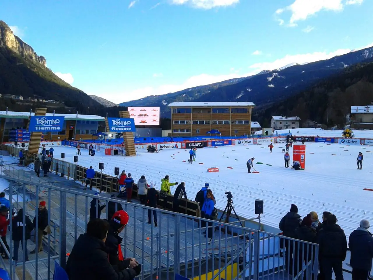
Open ledger · AOD.EU.VAL-DI-FIEMME.V01 · ORIGINALClose ledger · AOD.EU.VAL-DI-FIEMME.V01
Ledger AOD.EU.VAL-DI-FIEMME.V01
Tour de Ski 2013 at Lago di Tesero Cross-country Ski Stadium
Preparazione della pista dello Stadio del fondo di Lago di Tesero (Val di Fiemme, Trento) in occasione del Tour de Ski 2013. This photograph is used as a geographic witness to the place, not as evidence of the historical date shown in the chapter.
- Visual description
- Preparazione della pista dello Stadio del fondo di Lago di Tesero (Val di Fiemme, Trento) in occasione del Tour de Ski 2013
- Nature
- original
- Medium
- Open-licence photograph
- Source
- Wikimedia Commons · CC BY-SA 4.0
1991
Winter becomes organised
As a tourist attraction, Fiemme has become well known for its skiing areas, even hosting the FIS Nordic World Ski Championships for both 1991 and 2003.
Sources for this chapter
THE LIVING MAP
The mapped place
Val di Fiemme is recorded at 46.282° N, 11.437° E. Its catalogue reference reaches 2,440 metres. A modern resort map compresses terrain, exposure and access into a diagram. This exhibition keeps the underlying contour visible so the place does not become only a list of facilities.
Sources for this chapter
Open ledger · AOD.EU.VAL-DI-FIEMME.V00 · ORIGINALClose ledger · AOD.EU.VAL-DI-FIEMME.V00
Ledger AOD.EU.VAL-DI-FIEMME.V00
Val di Fiemme da Cavalese
The Fiemme valley, seen upstream from (Trentino, Italy). This photograph is used as a geographic witness to the place, not as evidence of the historical date shown in the chapter.
- Visual description
- The Fiemme valley, seen upstream from (Trentino, Italy)
- Nature
- original
- Medium
- Open-licence photograph
- Source
- Wikimedia Commons · CC BY-SA 4.0
TODAY
Val di Fiemme now
The Tour de Ski has since 2007 had its conclusion in Val di Fiemme with the Final Climb stage up the alpine skiing course on Alpe Cermis.
Sources for this chapter
THE LEDGER
Sources and credits
This exhibition is built from local, institutional and sporting records. The source ledger keeps the claims visible and leaves space for correction as further local evidence emerges.
Sources for this chapter
Artefacts in order of appearance
Val di Fiemme da Cavalese
AOD.EU.VAL-DI-FIEMME.V00 · original · Wikimedia Commons · CC BY-SA 4.0
Tour de Ski 2013 at Lago di Tesero Cross-country Ski Stadium
AOD.EU.VAL-DI-FIEMME.V01 · original · Wikimedia Commons · CC BY-SA 4.0
Editorial record
Full European Beta edition. Place evidence is adapted from the linked Fiemme Valley overview under CC BY-SA 4.0 and remains subject to named historical and local review. Cartography is generated from the PeakWave location catalogue.