Open ledger · AOD.UK.TIREE.V00 · ORIGINALClose ledger · AOD.UK.TIREE.V00
Ledger AOD.UK.TIREE.V00
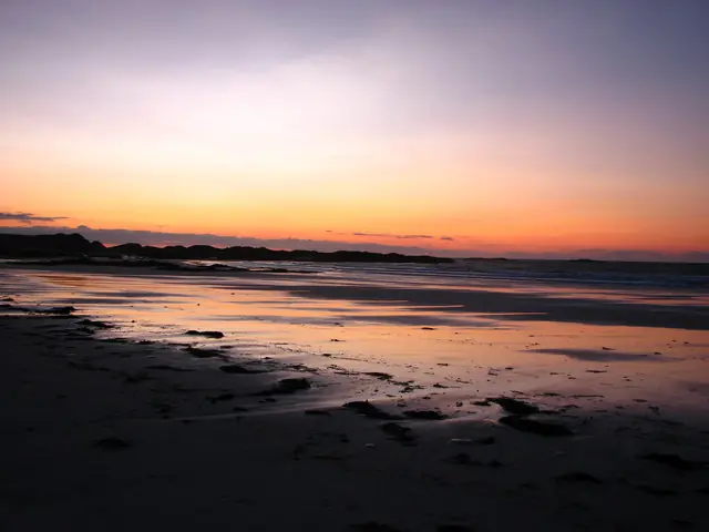
Traigh Chronaig beach sunset, Tiree
Traigh Chronaig beach sunset, Tiree. This photograph is used as a geographic witness to the place, not as evidence of the historical date shown in the chapter.
- Visual description
- Traigh Chronaig beach sunset, Tiree
- Nature
- original
- Medium
- Open-licence photograph
- Source
- Wikimedia Commons / Geograph · CC BY-SA 2.0
- Reviewed
- Josh Wildman
THE ISLAND
Tiree
A low Hebridean island where wind, crofting and wave sport share the same open landscape.
Scroll to follow the shoreline through time
Tiree is low, open and surrounded by beaches facing different directions.
With little high ground to interrupt the weather, wind is not background but one of the island’s organising forces.
Sources for this chapter
THE WORKING ISLAND
Crofting makes the landscape
Machair, grazing, fishing and a wide diaspora shaped Tiree’s communities.
The island archive begins with geology and carries through everyday livelihoods rather than presenting the beaches as empty discovery.
Sources for this chapter
LATE 20th CENTURY
Equipment makes exposure usable
Modern wetsuits, boards and ferry-borne travel made regular windsurfing and surfing practical.
Tiree’s many shorelines allowed riders to select exposure rather than wait at a single beach.
Sources for this chapter
Open ledger · AOD.UK.TIREE.V01 · ORIGINALClose ledger · AOD.UK.TIREE.V01
Ledger AOD.UK.TIREE.V01
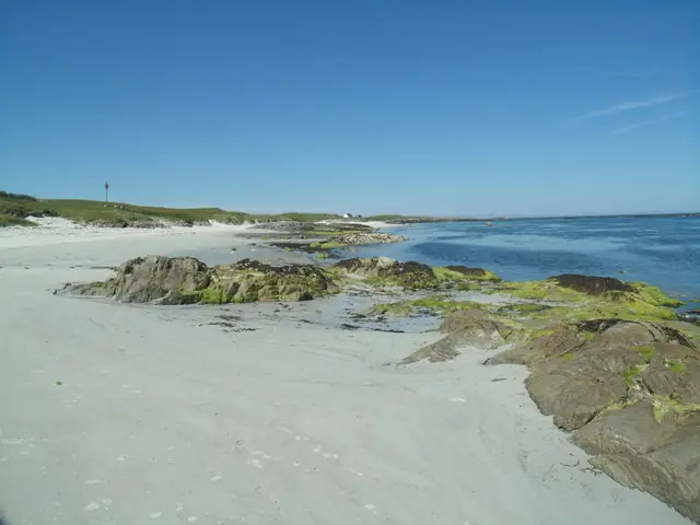
Beach at Port Ruadh, Tiree
Beach at Port Ruadh, Tiree. This photograph is used as a geographic witness to the place, not as evidence of the historical date shown in the chapter.
- Visual description
- Beach at Port Ruadh, Tiree
- Nature
- original
- Medium
- Open-licence photograph
- Source
- Wikimedia Commons / Geograph · CC BY-SA 2.0
- Reviewed
- Josh Wildman
THE ANNUAL EVENT
The Wave Classic
The Tiree Wave Classic gave the island a lasting place in British windsurfing culture.
Its course is the island itself: organisers choose the shore that matches the day’s wind and swell.
Sources for this chapter
THE LIVING MAP
The mapped place
Tiree is recorded at 56.497° N, 6.908° W. A surf map fixes a name to one stretch of moving water, but the place changes with tide, swell direction, wind and the shape of the seabed.
Sources for this chapter
Open ledger · AOD.UK.TIREE.V00 · ORIGINALClose ledger · AOD.UK.TIREE.V00
Ledger AOD.UK.TIREE.V00
Traigh Chronaig beach sunset, Tiree
Traigh Chronaig beach sunset, Tiree. This photograph is used as a geographic witness to the place, not as evidence of the historical date shown in the chapter.
- Visual description
- Traigh Chronaig beach sunset, Tiree
- Nature
- original
- Medium
- Open-licence photograph
- Source
- Wikimedia Commons / Geograph · CC BY-SA 2.0
- Reviewed
- Josh Wildman
TODAY
Sport within a working island
Surfing and windsurfing now support travel and local business, but Tiree remains a community before it is an event venue.
The strongest modern identity keeps visitors inside that reality.
Sources for this chapter
THE LEDGER
Sources and credits
This exhibition is built from local, institutional and sporting records. The source ledger keeps the claims visible and leaves space for correction as further local evidence emerges.
Sources for this chapter
Artefacts in order of appearance
Traigh Chronaig beach sunset, Tiree
AOD.UK.TIREE.V00 · original · Wikimedia Commons / Geograph · CC BY-SA 2.0
Beach at Port Ruadh, Tiree
AOD.UK.TIREE.V01 · original · Wikimedia Commons / Geograph · CC BY-SA 2.0
Editorial record
Full UK edition. Historical claims are linked to the local, public and sporting records used to write the exhibition. Cartography is generated from the PeakWave location catalogue.