Open ledger · AOD.UK.SENNEN.V00 · ORIGINALClose ledger · AOD.UK.SENNEN.V00
Ledger AOD.UK.SENNEN.V00
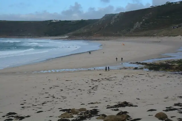
Sennen Cove , Coastal Scenery
Sennen Cove : Coastal Scenery. This photograph is used as a geographic witness to the place, not as evidence of the historical date shown in the chapter.
- Visual description
- Sennen Cove : Coastal Scenery
- Nature
- original
- Medium
- Open-licence photograph
- Source
- Wikimedia Commons / Geograph · CC BY-SA 2.0
- Reviewed
- Josh Wildman
LAND’S END
Sennen Cove
A fishing cove at Britain’s western edge that became a dependable Atlantic surf beach.
Scroll to follow the shoreline through time
Sennen occupies the southern end of Whitesand Bay, just north of Land’s End.
Pedn-men-du shelters part of the cove, while the long beach remains open to swell travelling across the Atlantic.
Sources for this chapter
THE WORKING COVE
Fishing gathered around the small harbour
Boats, a harbour and a seventeenth-century inn established a working settlement below the fields.
The cove’s identity came from landing and watching the sea before visitors arrived to use the beach.
Sources for this chapter
THE HOLIDAY COAST
The western road reached a beach, not an endpoint
Road and bus connections brought visitors beyond Land’s End to the cove itself.
Paths north to Gwynver and south around the headland revealed Whitesand Bay as a continuous coast rather than a final landmark.
Sources for this chapter
Open ledger · AOD.UK.SENNEN.V01 · ORIGINALClose ledger · AOD.UK.SENNEN.V01
Ledger AOD.UK.SENNEN.V01
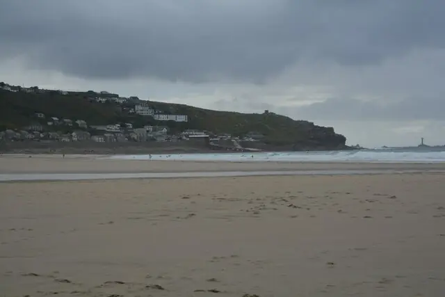
Sennen Cove , Sandy Beach
Sennen Cove : Sandy Beach. This photograph is used as a geographic witness to the place, not as evidence of the historical date shown in the chapter.
- Visual description
- Sennen Cove : Sandy Beach
- Nature
- original
- Medium
- Open-licence photograph
- Source
- Wikimedia Commons / Geograph · CC BY-SA 2.0
- Reviewed
- Josh Wildman
THE SURF YEARS
Reliable exposure made a surf centre
As modern surfing spread through Cornwall, Sennen’s position made it a dependable place to look for swell.
Different sections of the bay offered space for learners and more experienced surfers, supported by a local beach economy.
Sources for this chapter
THE LIVING MAP
The mapped place
Sennen Cove is recorded at 50.069° N, 5.698° W. A surf map fixes a name to one stretch of moving water, but the place changes with tide, swell direction, wind and the shape of the seabed.
Sources for this chapter
Open ledger · AOD.UK.SENNEN.V00 · ORIGINALClose ledger · AOD.UK.SENNEN.V00
Ledger AOD.UK.SENNEN.V00
Sennen Cove , Coastal Scenery
Sennen Cove : Coastal Scenery. This photograph is used as a geographic witness to the place, not as evidence of the historical date shown in the chapter.
- Visual description
- Sennen Cove : Coastal Scenery
- Nature
- original
- Medium
- Open-licence photograph
- Source
- Wikimedia Commons / Geograph · CC BY-SA 2.0
- Reviewed
- Josh Wildman
TODAY
The edge is now a place people stay
Sennen is now a surf, climbing and holiday village alongside a working harbour.
Its appeal comes from being exposed without feeling uninhabited: homes, boats and businesses sit immediately behind the Atlantic beach.
Sources for this chapter
THE LEDGER
Sources and credits
This exhibition is built from local, institutional and sporting records. The source ledger keeps the claims visible and leaves space for correction as further local evidence emerges.
Sources for this chapter
Artefacts in order of appearance
Sennen Cove , Coastal Scenery
AOD.UK.SENNEN.V00 · original · Wikimedia Commons / Geograph · CC BY-SA 2.0
Sennen Cove , Sandy Beach
AOD.UK.SENNEN.V01 · original · Wikimedia Commons / Geograph · CC BY-SA 2.0
Editorial record
Full UK edition. Historical claims are linked to the local, public and sporting records used to write the exhibition. Cartography is generated from the PeakWave location catalogue.