Open ledger · AOD.UK.SEABURN.V00 · ORIGINALClose ledger · AOD.UK.SEABURN.V00
Ledger AOD.UK.SEABURN.V00
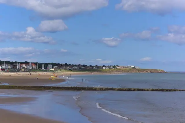
Seaburn Beach and Whitburn Bay, Sunderland
Seaburn Beach and Whitburn Bay, Sunderland. This photograph is used as a geographic witness to the place, not as evidence of the historical date shown in the chapter.
- Visual description
- Seaburn Beach and Whitburn Bay, Sunderland
- Nature
- original
- Medium
- Open-licence photograph
- Source
- Wikimedia Commons / Geograph · CC BY-SA 2.0
- Reviewed
- Josh Wildman
THE COAST
Seaburn
From open farmland to a planned interwar resort and Sunderland’s modern watersports shore.
Scroll to follow the shoreline through time
Seaburn lies on Sunderland’s magnesian limestone coast, whose geology records a much older sea.
For most of its later history the ground behind the beach remained farmland.
1936–1939
The resort is planned
A 1936 plan proposed a hotel, concert hall, boating lake, golf and other leisure facilities.
Seaburn Hotel and Hall opened by 1939, but war halted the fuller scheme.
Sources for this chapter
MID-20th CENTURY
Tram, road and housing meet the seafront
New housing, a tram route and post-war attractions connected Seaburn to Sunderland’s population.
The shore became a regular local destination rather than a remote edge.
Open ledger · AOD.UK.SEABURN.V01 · ORIGINALClose ledger · AOD.UK.SEABURN.V01
Ledger AOD.UK.SEABURN.V01
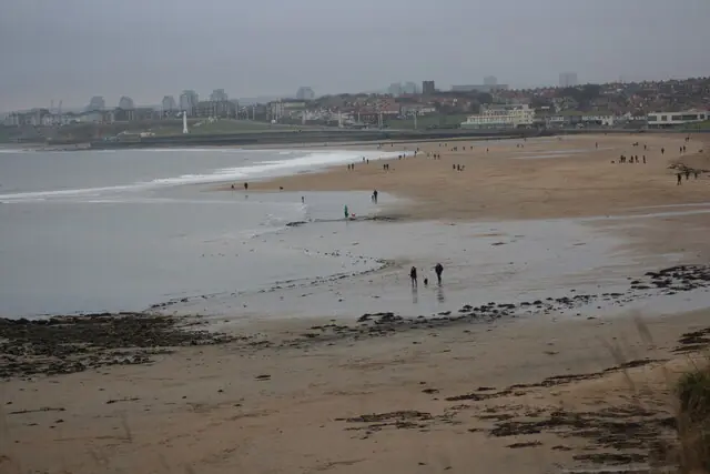
Beach at Seaburn
Beach at Seaburn. This photograph is used as a geographic witness to the place, not as evidence of the historical date shown in the chapter.
- Visual description
- Beach at Seaburn
- Nature
- original
- Medium
- Open-licence photograph
- Source
- Wikimedia Commons / Geograph · CC BY-SA 2.0
- Reviewed
- Josh Wildman
LATE 20th CENTURY
Board sports extend the season
As wetsuits spread, surfing and bodyboarding joined Seaburn’s recreation.
A council watersports centre established in 1996 gave instruction and safety a permanent base on the city shore.
THE LIVING MAP
The mapped place
Seaburn is recorded at 54.929° N, 1.377° W. A surf map fixes a name to one stretch of moving water, but the place changes with tide, swell direction, wind and the shape of the seabed.
Sources for this chapter
Open ledger · AOD.UK.SEABURN.V00 · ORIGINALClose ledger · AOD.UK.SEABURN.V00
Ledger AOD.UK.SEABURN.V00
Seaburn Beach and Whitburn Bay, Sunderland
Seaburn Beach and Whitburn Bay, Sunderland. This photograph is used as a geographic witness to the place, not as evidence of the historical date shown in the chapter.
- Visual description
- Seaburn Beach and Whitburn Bay, Sunderland
- Nature
- original
- Medium
- Open-licence photograph
- Source
- Wikimedia Commons / Geograph · CC BY-SA 2.0
- Reviewed
- Josh Wildman
TODAY
A city beach used all year
Seaburn now combines swimming, surfing, paddle sport, events and everyday promenade life.
Its modern value lies less in becoming a destination resort again than in remaining useful to the city beside it.
Sources for this chapter
THE LEDGER
Sources and credits
This exhibition is built from local, institutional and sporting records. The source ledger keeps the claims visible and leaves space for correction as further local evidence emerges.
Sources for this chapter
Artefacts in order of appearance
Seaburn Beach and Whitburn Bay, Sunderland
AOD.UK.SEABURN.V00 · original · Wikimedia Commons / Geograph · CC BY-SA 2.0
Beach at Seaburn
AOD.UK.SEABURN.V01 · original · Wikimedia Commons / Geograph · CC BY-SA 2.0
Editorial record
Full UK edition. Historical claims are linked to the local, public and sporting records used to write the exhibition. Cartography is generated from the PeakWave location catalogue.