
Open ledger · AOD.EU.SAUZE-DOULX.V00 · ORIGINALClose ledger · AOD.EU.SAUZE-DOULX.V00
Ledger AOD.EU.SAUZE-DOULX.V00
GG mountain
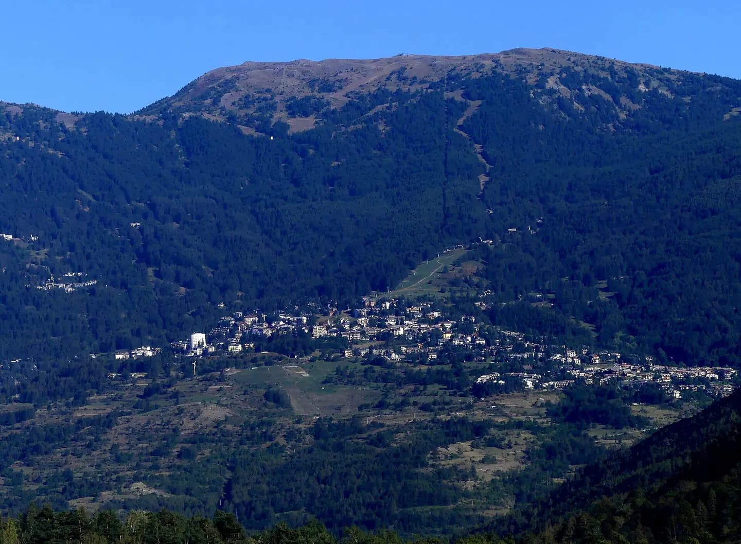
Area sciistica di Sauze d'Oulx. This photograph is used as a geographic witness to the place, not as evidence of the historical date shown in the chapter.
- Visual description
- Area sciistica di Sauze d'Oulx
- Nature
- original
- Medium
- Open-licence photograph
- Source
- Wikimedia Commons · CC BY-SA 4.0
BEFORE MODERN SPORT
Sauze d'Oulx
How settlement, access and winter sport shaped Sauze d'Oulx.
Scroll to read the contour through time
Sauze d'Oulx is a resort in the Via Lattea ski area.
Sources for this chapter
1928
Work and settlement beneath the snowline
During the Fascist Era, in 1928, its name was changed to Salice d'Ulzio, "foreigner" words being forbidden, according to the etymological interpretation of "Sauze" as "salice" (Italian for willow).
Sources for this chapter
ACCESS CHANGES
A route reaches Sauze d'Oulx
The surviving overview does not identify one decisive access date for Sauze d'Oulx.
This edition therefore leaves that date open rather than turning gradual change into a false single event.
Sources for this chapter
Open ledger · AOD.EU.SAUZE-DOULX.V01 · ORIGINALClose ledger · AOD.EU.SAUZE-DOULX.V01
Ledger AOD.EU.SAUZE-DOULX.V01
Sauze d'Oulx depuis la vallée en soirée
Sight, in the end of afternoon from A32 motorway near Oulx , of Sauze d'Oulx village and ski resort, in Susa Valley , Italy. This photograph is used as a geographic witness to the place, not as evidence of the historical date shown in the chapter.
- Visual description
- Sight, in the end of afternoon from A32 motorway near Oulx , of Sauze d'Oulx village and ski resort, in Susa Valley , Italy
- Nature
- original
- Medium
- Open-licence photograph
- Source
- Wikimedia Commons · CC BY-SA 4.0
2006
Winter becomes organised
It was the site of the freestyle skiing events of the 2006 Olympic Winter Games.
Sources for this chapter
THE LIVING MAP
The mapped place
Sauze d'Oulx is recorded at 45.030° N, 6.862° E. Its catalogue reference reaches 2,823 metres. A modern resort map compresses terrain, exposure and access into a diagram. This exhibition keeps the underlying contour visible so the place does not become only a list of facilities.
Sources for this chapter
Open ledger · AOD.EU.SAUZE-DOULX.V00 · ORIGINALClose ledger · AOD.EU.SAUZE-DOULX.V00
Ledger AOD.EU.SAUZE-DOULX.V00
GG mountain
Area sciistica di Sauze d'Oulx. This photograph is used as a geographic witness to the place, not as evidence of the historical date shown in the chapter.
- Visual description
- Area sciistica di Sauze d'Oulx
- Nature
- original
- Medium
- Open-licence photograph
- Source
- Wikimedia Commons · CC BY-SA 4.0
TODAY
Sauze d'Oulx now
Some ski passes include a days usage at Montgenèvre which can be reached via ski or regular coach connections organised by local tour companies.
Sources for this chapter
THE LEDGER
Sources and credits
This exhibition is built from local, institutional and sporting records. The source ledger keeps the claims visible and leaves space for correction as further local evidence emerges.
Sources for this chapter
Artefacts in order of appearance
GG mountain
AOD.EU.SAUZE-DOULX.V00 · original · Wikimedia Commons · CC BY-SA 4.0
Sauze d'Oulx depuis la vallée en soirée
AOD.EU.SAUZE-DOULX.V01 · original · Wikimedia Commons · CC BY-SA 4.0
Editorial record
Full European Beta edition. Place evidence is adapted from the linked Sauze d'Oulx overview under CC BY-SA 4.0 and remains subject to named historical and local review. Cartography is generated from the PeakWave location catalogue.