Open ledger · AOD.UK.SANDSEND.V00 · ORIGINALClose ledger · AOD.UK.SANDSEND.V00
Ledger AOD.UK.SANDSEND.V00
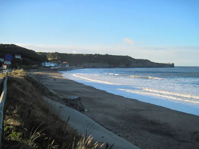
Sandsend Beach in evening sunlight
Sandsend Beach in evening sunlight. This photograph is used as a geographic witness to the place, not as evidence of the historical date shown in the chapter.
- Visual description
- Sandsend Beach in evening sunlight
- Nature
- original
- Medium
- Open-licence photograph
- Source
- Wikimedia Commons / Geograph · CC BY-SA 2.0
- Reviewed
- Josh Wildman
THE BEACH
Sandsend
A former fishing and industrial coast north of Whitby, now read through its open beach and caves.
Scroll to follow the shoreline through time
Sandsend extends north from Whitby beneath cliffs and valleys descending from the North York Moors.
Its exposed sand and northern headland create both open peaks and the locally named Caves section.
Sources for this chapter
WORKING SANDSEND
Fishing village on an industrial coast
Sandsend grew as a small fishing settlement within a coast also worked for alum, jet and stone.
The cliffs were sources of income before they became scenery.
Sources for this chapter
19th–20th CENTURIES
Road and railway make the shore legible
Connections to Whitby brought visitors along a coast previously organised around villages and industry.
The long strand gradually became a recreational extension of the town.
Sources for this chapter
Open ledger · AOD.UK.SANDSEND.V01 · ORIGINALClose ledger · AOD.UK.SANDSEND.V01
Ledger AOD.UK.SANDSEND.V01
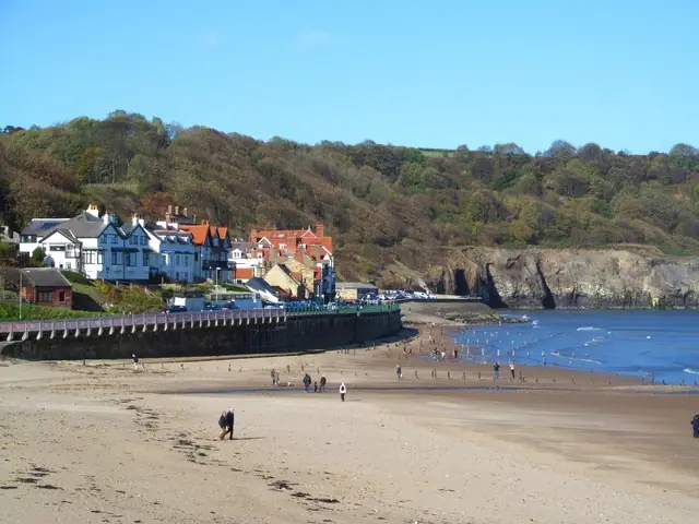
Sandsend beach
Sandsend beach. This photograph is used as a geographic witness to the place, not as evidence of the historical date shown in the chapter.
- Visual description
- Sandsend beach
- Nature
- original
- Medium
- Open-licence photograph
- Source
- Wikimedia Commons / Geograph · CC BY-SA 2.0
- Reviewed
- Josh Wildman
THE SURF YEARS
The Caves acquire a surf name
As Yorkshire surfing grew, riders distinguished the open beach from Caves beneath the northern headland.
The name encodes a specific response to swell and shelter within an otherwise broad bay.
THE LIVING MAP
The mapped place
Sandsend is recorded at 54.497° N, 0.686° W. A surf map fixes a name to one stretch of moving water, but the place changes with tide, swell direction, wind and the shape of the seabed.
Sources for this chapter
Open ledger · AOD.UK.SANDSEND.V00 · ORIGINALClose ledger · AOD.UK.SANDSEND.V00
Ledger AOD.UK.SANDSEND.V00
Sandsend Beach in evening sunlight
Sandsend Beach in evening sunlight. This photograph is used as a geographic witness to the place, not as evidence of the historical date shown in the chapter.
- Visual description
- Sandsend Beach in evening sunlight
- Nature
- original
- Medium
- Open-licence photograph
- Source
- Wikimedia Commons / Geograph · CC BY-SA 2.0
- Reviewed
- Josh Wildman
TODAY
A village within a regional surf system
Sandsend now serves local surfers, learners and visitors moving between Whitby and the National Park coast.
It works best as one connected option among several, chosen according to wind and tide.
Sources for this chapter
THE LEDGER
Sources and credits
This exhibition is built from local, institutional and sporting records. The source ledger keeps the claims visible and leaves space for correction as further local evidence emerges.
Sources for this chapter
Artefacts in order of appearance
Sandsend Beach in evening sunlight
AOD.UK.SANDSEND.V00 · original · Wikimedia Commons / Geograph · CC BY-SA 2.0
Sandsend beach
AOD.UK.SANDSEND.V01 · original · Wikimedia Commons / Geograph · CC BY-SA 2.0
Editorial record
Full UK edition. Historical claims are linked to the local, public and sporting records used to write the exhibition. Cartography is generated from the PeakWave location catalogue.