Open ledger · AOD.US.SAN-FRANCISCO-BAY.V00 · ORIGINALClose ledger · AOD.US.SAN-FRANCISCO-BAY.V00
Ledger AOD.US.SAN-FRANCISCO-BAY.V00
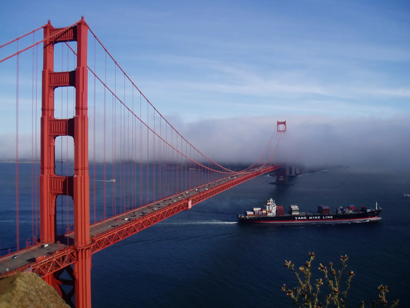
Golden Gate Bridge Yang Ming Line
Golden Gate Bridge , San Francisco Bay, Yang Ming Line freighter YM America. This photograph is used as a geographic witness to the place, not as evidence of the historical date shown in the chapter.
- Visual description
- Golden Gate Bridge , San Francisco Bay, Yang Ming Line freighter YM America
- Nature
- original
- Medium
- Open-licence photograph
- Source
- Wikimedia Commons · CC BY-SA 3.0
BEFORE MODERN SPORT
San Francisco Bay
How working water, access and organised sailing shaped San Francisco Bay.
Scroll to read the water through time
San Francisco Bay is a large tidal estuary in the U.S.
state of California, and gives its name to the San Francisco Bay Area.
Sources for this chapter
BEFORE TOURISM
A working shore
The bay was navigable as far south as San Jose until the 1850s, when hydraulic mining released massive amounts of sediment from the rivers that settled in those parts of the bay that had little or no current.
Sources for this chapter
1910
The route to the water
In 1910, the Southern Pacific railroad company built the Dumbarton Rail Bridge, the first bridge crossing San Francisco Bay.
Open ledger · AOD.US.SAN-FRANCISCO-BAY.V01 · ORIGINALClose ledger · AOD.US.SAN-FRANCISCO-BAY.V01
Ledger AOD.US.SAN-FRANCISCO-BAY.V01
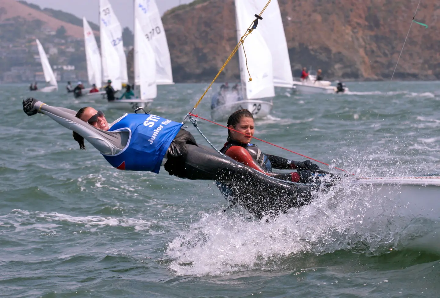
Syc usjwdc2008 1
Photo of participants in US Junior Women's Double-handed Sailing Championship on San Francisco Bay in October of 2008. Sponsored by Sausalito Yacht Club. This photograph is used as a geographic witness to the place, not as evidence of the historical date shown in the chapter.
- Visual description
- Photo of participants in US Junior Women's Double-handed Sailing Championship on San Francisco Bay in October of 2008. Sponsored by Sausalito Yacht Club
- Nature
- original
- Medium
- Open-licence photograph
- Source
- Wikimedia Commons · CC BY-SA 3.0
1927
Sailing becomes organised
Founded in 1927, the Saint Francis Yacht Club (StFYC) was formed when some of the members of the San Francisco Yacht Club decided to move their clubhouse from Sausalito to Belvedere, California to escape the rapidly growing commercial activity of Sausalito.
THE LIVING MAP
The mapped place
San Francisco Bay is recorded at 37.820° N, 122.380° W as a coastal open venue. A course drawn here is temporary: wind, current, shore and marks determine the water that sailors actually meet.
Sources for this chapter
Open ledger · AOD.US.SAN-FRANCISCO-BAY.V00 · ORIGINALClose ledger · AOD.US.SAN-FRANCISCO-BAY.V00
Ledger AOD.US.SAN-FRANCISCO-BAY.V00
Golden Gate Bridge Yang Ming Line
Golden Gate Bridge , San Francisco Bay, Yang Ming Line freighter YM America. This photograph is used as a geographic witness to the place, not as evidence of the historical date shown in the chapter.
- Visual description
- Golden Gate Bridge , San Francisco Bay, Yang Ming Line freighter YM America
- Nature
- original
- Medium
- Open-licence photograph
- Source
- Wikimedia Commons · CC BY-SA 3.0
TODAY
San Francisco Bay now
San Francisco Bay is popular for sailors (boats, as well as windsurfing and kitesurfing), due to consistent strong westerly/northwesterly thermally-generated winds – Beaufort force 6 (15–25 knots; 17–29 mph; 8–13 m/s) is common on summer afternoons – and protection from large open ocean swells.
THE LEDGER
Sources and credits
This exhibition is built from local, institutional and sporting records. The source ledger keeps the claims visible and leaves space for correction as further local evidence emerges.
Sources for this chapter
Artefacts in order of appearance
Golden Gate Bridge Yang Ming Line
AOD.US.SAN-FRANCISCO-BAY.V00 · original · Wikimedia Commons · CC BY-SA 3.0
Syc usjwdc2008 1
AOD.US.SAN-FRANCISCO-BAY.V01 · original · Wikimedia Commons · CC BY-SA 3.0
Editorial record
Full US Beta edition. Place evidence is adapted from the linked San Francisco Bay overview under CC BY-SA 4.0 and remains subject to named historical and local review. Cartography is generated from the PeakWave location catalogue.