
Open ledger · AOD.EU.SAINTE-FOY.V00 · ORIGINALClose ledger · AOD.EU.SAINTE-FOY.V00
Ledger AOD.EU.SAINTE-FOY.V00
Les drainages au village de la croix. N° 1338. - Mougin - btv1b10686444t
Photographie en noir et blanc de la restauration des terrains en montagne. Mots-clés : Ouvrages de dérivation ; Sainte-Foy-Tarentaise (Savoie, France) ; Savoie(France). This photograph is used as a geographic witness to the place, not as evidence of the historical date shown in the chapter.
- Visual description
- Photographie en noir et blanc de la restauration des terrains en montagne. Mots-clés : Ouvrages de dérivation ; Sainte-Foy-Tarentaise (Savoie, France) ; Savoie(France)
- Nature
- original
- Medium
- Open-licence photograph
- Source
- Wikimedia Commons · Public domain
BEFORE MODERN SPORT
Sainte-Foy-Tarentaise
How settlement, access and winter sport shaped Sainte-Foy-Tarentaise.
Scroll to read the contour through time
Sainte-Foy-Tarentaise is a commune in the Savoie department in the Auvergne-Rhône-Alpes region in south-eastern France.
Sources for this chapter
1170
Work and settlement beneath the snowline
It seems that there was a place of worship in Sainte-Foy as soon as the region was evangelized by Jacques de Tarentaise in the 5th century, probably dedicated to Sainte-Madeleine, the second patron saint of the village, but the name of Sainte-Foy only appears in an official text in 1170.
Sources for this chapter
ACCESS CHANGES
A route reaches Sainte-Foy-Tarentaise
About 4 km above the village (turning left at La Thuile) is the ski resort of Sainte Foy (referred as Sainte Foy Station).
Sources for this chapter
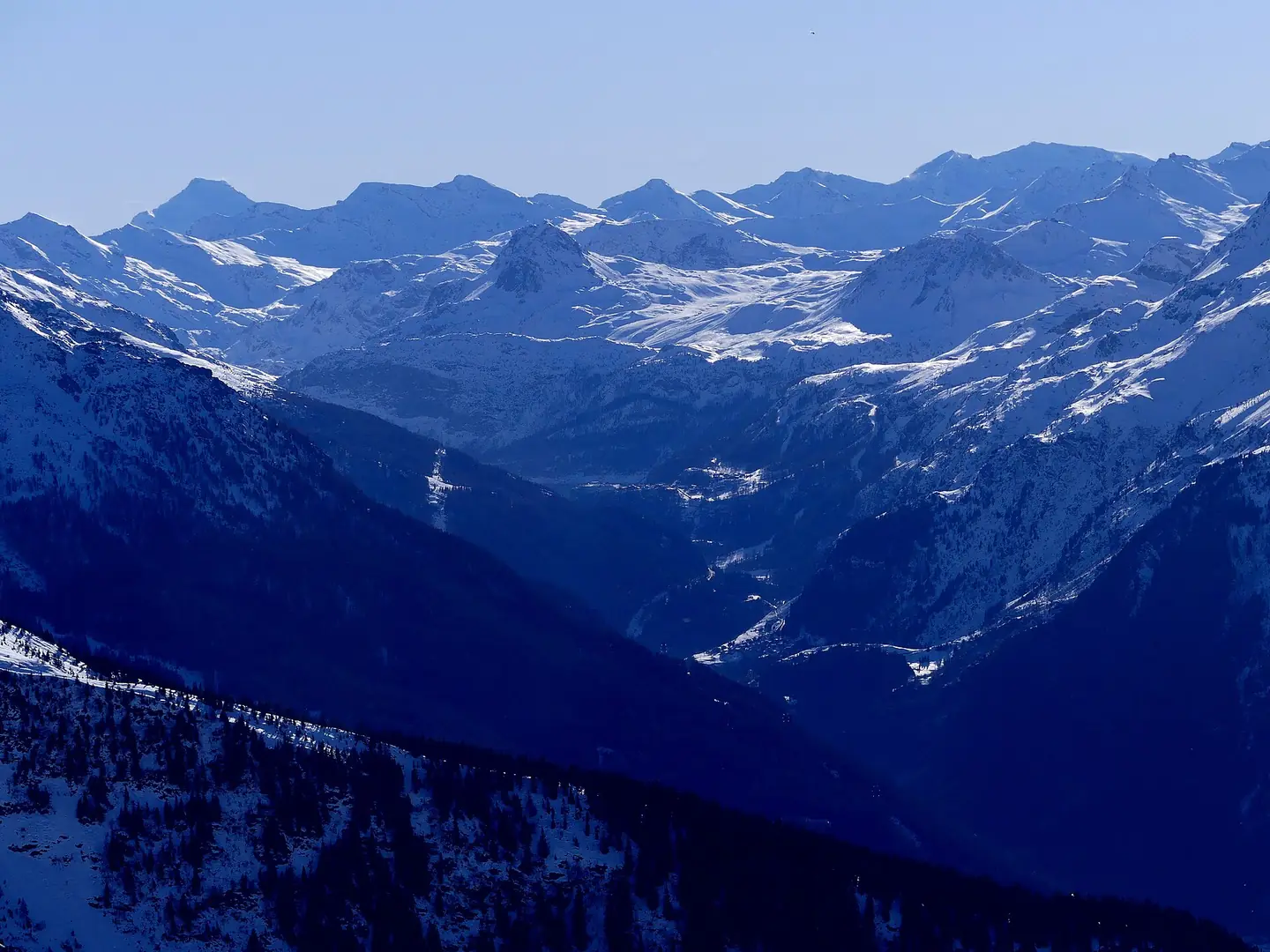
Open ledger · AOD.EU.SAINTE-FOY.V01 · ORIGINALClose ledger · AOD.EU.SAINTE-FOY.V01
Ledger AOD.EU.SAINTE-FOY.V01
Haute-Tarentaise enneigée depuis La Rosière
Sight, in winter from La Rosière ski resort, of high Tarentaise valley towards east and Tignes dam, in Savoie , France. This photograph is used as a geographic witness to the place, not as evidence of the historical date shown in the chapter.
- Visual description
- Sight, in winter from La Rosière ski resort, of high Tarentaise valley towards east and Tignes dam, in Savoie , France
- Nature
- original
- Medium
- Open-licence photograph
- Source
- Wikimedia Commons · CC BY-SA 4.0
1982
Winter becomes organised
From the 1960s on, several projects for winter sports resorts were proposed, until in 1982, the site of Bon Conseil was finally selected for a ski resort.
Sources for this chapter
THE LIVING MAP
The mapped place
Sainte-Foy-Tarentaise is recorded at 45.546° N, 6.883° E. Its catalogue reference reaches 2,620 metres. A modern resort map compresses terrain, exposure and access into a diagram. This exhibition keeps the underlying contour visible so the place does not become only a list of facilities.
Sources for this chapter
Open ledger · AOD.EU.SAINTE-FOY.V00 · ORIGINALClose ledger · AOD.EU.SAINTE-FOY.V00
Ledger AOD.EU.SAINTE-FOY.V00
Les drainages au village de la croix. N° 1338. - Mougin - btv1b10686444t
Photographie en noir et blanc de la restauration des terrains en montagne. Mots-clés : Ouvrages de dérivation ; Sainte-Foy-Tarentaise (Savoie, France) ; Savoie(France). This photograph is used as a geographic witness to the place, not as evidence of the historical date shown in the chapter.
- Visual description
- Photographie en noir et blanc de la restauration des terrains en montagne. Mots-clés : Ouvrages de dérivation ; Sainte-Foy-Tarentaise (Savoie, France) ; Savoie(France)
- Nature
- original
- Medium
- Open-licence photograph
- Source
- Wikimedia Commons · Public domain
TODAY
Sainte-Foy-Tarentaise now
There are two spas in the resort, ski shops, 4 bars, 7 restaurants and 2 small supermarkets.
Sources for this chapter
THE LEDGER
Sources and credits
This exhibition is built from local, institutional and sporting records. The source ledger keeps the claims visible and leaves space for correction as further local evidence emerges.
Sources for this chapter
Artefacts in order of appearance
Les drainages au village de la croix. N° 1338. - Mougin - btv1b10686444t
AOD.EU.SAINTE-FOY.V00 · original · Wikimedia Commons · Public domain
Haute-Tarentaise enneigée depuis La Rosière
AOD.EU.SAINTE-FOY.V01 · original · Wikimedia Commons · CC BY-SA 4.0
Editorial record
Full European Beta edition. Place evidence is adapted from the linked Sainte-Foy-Tarentaise overview under CC BY-SA 4.0 and remains subject to named historical and local review. Cartography is generated from the PeakWave location catalogue.