Open ledger · AOD.EU.RIKSGRANSEN.V00 · ORIGINALClose ledger · AOD.EU.RIKSGRANSEN.V00
Ledger AOD.EU.RIKSGRANSEN.V00
Riksgränsen august 2022
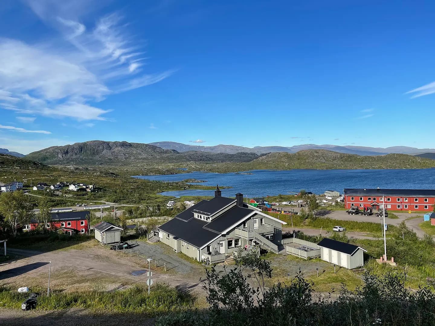
Riksgränsen, Swedish border town and ski resort in summer. This photograph is used as a geographic witness to the place, not as evidence of the historical date shown in the chapter.
- Visual description
- Riksgränsen, Swedish border town and ski resort in summer
- Nature
- original
- Medium
- Open-licence photograph
- Source
- Wikimedia Commons · CC0
BEFORE MODERN SPORT
Riksgränsen
How settlement, access and winter sport shaped Riksgränsen.
Scroll to read the contour through time
Riksgränsen (Swedish for 'National Border'; Norwegian: Riksgrensen) is a Swedish ski resort located at the northwest edge of Kiruna Municipality in Lappland, next to the Norwegian border.
Sources for this chapter
1900
Work and settlement beneath the snowline
The village was founded around 1900 in connection with the construction of the railway, whose traffic began 1902.
Sources for this chapter
ACCESS CHANGES
A route reaches Riksgränsen
Due to railway politics and limited range for steam locomotives, trains changed locomotives and crew and a roundhouse for locomotives was built.
Sources for this chapter
Open ledger · AOD.EU.RIKSGRANSEN.V01 · ORIGINALClose ledger · AOD.EU.RIKSGRANSEN.V01
Ledger AOD.EU.RIKSGRANSEN.V01
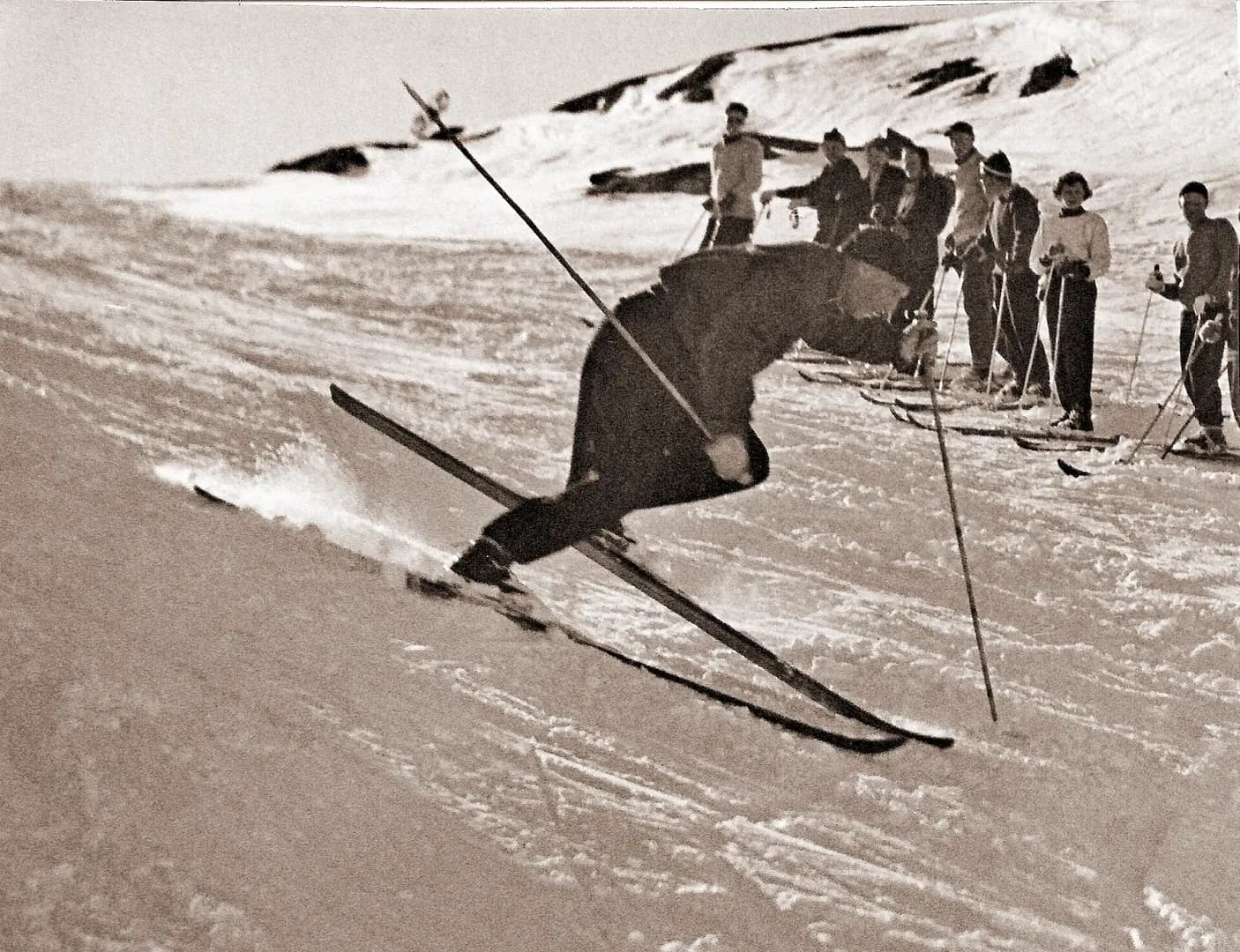
Diagonal slalom turn by Rimfors in Riksgränsen 1950s
Ski instructor Olle Rimfors demonstrates the diagonal turn in Riksgränsen around the mid 1950s. This photograph is used as a geographic witness to the place, not as evidence of the historical date shown in the chapter.
- Visual description
- Ski instructor Olle Rimfors demonstrates the diagonal turn in Riksgränsen around the mid 1950s
- Nature
- original
- Medium
- Open-licence photograph
- Source
- Wikimedia Commons · CC BY-SA 4.0
ORGANISED SPORT
Winter becomes organised
It is the most northerly ski resort in the world, being roughly 200 kilometres (120 mi) north of the Arctic Circle; the skiing season is from February to June, and from the end of May the lifts operate under the midnight sun.
Sources for this chapter
THE LIVING MAP
The mapped place
Riksgränsen is recorded at 68.428° N, 18.127° E. Its catalogue reference reaches 910 metres. A modern resort map compresses terrain, exposure and access into a diagram. This exhibition keeps the underlying contour visible so the place does not become only a list of facilities.
Sources for this chapter
Open ledger · AOD.EU.RIKSGRANSEN.V00 · ORIGINALClose ledger · AOD.EU.RIKSGRANSEN.V00
Ledger AOD.EU.RIKSGRANSEN.V00
Riksgränsen august 2022
Riksgränsen, Swedish border town and ski resort in summer. This photograph is used as a geographic witness to the place, not as evidence of the historical date shown in the chapter.
- Visual description
- Riksgränsen, Swedish border town and ski resort in summer
- Nature
- original
- Medium
- Open-licence photograph
- Source
- Wikimedia Commons · CC0
TODAY
Riksgränsen now
The deep snow cover and the time it takes for thawing prolongs the skiing season to the midnight sun window.
Sources for this chapter
THE LEDGER
Sources and credits
This exhibition is built from local, institutional and sporting records. The source ledger keeps the claims visible and leaves space for correction as further local evidence emerges.
Sources for this chapter
Artefacts in order of appearance
Riksgränsen august 2022
AOD.EU.RIKSGRANSEN.V00 · original · Wikimedia Commons · CC0
Diagonal slalom turn by Rimfors in Riksgränsen 1950s
AOD.EU.RIKSGRANSEN.V01 · original · Wikimedia Commons · CC BY-SA 4.0
Editorial record
Full European Beta edition. Place evidence is adapted from the linked Riksgränsen overview under CC BY-SA 4.0 and remains subject to named historical and local review. Cartography is generated from the PeakWave location catalogue.