Open ledger · AOD.UK.REST-BAY.V00 · ORIGINALClose ledger · AOD.UK.REST-BAY.V00
Ledger AOD.UK.REST-BAY.V00
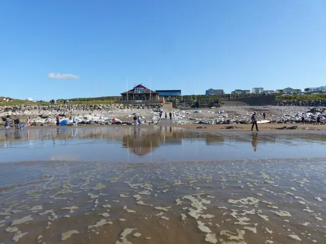
Looking towards the shore at Rest Bay, Porthcawl
Looking towards the shore at Rest Bay, Porthcawl. This photograph is used as a geographic witness to the place, not as evidence of the historical date shown in the chapter.
- Visual description
- Looking towards the shore at Rest Bay, Porthcawl
- Nature
- original
- Medium
- Open-licence photograph
- Source
- Wikimedia Commons / Geograph · CC BY-SA 2.0
- Reviewed
- Josh Wildman
THE BAY
Rest Bay
Porthcawl’s accessible Atlantic-facing bay and the centre of a surf culture growing since the 1960s.
Scroll to follow the shoreline through time
Rest Bay sits on a coastline with an exceptional tidal range.
Swell must cross offshore banks before breaking on the beach, so conditions can change sharply as the tide moves.
Sources for this chapter
PORTHCAWL BEFORE SURFING
A seaside town looks west
Porthcawl was already a resort and working coastal town when surfers arrived.
Rest Bay added a more exposed, active edge to a seaside identity built around promenades and beaches.
Sources for this chapter
1960–1973
Surfers arrive from the 1960s
Surfers have been coming to Porthcawl since the 1960s.
Its position close to the M4 made Rest Bay unusually reachable for a wide South Wales catchment as equipment improved.
Sources for this chapter
Open ledger · AOD.UK.REST-BAY.V01 · ORIGINALClose ledger · AOD.UK.REST-BAY.V01
Ledger AOD.UK.REST-BAY.V01
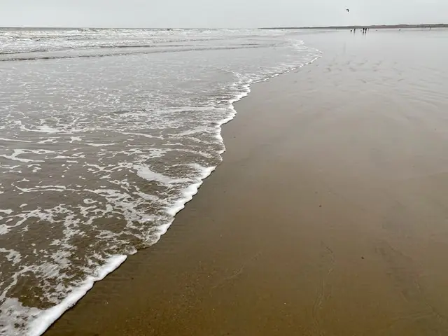
Incoming tide at Rest Bay
Incoming tide at Rest Bay. This photograph is used as a geographic witness to the place, not as evidence of the historical date shown in the chapter.
- Visual description
- Incoming tide at Rest Bay
- Nature
- original
- Medium
- Open-licence photograph
- Source
- Wikimedia Commons / Geograph · CC BY-SA 2.0
- Reviewed
- Josh Wildman
THE COMPETITIVE YEARS
A local scene produces champions
The federation era brought coaching, events and pathways into Welsh teams.
Rest Bay’s regular participation base included surfers who went on to British and European titles.
Sources for this chapter
THE LIVING MAP
The mapped place
Rest Bay is recorded at 51.488° N, 3.739° W. A surf map fixes a name to one stretch of moving water, but the place changes with tide, swell direction, wind and the shape of the seabed.
Sources for this chapter
Open ledger · AOD.UK.REST-BAY.V00 · ORIGINALClose ledger · AOD.UK.REST-BAY.V00
Ledger AOD.UK.REST-BAY.V00
Looking towards the shore at Rest Bay, Porthcawl
Looking towards the shore at Rest Bay, Porthcawl. This photograph is used as a geographic witness to the place, not as evidence of the historical date shown in the chapter.
- Visual description
- Looking towards the shore at Rest Bay, Porthcawl
- Nature
- original
- Medium
- Open-licence photograph
- Source
- Wikimedia Commons / Geograph · CC BY-SA 2.0
- Reviewed
- Josh Wildman
TODAY
A purpose-built public base
Rest Bay now has a watersports centre supporting lessons, hire and safer access.
The beach’s modern role is not exclusivity but a visible route into surfing, tempered by the need to understand its rapidly changing tide.
Sources for this chapter
THE LEDGER
Sources and credits
This exhibition is built from local, institutional and sporting records. The source ledger keeps the claims visible and leaves space for correction as further local evidence emerges.
Sources for this chapter
Artefacts in order of appearance
Looking towards the shore at Rest Bay, Porthcawl
AOD.UK.REST-BAY.V00 · original · Wikimedia Commons / Geograph · CC BY-SA 2.0
Incoming tide at Rest Bay
AOD.UK.REST-BAY.V01 · original · Wikimedia Commons / Geograph · CC BY-SA 2.0
Editorial record
Full UK edition. Historical claims are linked to the local, public and sporting records used to write the exhibition. Cartography is generated from the PeakWave location catalogue.