Open ledger · AOD.UK.PWLLHELI.V00 · ORIGINALClose ledger · AOD.UK.PWLLHELI.V00
Ledger AOD.UK.PWLLHELI.V00
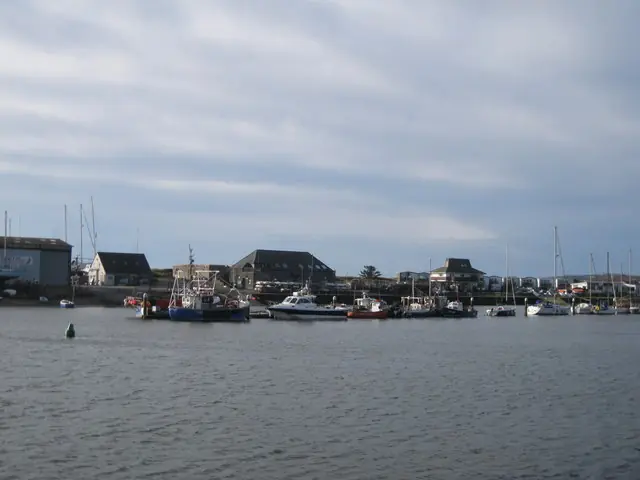
Harbwr allanol Pwllheli Outer harbour
Harbwr allanol Pwllheli Outer harbour. This photograph is used as a geographic witness to the place, not as evidence of the historical date shown in the chapter.
- Visual description
- Harbwr allanol Pwllheli Outer harbour
- Nature
- original
- Medium
- Open-licence photograph
- Source
- Wikimedia Commons / Geograph · CC BY-SA 2.0
- Reviewed
- Josh Wildman
THE SHELTERED PORT
Pwllheli
A sheltered Welsh port that grew from fishing and shipbuilding into a national sailing base.
Scroll to read the water through time
Pwllheli occupies a sheltered position on Cardigan Bay.
The harbour offered refuge and a working edge to a coast otherwise exposed to Atlantic weather.
Sources for this chapter
1284–19th CENTURY
Fishing, markets and boatbuilding
Pwllheli appears in written records in 1284 and gained municipal rights in 1355.
Fishing, boatbuilding, quarrying and trade shaped the town long before leisure craft became prominent.
Sources for this chapter
1958
A club takes shape
Clwb Hwylio Pwllheli Sailing Club was established in 1958.
Through several homes it built a programme able to use both the harbour and open Cardigan Bay.
Sources for this chapter
Open ledger · AOD.UK.PWLLHELI.V01 · ORIGINALClose ledger · AOD.UK.PWLLHELI.V01
Ledger AOD.UK.PWLLHELI.V01
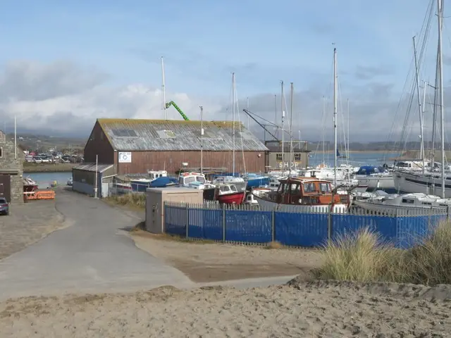
Boatyard by Pwllheli harbour
Boatyard by Pwllheli harbour. This photograph is used as a geographic witness to the place, not as evidence of the historical date shown in the chapter.
- Visual description
- Boatyard by Pwllheli harbour
- Nature
- original
- Medium
- Open-licence photograph
- Source
- Wikimedia Commons / Geograph · CC BY-SA 2.0
- Reviewed
- Josh Wildman
2015
A national academy opens
In July 2015 the club moved into its fifth home at Plas Heli, the Welsh National Sailing Academy.
The facilities allowed Pwllheli to host training and major events at a scale the earlier clubhouses could not.
Sources for this chapter
THE LIVING MAP
The mapped place
Pwllheli is recorded at 52.880° N, 4.400° W as a coastal open venue. A course drawn here is temporary: wind, current, shore and marks determine the water that sailors actually meet.
Sources for this chapter
Open ledger · AOD.UK.PWLLHELI.V00 · ORIGINALClose ledger · AOD.UK.PWLLHELI.V00
Ledger AOD.UK.PWLLHELI.V00
Harbwr allanol Pwllheli Outer harbour
Harbwr allanol Pwllheli Outer harbour. This photograph is used as a geographic witness to the place, not as evidence of the historical date shown in the chapter.
- Visual description
- Harbwr allanol Pwllheli Outer harbour
- Nature
- original
- Medium
- Open-licence photograph
- Source
- Wikimedia Commons / Geograph · CC BY-SA 2.0
- Reviewed
- Josh Wildman
TODAY
A Welsh base for open-water racing
Pwllheli now connects a living harbour town with dinghy and keelboat competition, youth pathways and championship racing.
The modern venue rests on the same shelter that first made the port useful.
Sources for this chapter
THE LEDGER
Sources and credits
This exhibition is built from local, institutional and sporting records. The source ledger keeps the claims visible and leaves space for correction as further local evidence emerges.
Sources for this chapter
Artefacts in order of appearance
Harbwr allanol Pwllheli Outer harbour
AOD.UK.PWLLHELI.V00 · original · Wikimedia Commons / Geograph · CC BY-SA 2.0
Boatyard by Pwllheli harbour
AOD.UK.PWLLHELI.V01 · original · Wikimedia Commons / Geograph · CC BY-SA 2.0
Editorial record
Full UK edition. Historical claims are linked to the local, public and sporting records used to write the exhibition. Cartography is generated from the PeakWave location catalogue.