Open ledger · AOD.UK.PUTSBOROUGH.V00 · ORIGINALClose ledger · AOD.UK.PUTSBOROUGH.V00
Ledger AOD.UK.PUTSBOROUGH.V00
North Devon , Putsborough Sand
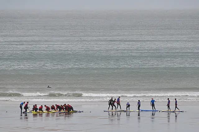
North Devon : Putsborough Sand. This photograph is used as a geographic witness to the place, not as evidence of the historical date shown in the chapter.
- Visual description
- North Devon : Putsborough Sand
- Nature
- original
- Medium
- Open-licence photograph
- Source
- Wikimedia Commons / Geograph · CC BY-SA 2.0
- Reviewed
- Josh Wildman
THE SOUTHERN END
Putsborough
The sheltered end of a three-mile beach, connected to North Devon’s earliest surf history.
Scroll to follow the shoreline through time
Putsborough forms the southern end of the long Woolacombe strand.
Baggy Point can shelter the beach from south-westerly wind, giving it a different role from the open sand farther north.
Sources for this chapter
BEFORE THE HOLIDAY BEACH
A coast worked from land and sea
Farming, fishing and scattered coastal settlements shaped the ground behind the strand.
The beach connected communities before it separated named visitor destinations.
Sources for this chapter
1904–1969
North Devon learns to surf
Wave riding was recorded in North Devon in the early twentieth century, then fibreglass boards and better wetsuits drove rapid growth in the 1960s.
Putsborough became one option in a coast-wide search for the best wind.
Open ledger · AOD.UK.PUTSBOROUGH.V01 · ORIGINALClose ledger · AOD.UK.PUTSBOROUGH.V01
Ledger AOD.UK.PUTSBOROUGH.V01
North Devon , Putsborough Sand
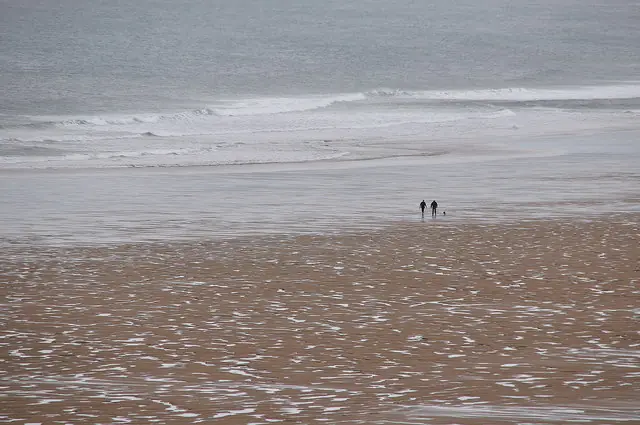
North Devon : Putsborough Sand. This photograph is used as a geographic witness to the place, not as evidence of the historical date shown in the chapter.
- Visual description
- North Devon : Putsborough Sand
- Nature
- original
- Medium
- Open-licence photograph
- Source
- Wikimedia Commons / Geograph · CC BY-SA 2.0
- Reviewed
- Josh Wildman
THE SURF COAST
One beach, several breaks
Surfers learned to treat Putsborough, Woolacombe and the banks between them as related but not identical.
Choosing where to paddle out became an exercise in reading shelter, tide and crowd.
Sources for this chapter
THE LIVING MAP
The mapped place
Putsborough is recorded at 51.156° N, 4.235° W. A surf map fixes a name to one stretch of moving water, but the place changes with tide, swell direction, wind and the shape of the seabed.
Sources for this chapter
Open ledger · AOD.UK.PUTSBOROUGH.V00 · ORIGINALClose ledger · AOD.UK.PUTSBOROUGH.V00
Ledger AOD.UK.PUTSBOROUGH.V00
North Devon , Putsborough Sand
North Devon : Putsborough Sand. This photograph is used as a geographic witness to the place, not as evidence of the historical date shown in the chapter.
- Visual description
- North Devon : Putsborough Sand
- Nature
- original
- Medium
- Open-licence photograph
- Source
- Wikimedia Commons / Geograph · CC BY-SA 2.0
- Reviewed
- Josh Wildman
TODAY
Shelter remains its advantage
Putsborough remains part of the North Devon World Surfing Reserve and a working alternative when exposed beaches are untidy.
Its identity comes from position within the bay, not from a standalone resort story.
Sources for this chapter
THE LEDGER
Sources and credits
This exhibition is built from local, institutional and sporting records. The source ledger keeps the claims visible and leaves space for correction as further local evidence emerges.
Sources for this chapter
Artefacts in order of appearance
North Devon , Putsborough Sand
AOD.UK.PUTSBOROUGH.V00 · original · Wikimedia Commons / Geograph · CC BY-SA 2.0
North Devon , Putsborough Sand
AOD.UK.PUTSBOROUGH.V01 · original · Wikimedia Commons / Geograph · CC BY-SA 2.0
Editorial record
Full UK edition. Historical claims are linked to the local, public and sporting records used to write the exhibition. Cartography is generated from the PeakWave location catalogue.