Open ledger · AOD.UK.PORTRUSH.V00 · ORIGINALClose ledger · AOD.UK.PORTRUSH.V00
Ledger AOD.UK.PORTRUSH.V00
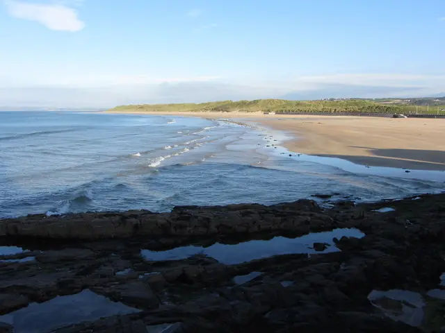
Curran Strand beach, Portrush
Curran Strand beach, Portrush. This photograph is used as a geographic witness to the place, not as evidence of the historical date shown in the chapter.
- Visual description
- Curran Strand beach, Portrush
- Nature
- original
- Medium
- Open-licence photograph
- Source
- Wikimedia Commons / Geograph · CC BY-SA 2.0
- Reviewed
- Josh Wildman
AFTER THE ICE
Portrush
A north-coast resort where post-glacial sand, railway tourism and Irish surfing meet.
Scroll to follow the shoreline through time
At Portrush West Strand, peat and beach deposits record sea-level change after the last Ice Age.
The modern resort occupies a coast that has repeatedly moved between land, wet ground and sand.
Sources for this chapter
THE RESORT YEARS
The promontory becomes a resort
Portrush grew as a seaside town around beaches on either side of a rocky promontory.
Rail access and holiday culture turned the strands into shared public spaces for bathing and recreation.
Sources for this chapter
THE SURF ARRIVAL
Cold water becomes practical
Improved wetsuits and road travel allowed a sustained local surf culture to form on Northern Ireland’s north coast.
Portrush offered several beaches, shops and an accessible town base.
Sources for this chapter
Open ledger · AOD.UK.PORTRUSH.V01 · ORIGINALClose ledger · AOD.UK.PORTRUSH.V01
Ledger AOD.UK.PORTRUSH.V01
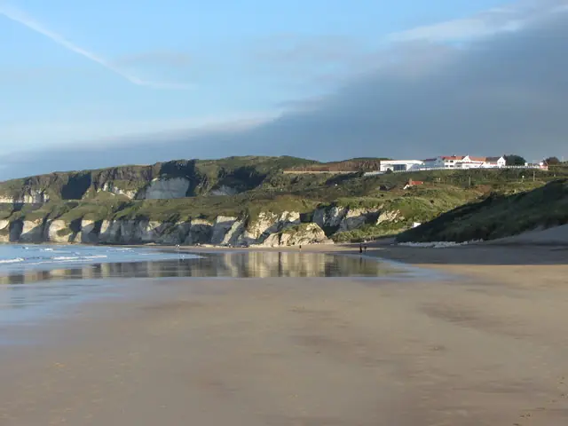
Beach near Whiterocks, Portrush
Beach near Whiterocks, Portrush. This photograph is used as a geographic witness to the place, not as evidence of the historical date shown in the chapter.
- Visual description
- Beach near Whiterocks, Portrush
- Nature
- original
- Medium
- Open-licence photograph
- Source
- Wikimedia Commons / Geograph · CC BY-SA 2.0
- Reviewed
- Josh Wildman
THE SURF TOWN
Portrush becomes shorthand for surfing
Schools, competitors and travelling surfers made Portrush the recognised centre of the Northern Irish scene.
The town’s importance comes from a community and network of breaks, not a claim to one perfect wave.
Sources for this chapter
THE LIVING MAP
The mapped place
Portrush is recorded at 55.206° N, 6.655° W. A surf map fixes a name to one stretch of moving water, but the place changes with tide, swell direction, wind and the shape of the seabed.
Sources for this chapter
Open ledger · AOD.UK.PORTRUSH.V00 · ORIGINALClose ledger · AOD.UK.PORTRUSH.V00
Ledger AOD.UK.PORTRUSH.V00
Curran Strand beach, Portrush
Curran Strand beach, Portrush. This photograph is used as a geographic witness to the place, not as evidence of the historical date shown in the chapter.
- Visual description
- Curran Strand beach, Portrush
- Nature
- original
- Medium
- Open-licence photograph
- Source
- Wikimedia Commons / Geograph · CC BY-SA 2.0
- Reviewed
- Josh Wildman
TODAY
A resort with a year-round line-up
Portrush still combines ordinary seaside life with a mature surf economy.
Lessons, local expertise and multiple beaches make surfing visible beyond the short summer holiday season.
Sources for this chapter
THE LEDGER
Sources and credits
This exhibition is built from local, institutional and sporting records. The source ledger keeps the claims visible and leaves space for correction as further local evidence emerges.
Sources for this chapter
Artefacts in order of appearance
Curran Strand beach, Portrush
AOD.UK.PORTRUSH.V00 · original · Wikimedia Commons / Geograph · CC BY-SA 2.0
Beach near Whiterocks, Portrush
AOD.UK.PORTRUSH.V01 · original · Wikimedia Commons / Geograph · CC BY-SA 2.0
Editorial record
Full UK edition. Historical claims are linked to the local, public and sporting records used to write the exhibition. Cartography is generated from the PeakWave location catalogue.