Open ledger · AOD.UK.PORTHTOWAN.V00 · ORIGINALClose ledger · AOD.UK.PORTHTOWAN.V00
Ledger AOD.UK.PORTHTOWAN.V00
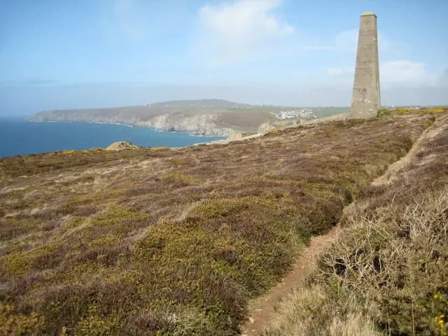
Chimney on the coast near Porthtowan
Chimney on the coast near Porthtowan. This photograph is used as a geographic witness to the place, not as evidence of the historical date shown in the chapter.
- Visual description
- Chimney on the coast near Porthtowan
- Nature
- original
- Medium
- Open-licence photograph
- Source
- Wikimedia Commons / Geograph · CC BY-SA 2.0
- Reviewed
- Josh Wildman
THE TOWAN
Porthtowan
A copper-mining valley that exchanged ore processing for a life organised around surf.
Scroll to follow the shoreline through time
Porthtowan’s stream valley reaches a west-facing beach between steep cliffs.
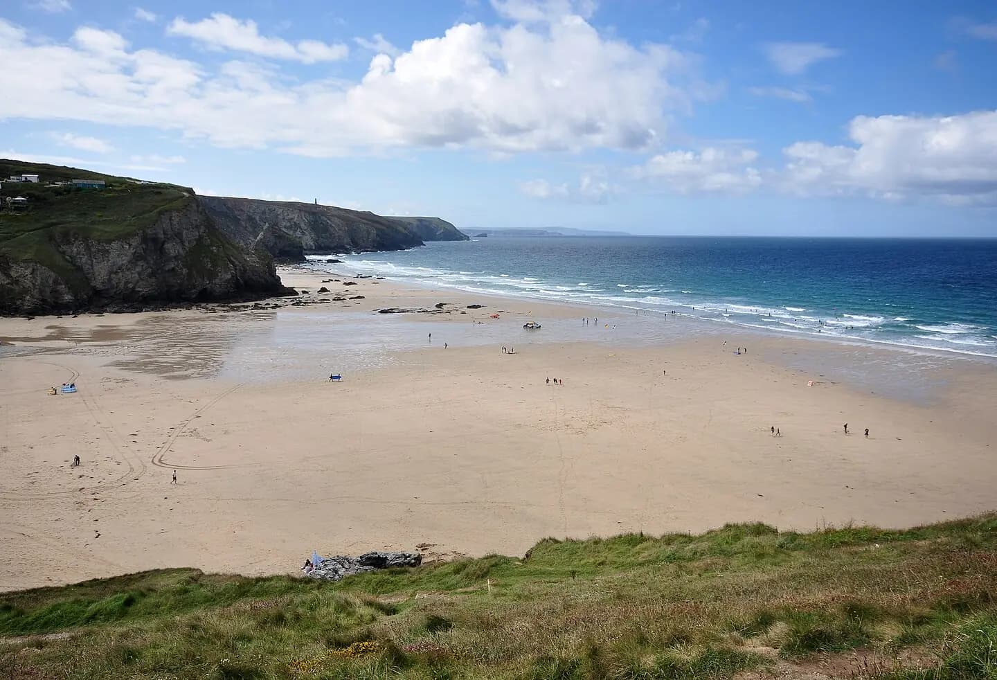
At low tide the sand expands, while the confined entrance concentrates Atlantic swell.
Sources for this chapter
THE MINING CENTURIES
Copper shaped the settlement
From the eighteenth century, copper mining dominated local work.
Wheal Towan and neighbouring mines connected the small valley to Cornwall’s wider mineral economy.
Sources for this chapter
AFTER THE MINES
A post-industrial beach emerged
As mining declined, the beach first drew visitors from nearby towns and villages, then a wider holiday public.
Engine houses on the cliff route remained visible evidence of the economy that preceded tourism.
Sources for this chapter
Open ledger · AOD.UK.PORTHTOWAN.V01 · ORIGINALClose ledger · AOD.UK.PORTHTOWAN.V01
Ledger AOD.UK.PORTHTOWAN.V01
Porthtowan beach
Porthtowan beach in Cornwall, at low tide. The North Cornwall coast stretches towards the Penwith peninsula in the distance. This photograph is used as a geographic witness to the place, not as evidence of the historical date shown in the chapter.
- Visual description
- Porthtowan beach in Cornwall, at low tide. The North Cornwall coast stretches towards the Penwith peninsula in the distance
- Nature
- original
- Medium
- Open-licence photograph
- Source
- Wikimedia Commons · CC BY-SA 3.0
- Reviewed
- Josh Wildman
THE SURF YEARS
The west-facing break built a surf identity
Porthtowan’s curling beachbreak made it part of Cornwall’s core surf coast.
It can support learning in manageable conditions, but stronger swell and rips require a different level of judgement.
THE LIVING MAP
The mapped place
Porthtowan is recorded at 50.284° N, 5.249° W. A surf map fixes a name to one stretch of moving water, but the place changes with tide, swell direction, wind and the shape of the seabed.
Sources for this chapter
Open ledger · AOD.UK.PORTHTOWAN.V00 · ORIGINALClose ledger · AOD.UK.PORTHTOWAN.V00
Ledger AOD.UK.PORTHTOWAN.V00
Chimney on the coast near Porthtowan
Chimney on the coast near Porthtowan. This photograph is used as a geographic witness to the place, not as evidence of the historical date shown in the chapter.
- Visual description
- Chimney on the coast near Porthtowan
- Nature
- original
- Medium
- Open-licence photograph
- Source
- Wikimedia Commons / Geograph · CC BY-SA 2.0
- Reviewed
- Josh Wildman
TODAY
Mining remains sit above a modern surf beach
Porthtowan is now organised around beach access, lifeguarding and surfing, with mine buildings still visible on the surrounding coast.
Its transformation is legible in one view from valley floor to cliff.
Sources for this chapter
THE LEDGER
Sources and credits
This exhibition is built from local, institutional and sporting records. The source ledger keeps the claims visible and leaves space for correction as further local evidence emerges.
Sources for this chapter
Artefacts in order of appearance
Chimney on the coast near Porthtowan
AOD.UK.PORTHTOWAN.V00 · original · Wikimedia Commons / Geograph · CC BY-SA 2.0
Porthtowan beach
AOD.UK.PORTHTOWAN.V01 · original · Wikimedia Commons · CC BY-SA 3.0
Editorial record
Full UK edition. Historical claims are linked to the local, public and sporting records used to write the exhibition. Cartography is generated from the PeakWave location catalogue.