Open ledger · AOD.UK.PORTHMEOR.V00 · ORIGINALClose ledger · AOD.UK.PORTHMEOR.V00
Ledger AOD.UK.PORTHMEOR.V00
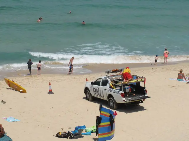
Lifeguards on Porthmeor Beach, St Ives, Cornwall
Lifeguards on Porthmeor Beach, St Ives, Cornwall. This photograph is used as a geographic witness to the place, not as evidence of the historical date shown in the chapter.
- Visual description
- Lifeguards on Porthmeor Beach, St Ives, Cornwall
- Nature
- original
- Medium
- Open-licence photograph
- Source
- Wikimedia Commons / Geograph · CC BY-SA 2.0
- Reviewed
- Josh Wildman
BEFORE THE SEA WALL
Porthmeor
A St Ives beach where fishing, modern art and surfing share one sea wall.
Scroll to follow the shoreline through time
Porthmeor faces the Atlantic side of St Ives.
Before the mid-eighteenth century, wind-blown sand restricted building above the beach, although fishermen used the ground for drying nets, mending gear and rope work.
Sources for this chapter
THE 19th CENTURY
Pilchards filled the cellars
After John Smeaton’s sea wall made expansion possible, fish cellars and net lofts grew along Porthmeor.
Concrete brine tanks, reused ship timbers and mine pipes record an industrial-scale pilchard economy.
Sources for this chapter
1885–1948
Studios took over the net lofts
As fishing declined and tourism grew, artists converted lofts above the cellars.
Julius Olsson opened a painting school; later Ben Nicholson, Barbara Hepworth and other St Ives modernists made the complex internationally significant.
Sources for this chapter
Open ledger · AOD.UK.PORTHMEOR.V01 · ORIGINALClose ledger · AOD.UK.PORTHMEOR.V01
Ledger AOD.UK.PORTHMEOR.V01
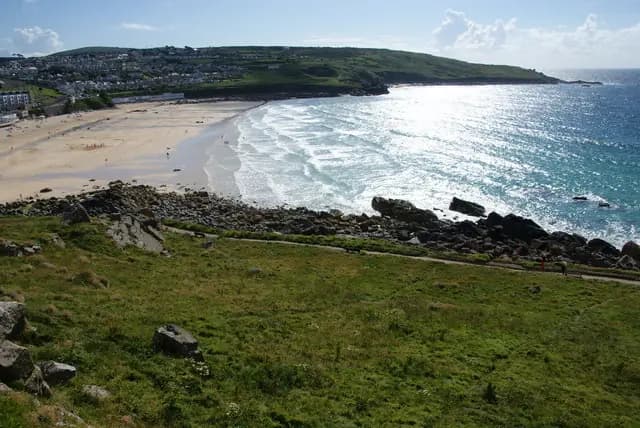
Porthmeor Beach, St Ives
Porthmeor Beach, St Ives. This photograph is used as a geographic witness to the place, not as evidence of the historical date shown in the chapter.
- Visual description
- Porthmeor Beach, St Ives
- Nature
- original
- Medium
- Open-licence photograph
- Source
- Wikimedia Commons / Geograph · CC BY-SA 2.0
- Reviewed
- Josh Wildman
THE SURF YEARS
Surfing joined work and art on the same beach
Boards and wetsuits added surfing to a shore already watched closely by fishermen and painters.
Porthmeor’s beachbreak became part of St Ives life without displacing the cellars or working studios above it.
THE LIVING MAP
The mapped place
Porthmeor is recorded at 50.216° N, 5.486° W. A surf map fixes a name to one stretch of moving water, but the place changes with tide, swell direction, wind and the shape of the seabed.
Sources for this chapter
Open ledger · AOD.UK.PORTHMEOR.V00 · ORIGINALClose ledger · AOD.UK.PORTHMEOR.V00
Ledger AOD.UK.PORTHMEOR.V00
Lifeguards on Porthmeor Beach, St Ives, Cornwall
Lifeguards on Porthmeor Beach, St Ives, Cornwall. This photograph is used as a geographic witness to the place, not as evidence of the historical date shown in the chapter.
- Visual description
- Lifeguards on Porthmeor Beach, St Ives, Cornwall
- Nature
- original
- Medium
- Open-licence photograph
- Source
- Wikimedia Commons / Geograph · CC BY-SA 2.0
- Reviewed
- Josh Wildman
TODAY
The overlap is the important artefact
Fishermen still use the cellars and artists still work in the studios while surfers enter the water below.
Porthmeor is unusual because its industries did not simply replace one another; they remain stacked in the same building.
Sources for this chapter
THE LEDGER
Sources and credits
This exhibition is built from local, institutional and sporting records. The source ledger keeps the claims visible and leaves space for correction as further local evidence emerges.
Sources for this chapter
Artefacts in order of appearance
Lifeguards on Porthmeor Beach, St Ives, Cornwall
AOD.UK.PORTHMEOR.V00 · original · Wikimedia Commons / Geograph · CC BY-SA 2.0
Porthmeor Beach, St Ives
AOD.UK.PORTHMEOR.V01 · original · Wikimedia Commons / Geograph · CC BY-SA 2.0
Editorial record
Full UK edition. Historical claims are linked to the local, public and sporting records used to write the exhibition. Cartography is generated from the PeakWave location catalogue.