Open ledger · AOD.UK.PORTHLEVEN.V00 · ORIGINALClose ledger · AOD.UK.PORTHLEVEN.V00
Ledger AOD.UK.PORTHLEVEN.V00
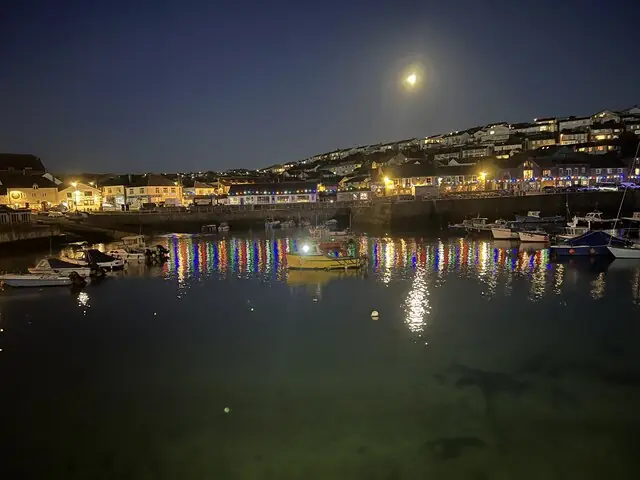
Porthleven Harbour
Porthleven Harbour. This photograph is used as a geographic witness to the place, not as evidence of the historical date shown in the chapter.
- Visual description
- Porthleven Harbour
- Nature
- original
- Medium
- Open-licence photograph
- Source
- Wikimedia Commons / Geograph · CC BY-SA 2.0
- Reviewed
- Josh Wildman
MOUNTS BAY
Porthleven
A harbour of refuge beside one of Cornwall’s most demanding reef waves.
Scroll to follow the shoreline through time
Porthleven lies on an exposed coast where Atlantic storms wrap into Mounts Bay.
Reef, steep beach and the long shingle barrier towards Loe Bar make the water powerful even when the town appears sheltered.
Sources for this chapter
1811–1825
Shipwreck risk created a harbour
The granite harbour was built between 1811 and 1825 as refuge and working port on a coast notorious for wrecks.
Wharves, jetties, steps and a main pier organised fishing and trade around protected water.
Sources for this chapter
1855–1858
Harveys enlarged the port
The harbour was extended for Harveys of Hayle between 1855 and 1858.
Engineering changed how vessels entered the town, but could not remove the exposed reef outside its walls.
Sources for this chapter
Open ledger · AOD.UK.PORTHLEVEN.V01 · ORIGINALClose ledger · AOD.UK.PORTHLEVEN.V01
Ledger AOD.UK.PORTHLEVEN.V01
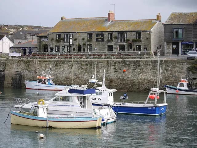
Harbour Inn Porthleven Cornwall
Harbour Inn Porthleven Cornwall. This photograph is used as a geographic witness to the place, not as evidence of the historical date shown in the chapter.
- Visual description
- Harbour Inn Porthleven Cornwall
- Nature
- original
- Medium
- Open-licence photograph
- Source
- Wikimedia Commons / Geograph · CC BY-SA 2.0
- Reviewed
- Josh Wildman
THE SURF YEARS
Surfers read the water outside the refuge
Experienced surfers recognised a high-quality reef break beside the harbour.
The wave works on the dangerous water the port was designed to escape, making judgement and local experience essential.
Sources for this chapter
THE LIVING MAP
The mapped place
Porthleven is recorded at 50.084° N, 5.318° W. A surf map fixes a name to one stretch of moving water, but the place changes with tide, swell direction, wind and the shape of the seabed.
Sources for this chapter
Open ledger · AOD.UK.PORTHLEVEN.V00 · ORIGINALClose ledger · AOD.UK.PORTHLEVEN.V00
Ledger AOD.UK.PORTHLEVEN.V00
Porthleven Harbour
Porthleven Harbour. This photograph is used as a geographic witness to the place, not as evidence of the historical date shown in the chapter.
- Visual description
- Porthleven Harbour
- Nature
- original
- Medium
- Open-licence photograph
- Source
- Wikimedia Commons / Geograph · CC BY-SA 2.0
- Reviewed
- Josh Wildman
TODAY
Working harbour and surf landmark coexist
Porthleven now combines fishing, food, art and a nationally recognised surf break.
The harbour remains the town’s centre, while winter waves outside its walls make the original reason for building it immediately clear.
Sources for this chapter
THE LEDGER
Sources and credits
This exhibition is built from local, institutional and sporting records. The source ledger keeps the claims visible and leaves space for correction as further local evidence emerges.
Sources for this chapter
Artefacts in order of appearance
Porthleven Harbour
AOD.UK.PORTHLEVEN.V00 · original · Wikimedia Commons / Geograph · CC BY-SA 2.0
Harbour Inn Porthleven Cornwall
AOD.UK.PORTHLEVEN.V01 · original · Wikimedia Commons / Geograph · CC BY-SA 2.0
Editorial record
Full UK edition. Historical claims are linked to the local, public and sporting records used to write the exhibition. Cartography is generated from the PeakWave location catalogue.