Open ledger · AOD.UK.PERRANPORTH.V00 · ORIGINALClose ledger · AOD.UK.PERRANPORTH.V00
Ledger AOD.UK.PERRANPORTH.V00
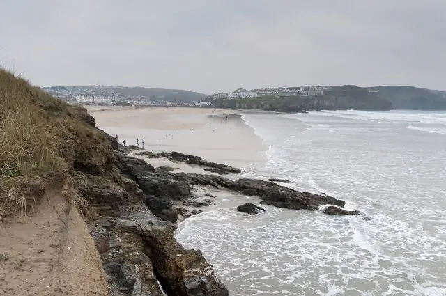
Perranporth - The beach and the town
Perranporth - The beach and the town. This photograph is used as a geographic witness to the place, not as evidence of the historical date shown in the chapter.
- Visual description
- Perranporth - The beach and the town
- Nature
- original
- Medium
- Open-licence photograph
- Source
- Wikimedia Commons / Geograph · CC BY-SA 2.0
- Reviewed
- Josh Wildman
PERRAN SANDS
Perranporth
A saint’s landing place, mining coast and early centre of British wave riding.
Scroll to follow the shoreline through time
Perranporth’s long beach and dunes are part of a mobile sand system.
Buildings and archaeology behind the shore have been buried, exposed and buried again.
THE SAINT’S STORY
Tradition places Piran behind the beach
Cornish tradition says Saint Piran landed here and built an oratory behind the beach.
The story belongs to local cultural memory; the surviving oratory and later church ruins show the long religious use of the dunes.
Sources for this chapter
1879
Mining decline produced a new road
After local mining contracted, clergy organised work for distressed miners on a better road between Bolingey and Perranporth.
Work began on 7 May 1879, improving access to a coast whose economy was beginning to change.
Sources for this chapter
Open ledger · AOD.UK.PERRANPORTH.V01 · ORIGINALClose ledger · AOD.UK.PERRANPORTH.V01
Ledger AOD.UK.PERRANPORTH.V01
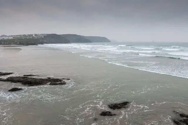
Perranporth - Looking across the beach
Perranporth - Looking across the beach. This photograph is used as a geographic witness to the place, not as evidence of the historical date shown in the chapter.
- Visual description
- Perranporth - Looking across the beach
- Nature
- original
- Medium
- Open-licence photograph
- Source
- Wikimedia Commons / Geograph · CC BY-SA 2.0
- Reviewed
- Josh Wildman
BETWEEN THE WARS
Coffin lids became wave-riding boards
Local carpenter and undertaker Tom Tremewan made wooden bellyboards from timber he had available, reportedly including coffin lids.
Perranporth therefore connects modern surf culture to an older British practice of prone wave riding.
THE LIVING MAP
The mapped place
Perranporth is recorded at 50.348° N, 5.160° W. A surf map fixes a name to one stretch of moving water, but the place changes with tide, swell direction, wind and the shape of the seabed.
Sources for this chapter
Open ledger · AOD.UK.PERRANPORTH.V00 · ORIGINALClose ledger · AOD.UK.PERRANPORTH.V00
Ledger AOD.UK.PERRANPORTH.V00
Perranporth - The beach and the town
Perranporth - The beach and the town. This photograph is used as a geographic witness to the place, not as evidence of the historical date shown in the chapter.
- Visual description
- Perranporth - The beach and the town
- Nature
- original
- Medium
- Open-licence photograph
- Source
- Wikimedia Commons / Geograph · CC BY-SA 2.0
- Reviewed
- Josh Wildman
TODAY
Surfing sits beside mining and religious history
Perranporth is now a major surf and holiday beach, but its local museum presents mining, farming, fishing and wave riding together.
That combined record is more revealing than treating the place as a resort with no previous life.
Sources for this chapter
THE LEDGER
Sources and credits
This exhibition is built from local, institutional and sporting records. The source ledger keeps the claims visible and leaves space for correction as further local evidence emerges.
Sources for this chapter
Artefacts in order of appearance
Perranporth - The beach and the town
AOD.UK.PERRANPORTH.V00 · original · Wikimedia Commons / Geograph · CC BY-SA 2.0
Perranporth - Looking across the beach
AOD.UK.PERRANPORTH.V01 · original · Wikimedia Commons / Geograph · CC BY-SA 2.0
Editorial record
Full UK edition. Historical claims are linked to the local, public and sporting records used to write the exhibition. Cartography is generated from the PeakWave location catalogue.