Open ledger · AOD.EU.PASSO-TONALE.V00 · ORIGINALClose ledger · AOD.EU.PASSO-TONALE.V00
Ledger AOD.EU.PASSO-TONALE.V00
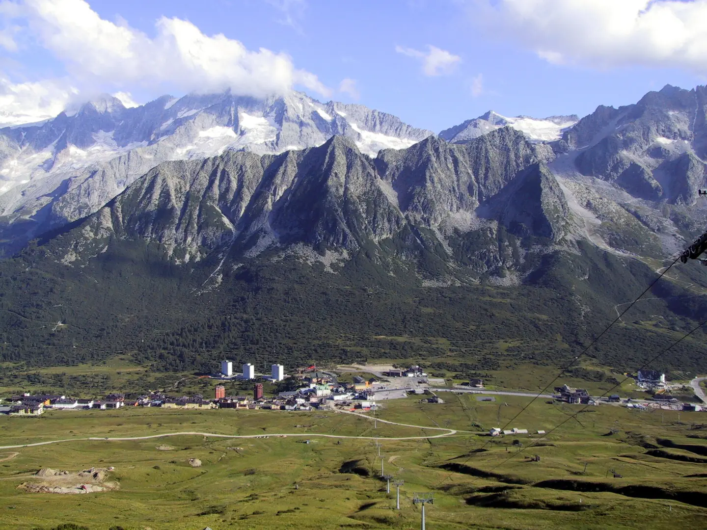
Passo Tonale summer
Passo del Tonale ripreso dall'arrivo delle seggiovia Alpe Alta (m.2245). Estate 2002 - Foto da me scattata e rilasciata nel pubblico dominio. This photograph is used as a geographic witness to the place, not as evidence of the historical date shown in the chapter.
- Visual description
- Passo del Tonale ripreso dall'arrivo delle seggiovia Alpe Alta (m.2245). Estate 2002 - Foto da me scattata e rilasciata nel pubblico dominio
- Nature
- original
- Medium
- Open-licence photograph
- Source
- Wikimedia Commons · Public domain
BEFORE MODERN SPORT
Passo Tonale
How settlement, access and winter sport shaped Passo Tonale.
Scroll to read the contour through time
Tonale Pass (Italian: Passo del Tonale) (el.
Sources for this chapter
BEFORE TOURISM
Before the resort map
The linked local overview does not preserve a clear account of Passo Tonale before modern tourism.
This edition leaves that part of the timeline open rather than mistaking the first surviving sporting reference for the beginning of the place.
Sources for this chapter
ACCESS CHANGES
A route reaches Passo Tonale
The surviving overview does not identify one decisive access date for Passo Tonale.
This edition therefore leaves that date open rather than turning gradual change into a false single event.
Sources for this chapter
Open ledger · AOD.EU.PASSO-TONALE.V01 · ORIGINALClose ledger · AOD.EU.PASSO-TONALE.V01
Ledger AOD.EU.PASSO-TONALE.V01
Tonale - Piste Valbiolo - View from Passo Contrabandieri(2008y.) - panoramio
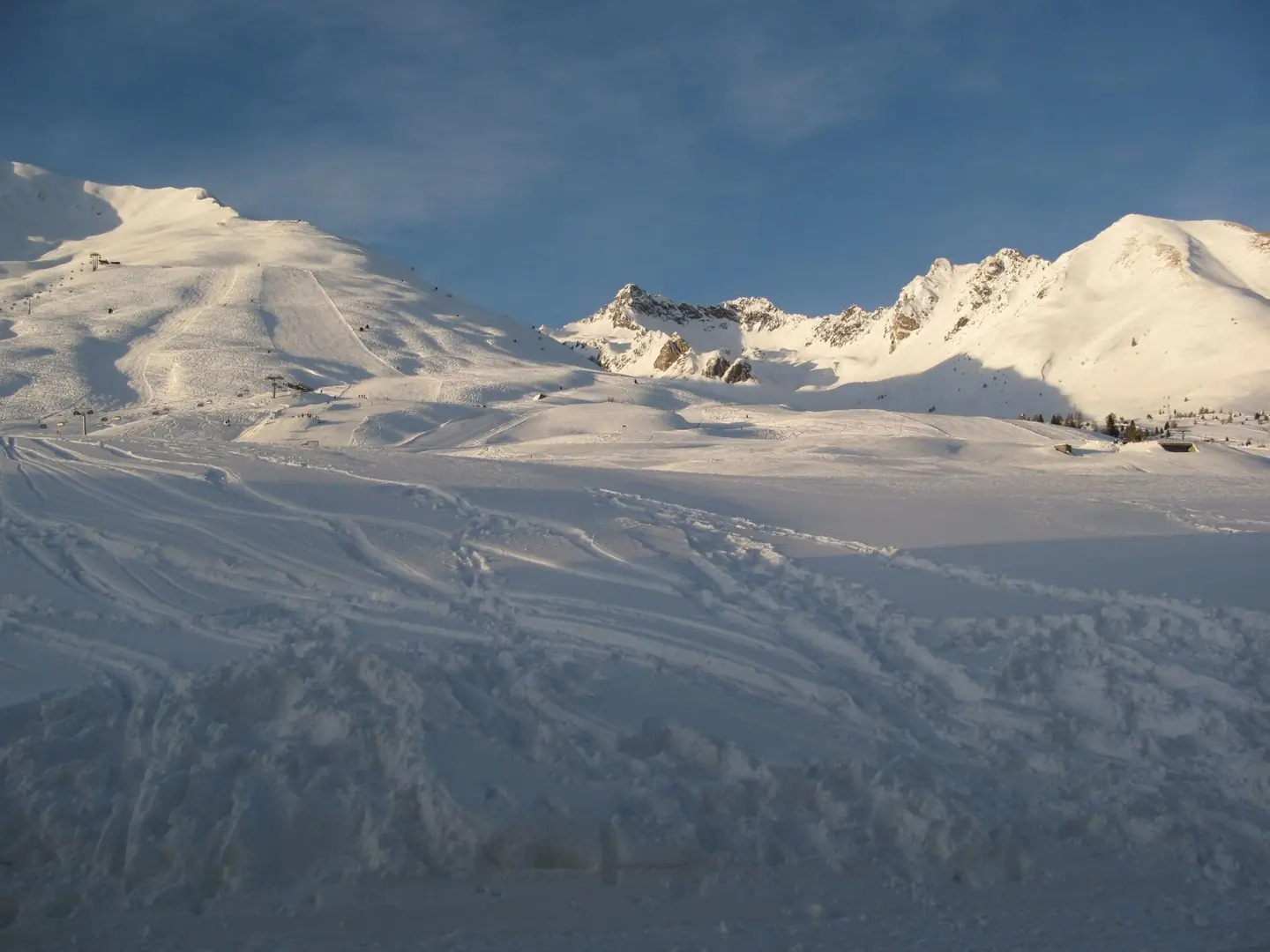
Tonale - Piste Valbiolo - View from Passo Contrabandieri(2008y.). This photograph is used as a geographic witness to the place, not as evidence of the historical date shown in the chapter.
- Visual description
- Tonale - Piste Valbiolo - View from Passo Contrabandieri(2008y.)
- Nature
- original
- Medium
- Open-licence photograph
- Source
- Wikimedia Commons · CC BY-SA 3.0
ORGANISED SPORT
Winter becomes organised
The pass has hotels and shops for tourists in winter, as the land around the pass is used for winter sports – mainly skiing (see Adamello Ski Raid) and snowboarding.
Sources for this chapter
THE LIVING MAP
The mapped place
Passo Tonale is recorded at 46.264° N, 10.586° E. Its catalogue reference reaches 3,016 metres. A modern resort map compresses terrain, exposure and access into a diagram. This exhibition keeps the underlying contour visible so the place does not become only a list of facilities.
Sources for this chapter
Open ledger · AOD.EU.PASSO-TONALE.V00 · ORIGINALClose ledger · AOD.EU.PASSO-TONALE.V00
Ledger AOD.EU.PASSO-TONALE.V00
Passo Tonale summer
Passo del Tonale ripreso dall'arrivo delle seggiovia Alpe Alta (m.2245). Estate 2002 - Foto da me scattata e rilasciata nel pubblico dominio. This photograph is used as a geographic witness to the place, not as evidence of the historical date shown in the chapter.
- Visual description
- Passo del Tonale ripreso dall'arrivo delle seggiovia Alpe Alta (m.2245). Estate 2002 - Foto da me scattata e rilasciata nel pubblico dominio
- Nature
- original
- Medium
- Open-licence photograph
- Source
- Wikimedia Commons · Public domain
TODAY
Passo Tonale now
Passo Tonale remains a lived-in place as well as a sporting destination.
Its present identity continues to depend on the relationship between residents, visitors, access and the landscape or water that first shaped it.
Sources for this chapter
THE LEDGER
Sources and credits
This exhibition is built from local, institutional and sporting records. The source ledger keeps the claims visible and leaves space for correction as further local evidence emerges.
Sources for this chapter
Artefacts in order of appearance
Passo Tonale summer
AOD.EU.PASSO-TONALE.V00 · original · Wikimedia Commons · Public domain
Tonale - Piste Valbiolo - View from Passo Contrabandieri(2008y.) - panoramio
AOD.EU.PASSO-TONALE.V01 · original · Wikimedia Commons · CC BY-SA 3.0
Editorial record
Full European Beta edition. Place evidence is adapted from the linked Tonale Pass overview under CC BY-SA 4.0 and remains subject to named historical and local review. Cartography is generated from the PeakWave location catalogue.