
Open ledger · AOD.US.PALISADES-TAHOE.V00 · ORIGINALClose ledger · AOD.US.PALISADES-TAHOE.V00
Ledger AOD.US.PALISADES-TAHOE.V00
TheVillageatSquawValley-exterior
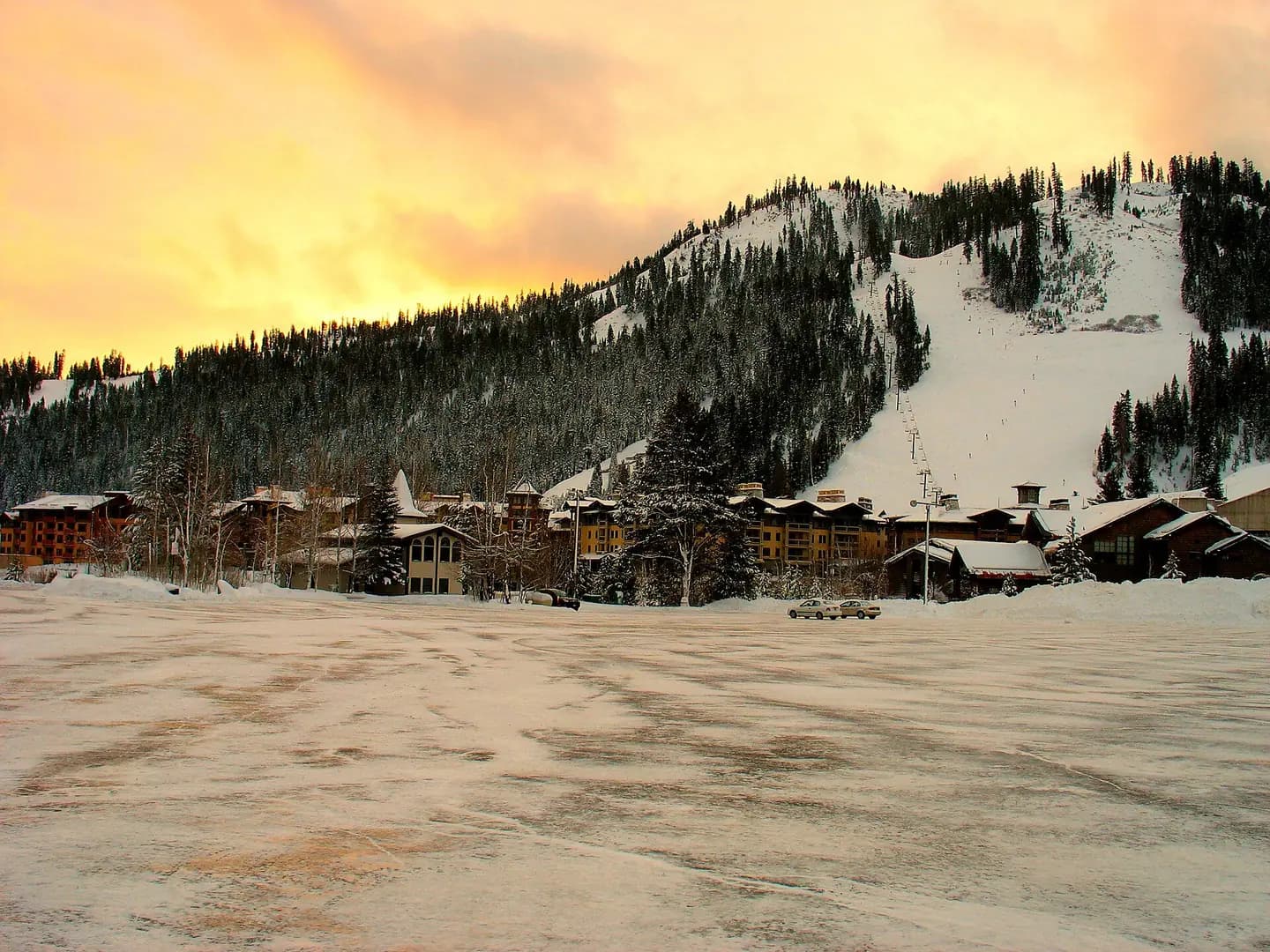
The Village at Palisades Tahoe resort with mountain in background. This photograph is used as a geographic witness to the place, not as evidence of the historical date shown in the chapter.
- Visual description
- The Village at Palisades Tahoe resort with mountain in background
- Nature
- original
- Medium
- Open-licence photograph
- Source
- Wikimedia Commons · Public domain
BEFORE MODERN SPORT
Palisades Tahoe
How settlement, access and winter sport shaped Palisades Tahoe.
Scroll to read the contour through time
Olympic Valley (historically and informally known as Squaw Valley) is an unincorporated community located in Placer County, California, United States.
Sources for this chapter
1948
Work and settlement beneath the snowline
In June 1948, the two founded the Squaw Valley Development Company and Cushing replaced Poulsen as president of the Squaw Valley Development Corporation by October 1949.
Sources for this chapter
1942
A route reaches Palisades Tahoe
By 1942, Wayne Poulsen, a former star skier from the University of Nevada, had acquired 2,000 acres (810 ha) in the valley from the Southern Pacific Railroad.
Open ledger · AOD.US.PALISADES-TAHOE.V01 · ORIGINALClose ledger · AOD.US.PALISADES-TAHOE.V01
Ledger AOD.US.PALISADES-TAHOE.V01
Squaw Valley in the morning
Squaw Valley early in the morning. This photograph is used as a geographic witness to the place, not as evidence of the historical date shown in the chapter.
- Visual description
- Squaw Valley early in the morning
- Nature
- original
- Medium
- Open-licence photograph
- Source
- Wikimedia Commons · CC BY 2.0
1949
Winter becomes organised
The ski area opened in 1949 and hosted the 1960 Winter Olympics.
Those Games gave the valley an international sporting identity that long outlasted the event.
THE LIVING MAP
The mapped place
Palisades Tahoe is recorded at 39.197° N, 120.235° W. Its catalogue reference reaches 2,745 metres. A modern resort map compresses terrain, exposure and access into a diagram. This exhibition keeps the underlying contour visible so the place does not become only a list of facilities.
Sources for this chapter
Open ledger · AOD.US.PALISADES-TAHOE.V00 · ORIGINALClose ledger · AOD.US.PALISADES-TAHOE.V00
Ledger AOD.US.PALISADES-TAHOE.V00
TheVillageatSquawValley-exterior
The Village at Palisades Tahoe resort with mountain in background. This photograph is used as a geographic witness to the place, not as evidence of the historical date shown in the chapter.
- Visual description
- The Village at Palisades Tahoe resort with mountain in background
- Nature
- original
- Medium
- Open-licence photograph
- Source
- Wikimedia Commons · Public domain
TODAY
Palisades Tahoe now
The creation of the Squaw Valley Development Corporation and Squaw Valley Ski Resort mark the modern era of the valley.
THE LEDGER
Sources and credits
This exhibition is built from local, institutional and sporting records. The source ledger keeps the claims visible and leaves space for correction as further local evidence emerges.
Sources for this chapter
Artefacts in order of appearance
TheVillageatSquawValley-exterior
AOD.US.PALISADES-TAHOE.V00 · original · Wikimedia Commons · Public domain
Squaw Valley in the morning
AOD.US.PALISADES-TAHOE.V01 · original · Wikimedia Commons · CC BY 2.0
Editorial record
Full US Beta edition. Place evidence is adapted from the linked Olympic Valley, California overview under CC BY-SA 4.0 and remains subject to named historical and local review. Cartography is generated from the PeakWave location catalogue.