Open ledger · AOD.EU.OBERGURGL.V00 · ORIGINALClose ledger · AOD.EU.OBERGURGL.V00
Ledger AOD.EU.OBERGURGL.V00
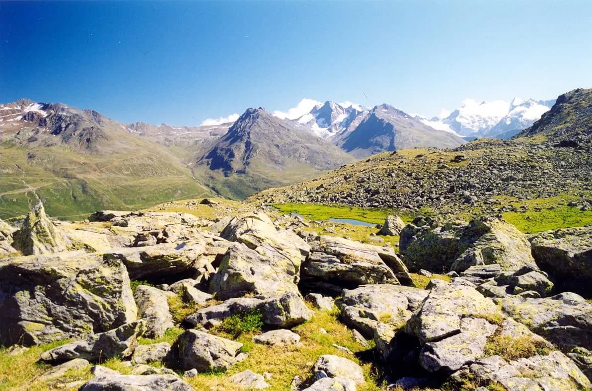
Hochgurgl, Austria
Hochgurgl, Austria. This photograph is used as a geographic witness to the place, not as evidence of the historical date shown in the chapter.
- Visual description
- Hochgurgl, Austria
- Nature
- original
- Medium
- Open-licence photograph
- Source
- Wikimedia Commons · CC BY 2.0
BEFORE MODERN SPORT
Obergurgl-Hochgurgl
How settlement, access and winter sport shaped Obergurgl-Hochgurgl.
Scroll to read the contour through time
Obergurgl is a village in the Ötztal Alps in Tyrol, Austria.
Sources for this chapter
1931
Work and settlement beneath the snowline
Obergurgl became famous in 1931, when the Swiss explorer Auguste Piccard was forced to land on the nearby Großer Gurgler Ferner glacier during his historic balloon flight, during which he became the first man to fly into the stratosphere.
Sources for this chapter
ACCESS CHANGES
A route reaches Obergurgl-Hochgurgl
There is a breeding establishment for Haflinger horses in the village, which is owned by the Scheiber family, who also own the Hotel Edelweiss & Gurgl.
Sources for this chapter
Open ledger · AOD.EU.OBERGURGL.V01 · ORIGINALClose ledger · AOD.EU.OBERGURGL.V01
Ledger AOD.EU.OBERGURGL.V01
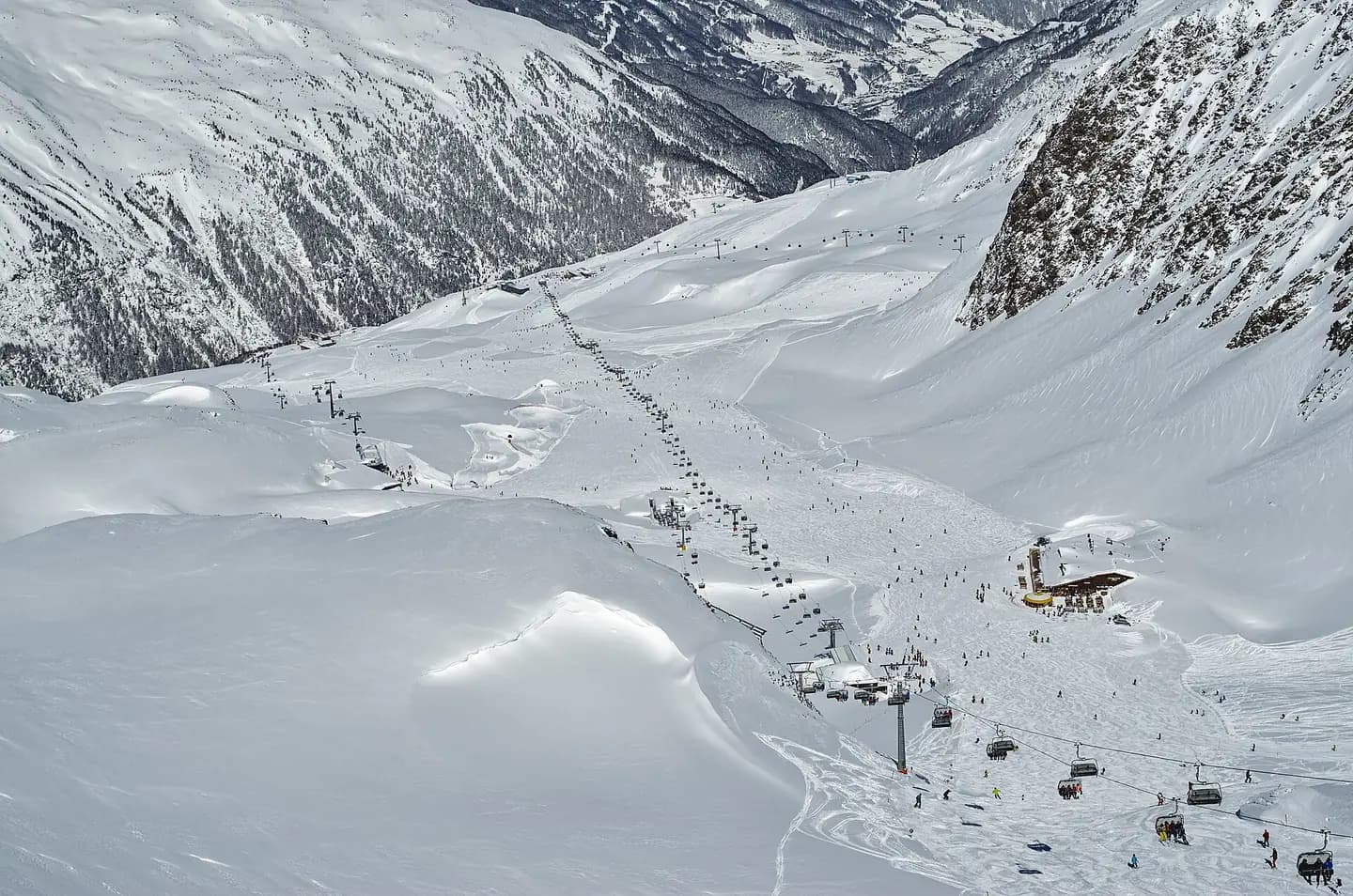
Chairlift in Ski Area Obergurgl-Hochgurgl in Tirol
Chairlift in Ski Area Obergurgl-Hochgurgl in Tirol. This photograph is used as a geographic witness to the place, not as evidence of the historical date shown in the chapter.
- Visual description
- Chairlift in Ski Area Obergurgl-Hochgurgl in Tirol
- Nature
- original
- Medium
- Open-licence photograph
- Source
- Wikimedia Commons · CC BY-SA 4.0
2015
Winter becomes organised
Obergurgl-Hochgurgl Skiresorts-Test Archived 2015-03-21 at the Wayback Machine Obergurgl ski resort guide
Sources for this chapter
THE LIVING MAP
The mapped place
Obergurgl-Hochgurgl is recorded at 46.870° N, 11.026° E. Its catalogue reference reaches 3,080 metres. A modern resort map compresses terrain, exposure and access into a diagram. This exhibition keeps the underlying contour visible so the place does not become only a list of facilities.
Sources for this chapter
Open ledger · AOD.EU.OBERGURGL.V00 · ORIGINALClose ledger · AOD.EU.OBERGURGL.V00
Ledger AOD.EU.OBERGURGL.V00
Hochgurgl, Austria
Hochgurgl, Austria. This photograph is used as a geographic witness to the place, not as evidence of the historical date shown in the chapter.
- Visual description
- Hochgurgl, Austria
- Nature
- original
- Medium
- Open-licence photograph
- Source
- Wikimedia Commons · CC BY 2.0
TODAY
Obergurgl-Hochgurgl now
Obergurgl forms part of the ski resort area of Obergurgl-Hochgurgl and lies at the southern end of the Ötztal Gurglertal valley, the longest side valley off the Inntal valley.
Sources for this chapter
THE LEDGER
Sources and credits
This exhibition is built from local, institutional and sporting records. The source ledger keeps the claims visible and leaves space for correction as further local evidence emerges.
Sources for this chapter
Artefacts in order of appearance
Hochgurgl, Austria
AOD.EU.OBERGURGL.V00 · original · Wikimedia Commons · CC BY 2.0
Chairlift in Ski Area Obergurgl-Hochgurgl in Tirol
AOD.EU.OBERGURGL.V01 · original · Wikimedia Commons · CC BY-SA 4.0
Editorial record
Full European Beta edition. Place evidence is adapted from the linked Obergurgl overview under CC BY-SA 4.0 and remains subject to named historical and local review. Cartography is generated from the PeakWave location catalogue.