Open ledger · AOD.UK.NEWGALE.V00 · ORIGINALClose ledger · AOD.UK.NEWGALE.V00
Ledger AOD.UK.NEWGALE.V00
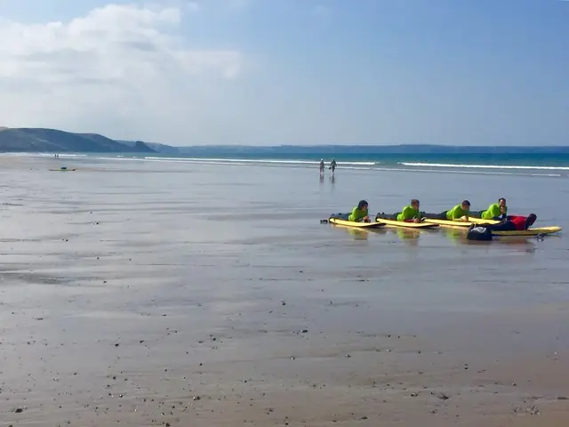
Surfing school on Newgale beach
Surfing school on Newgale beach. This photograph is used as a geographic witness to the place, not as evidence of the historical date shown in the chapter.
- Visual description
- Surfing school on Newgale beach
- Nature
- original
- Medium
- Open-licence photograph
- Source
- Wikimedia Commons / Geograph · CC BY-SA 2.0
- Reviewed
- Josh Wildman
1859
Newgale
A storm-built pebble bank and two-mile beach that became a Pembrokeshire surf mainstay.
Scroll to follow the shoreline through time
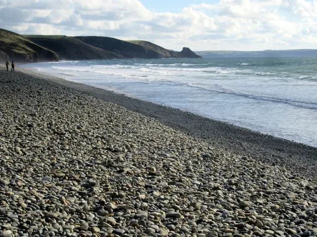
Newgale’s two-mile beach is backed by a high pebble bank formed by a major storm in 1859.
The ridge still separates road and settlement from the sea while remaining vulnerable to later storms.
Sources for this chapter
AFTER 1859
The coast adapts behind the stones
Homes, roads and seasonal businesses developed behind a beach whose most obvious structure was made by the sea itself.
Living here meant treating coastal change as practical reality.
Sources for this chapter
POST-WAR TRAVEL
A long beach becomes accessible
Road access, camping and portable surf equipment turned Newgale into a repeatable base for exploring Pembrokeshire.
The beach’s length distributed people across several sandbanks.
Sources for this chapter
Open ledger · AOD.UK.NEWGALE.V01 · ORIGINALClose ledger · AOD.UK.NEWGALE.V01
Ledger AOD.UK.NEWGALE.V01
Shingle on Newgale beach
Shingle on Newgale beach. This photograph is used as a geographic witness to the place, not as evidence of the historical date shown in the chapter.
- Visual description
- Shingle on Newgale beach
- Nature
- original
- Medium
- Open-licence photograph
- Source
- Wikimedia Commons / Geograph · CC BY-SA 2.0
- Reviewed
- Josh Wildman
THE MODERN SURF ERA
A dependable Welsh beachbreak
As Welsh surfing organised from 1973, Newgale became known as a flexible all-round beach alongside Freshwater West and Whitesands.
Surf schools added a pathway from visitor to participant.
THE LIVING MAP
The mapped place
Newgale is recorded at 51.836° N, 5.121° W. A surf map fixes a name to one stretch of moving water, but the place changes with tide, swell direction, wind and the shape of the seabed.
Sources for this chapter
Open ledger · AOD.UK.NEWGALE.V00 · ORIGINALClose ledger · AOD.UK.NEWGALE.V00
Ledger AOD.UK.NEWGALE.V00
Surfing school on Newgale beach
Surfing school on Newgale beach. This photograph is used as a geographic witness to the place, not as evidence of the historical date shown in the chapter.
- Visual description
- Surfing school on Newgale beach
- Nature
- original
- Medium
- Open-licence photograph
- Source
- Wikimedia Commons / Geograph · CC BY-SA 2.0
- Reviewed
- Josh Wildman
TODAY
The bank remains unfinished
Newgale is now a surf beach, road corridor and holiday settlement, but the 1859 barrier is not a permanent wall.
Storm response and long-term coastal adaptation remain part of its living history.
Sources for this chapter
THE LEDGER
Sources and credits
This exhibition is built from local, institutional and sporting records. The source ledger keeps the claims visible and leaves space for correction as further local evidence emerges.
Sources for this chapter
Artefacts in order of appearance
Surfing school on Newgale beach
AOD.UK.NEWGALE.V00 · original · Wikimedia Commons / Geograph · CC BY-SA 2.0
Shingle on Newgale beach
AOD.UK.NEWGALE.V01 · original · Wikimedia Commons / Geograph · CC BY-SA 2.0
Editorial record
Full UK edition. Historical claims are linked to the local, public and sporting records used to write the exhibition. Cartography is generated from the PeakWave location catalogue.