Open ledger · AOD.UK.NEVIS-RANGE.V00 · ORIGINALClose ledger · AOD.UK.NEVIS-RANGE.V00
Ledger AOD.UK.NEVIS-RANGE.V00
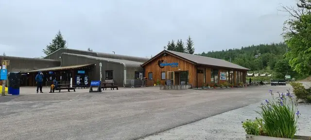
Nevis Range Ski Centre
Nevis Range Ski Centre. This photograph is used as a geographic witness to the place, not as evidence of the historical date shown in the chapter.
- Visual description
- Nevis Range Ski Centre
- Nature
- original
- Medium
- Open-licence photograph
- Source
- Wikimedia Commons / Geograph · CC BY-SA 2.0
- Reviewed
- Josh Wildman
THE MOUNTAIN
Nevis Range
Aonach Mòr’s long journey from walked descents to gondola-served mountain.
Scroll to read the contour through time
Nevis Range occupies Aonach Mòr, the neighbouring mountain to Ben Nevis.
Its broad northern and eastern slopes offered snow terrain close to Fort William without placing the lift system on Britain’s highest summit.
Sources for this chapter
FROM THE 1930s
Skiing before uplift
Skiers used Aonach Mòr from the 1930s, climbing for their descents.
The idea of a developed centre came later than the practice of skiing the mountain itself.
Sources for this chapter
1968–1988
Two decades of planning
Proposals were explored from 1968 and developed again from 1974.
Approval arrived in 1986 and construction began in December 1988, making the eventual opening the result of a long planning process rather than a sudden discovery.
Sources for this chapter
Open ledger · AOD.UK.NEVIS-RANGE.V01 · ORIGINALClose ledger · AOD.UK.NEVIS-RANGE.V01
Ledger AOD.UK.NEVIS-RANGE.V01
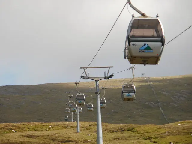
Gondolas on the way up towards Aonach Mor
Gondolas on the way up towards Aonach Mor. This photograph is used as a geographic witness to the place, not as evidence of the historical date shown in the chapter.
- Visual description
- Gondolas on the way up towards Aonach Mor
- Nature
- original
- Medium
- Open-licence photograph
- Source
- Wikimedia Commons / Geograph · CC BY-SA 2.0
- Reviewed
- Josh Wildman
19 DECEMBER 1989
The gondola opens
The centre opened to the public on 19 December 1989.
Its gondola created a direct journey from the forested lower slopes to the mountain, defining both the visitor experience and the operating system.
Sources for this chapter
THE LIVING MAP
The mapped place
Nevis Range is recorded at 56.848° N, 5.088° W. Its catalogue reference reaches 1,221 metres. A modern resort map compresses terrain, exposure and access into a diagram. This exhibition keeps the underlying contour visible so the place does not become only a list of facilities.
Sources for this chapter
Open ledger · AOD.UK.NEVIS-RANGE.V00 · ORIGINALClose ledger · AOD.UK.NEVIS-RANGE.V00
Ledger AOD.UK.NEVIS-RANGE.V00
Nevis Range Ski Centre
Nevis Range Ski Centre. This photograph is used as a geographic witness to the place, not as evidence of the historical date shown in the chapter.
- Visual description
- Nevis Range Ski Centre
- Nature
- original
- Medium
- Open-licence photograph
- Source
- Wikimedia Commons / Geograph · CC BY-SA 2.0
- Reviewed
- Josh Wildman
TODAY
A second sporting identity
Nevis Range now serves snow users and mountain bikers.
A downhill track opened in 2000 and World Cup racing followed in 2002, giving the gondola a year-round role and the mountain a second international sporting history.
Sources for this chapter
THE LEDGER
Sources and credits
This exhibition is built from local, institutional and sporting records. The source ledger keeps the claims visible and leaves space for correction as further local evidence emerges.
Sources for this chapter
Artefacts in order of appearance
Nevis Range Ski Centre
AOD.UK.NEVIS-RANGE.V00 · original · Wikimedia Commons / Geograph · CC BY-SA 2.0
Gondolas on the way up towards Aonach Mor
AOD.UK.NEVIS-RANGE.V01 · original · Wikimedia Commons / Geograph · CC BY-SA 2.0
Editorial record
Full UK edition. Historical claims are linked to the local, public and sporting records used to write the exhibition. Cartography is generated from the PeakWave location catalogue.