
Open ledger · AOD.UK.MANORBIER.V00 · ORIGINALClose ledger · AOD.UK.MANORBIER.V00
Ledger AOD.UK.MANORBIER.V00
Manorbier Castle from the beach. - panoramio
Manorbier Castle from the beach. This photograph is used as a geographic witness to the place, not as evidence of the historical date shown in the chapter.
- Visual description
- Manorbier Castle from the beach
- Nature
- original
- Medium
- Open-licence photograph
- Source
- Wikimedia Commons · CC BY 3.0
- Reviewed
- Josh Wildman
BEFORE THE CASTLE
Manorbier
Burial chamber, Norman castle, smuggling tales and a reef-edged Pembrokeshire surf bay.
Scroll to follow the shoreline through time
Manorbier beach lies below a valley containing King’s Quoit, a Neolithic burial chamber.
The surf bay is one edge of a landscape used and marked for thousands of years.
MEDIEVAL MANORBIER
Castle, church and village face the sea
The Norman castle and church shaped a compact settlement above the beach.
Their position records the importance of watching, controlling and reaching the coast.
Sources for this chapter
17th–19th CENTURIES
The coves carry contraband
Pembrokeshire records smuggling through small coves from the seventeenth century.
The local tale of Jolly Jack Furze connects Manorbier Castle’s cellars to that illicit maritime economy, and is preserved as story rather than proven event.
Sources for this chapter
Open ledger · AOD.UK.MANORBIER.V01 · ORIGINALClose ledger · AOD.UK.MANORBIER.V01
Ledger AOD.UK.MANORBIER.V01
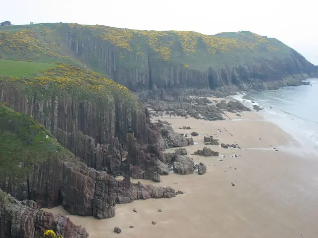
The beach at Presipe, Manorbier
The beach at Presipe, Manorbier. This photograph is used as a geographic witness to the place, not as evidence of the historical date shown in the chapter.
- Visual description
- The beach at Presipe, Manorbier
- Nature
- original
- Medium
- Open-licence photograph
- Source
- Wikimedia Commons / Geograph · CC BY-SA 2.0
- Reviewed
- Josh Wildman
THE SURF YEARS
A rocky bay joins Welsh surf culture
Wetsuits and road travel brought surfers to Pembrokeshire’s less accessible bays.
Manorbier’s combination of beach and reef required a more precise reading than the county’s long open strands.
Sources for this chapter
THE LIVING MAP
The mapped place
Manorbier is recorded at 51.641° N, 4.800° W. A surf map fixes a name to one stretch of moving water, but the place changes with tide, swell direction, wind and the shape of the seabed.
Sources for this chapter
Open ledger · AOD.UK.MANORBIER.V00 · ORIGINALClose ledger · AOD.UK.MANORBIER.V00
Ledger AOD.UK.MANORBIER.V00
Manorbier Castle from the beach. - panoramio
Manorbier Castle from the beach. This photograph is used as a geographic witness to the place, not as evidence of the historical date shown in the chapter.
- Visual description
- Manorbier Castle from the beach
- Nature
- original
- Medium
- Open-licence photograph
- Source
- Wikimedia Commons · CC BY 3.0
- Reviewed
- Josh Wildman
TODAY
History remains visible from the water
Manorbier now brings castle visitors, walkers, beach users and surfers into the same small valley.
Few surf places reveal their pre-sport history so clearly from the line-up.
THE LEDGER
Sources and credits
This exhibition is built from local, institutional and sporting records. The source ledger keeps the claims visible and leaves space for correction as further local evidence emerges.
Sources for this chapter
Artefacts in order of appearance
Manorbier Castle from the beach. - panoramio
AOD.UK.MANORBIER.V00 · original · Wikimedia Commons · CC BY 3.0
The beach at Presipe, Manorbier
AOD.UK.MANORBIER.V01 · original · Wikimedia Commons / Geograph · CC BY-SA 2.0
Editorial record
Full UK edition. Historical claims are linked to the local, public and sporting records used to write the exhibition. Cartography is generated from the PeakWave location catalogue.