Open ledger · AOD.UK.LUSTY-GLAZE.V00 · ORIGINALClose ledger · AOD.UK.LUSTY-GLAZE.V00
Ledger AOD.UK.LUSTY-GLAZE.V00
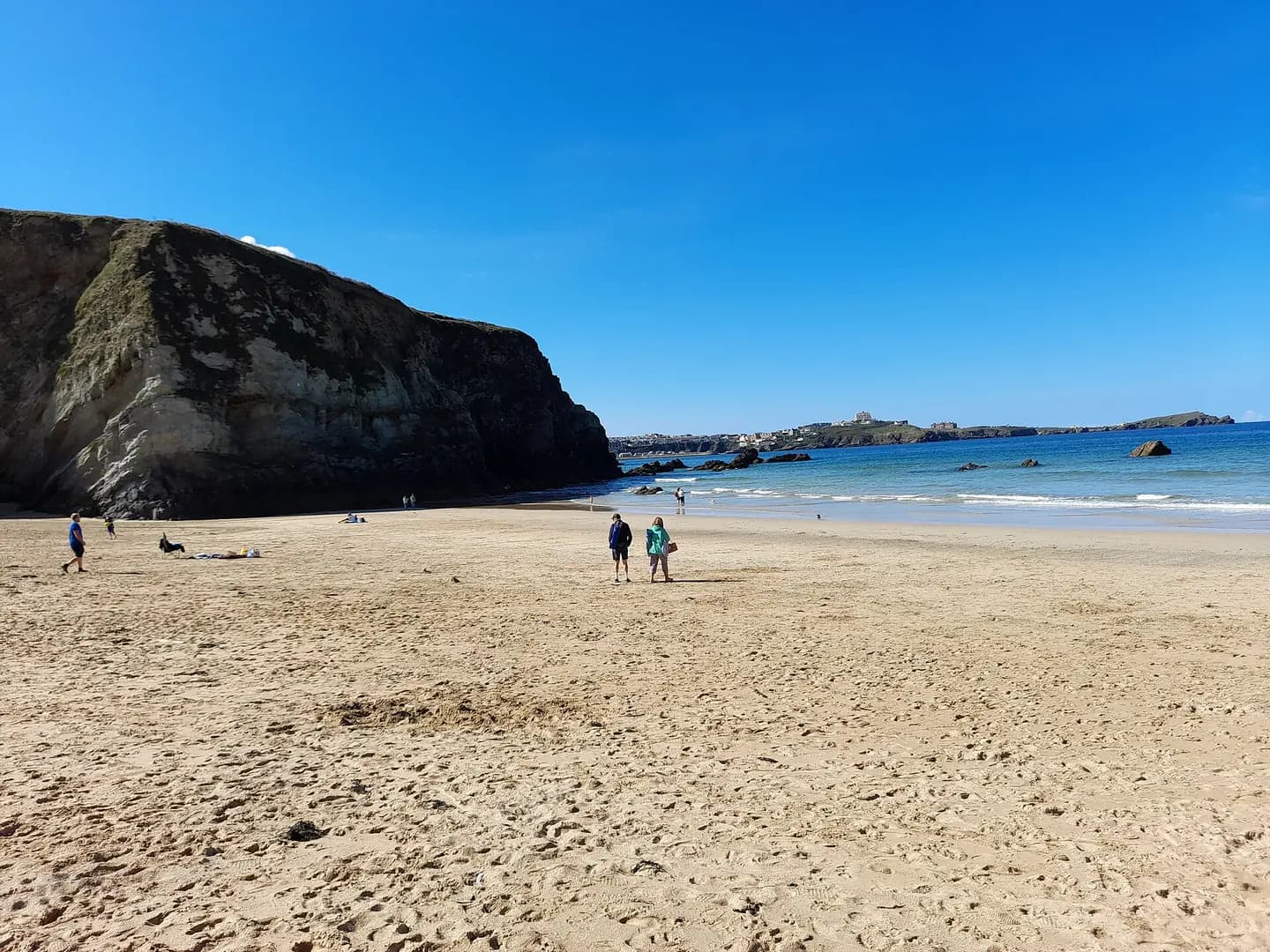
Lusty Glaze
Lusty Glaze. This photograph is used as a geographic witness to the place, not as evidence of the historical date shown in the chapter.
- Visual description
- Lusty Glaze
- Nature
- original
- Medium
- Open-licence photograph
- Source
- Wikimedia Commons / Geograph · CC BY-SA 2.0
- Reviewed
- Josh Wildman
THE COVE
Lusty Glaze
An iron-ore cove remade as a bathing resort, rescue centre and activity beach.
Scroll to follow the shoreline through time
Lusty Glaze is a confined beach below steep cliffs on Newquay Bay.
Its difficult vertical access determined both how ore left the cove and how later visitors reached the sand.
Sources for this chapter
THE 19th CENTURY
Iron ore moved by horse and cart
Miners cut a deep scar and steps into the cliff so iron ore could be winched upward.
In heavy seas, horses and carts carried ore across Newquay’s beaches to the harbour.
Sources for this chapter
ABOUT 1921
An abandoned mine became a bathing resort
After mining ended, Lusty Glaze began operating as a private bathing resort around 1921.
The industrial steps and privately owned foreshore were reused rather than erased.
Sources for this chapter
Open ledger · AOD.UK.LUSTY-GLAZE.V01 · ORIGINALClose ledger · AOD.UK.LUSTY-GLAZE.V01
Ledger AOD.UK.LUSTY-GLAZE.V01
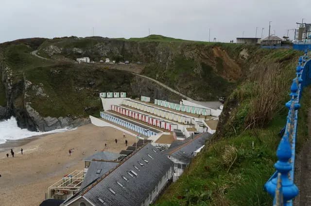
Beach Huts at Tolcarne Beach, Newquay
Beach Huts at Tolcarne Beach, Newquay. This photograph is used as a geographic witness to the place, not as evidence of the historical date shown in the chapter.
- Visual description
- Beach Huts at Tolcarne Beach, Newquay
- Nature
- original
- Medium
- Open-licence photograph
- Source
- Wikimedia Commons / Geograph · CC BY-SA 2.0
- Reviewed
- Josh Wildman
THE 20th CENTURY
Rescue training led to organised activity
The cove later served rescue training and developed into an activity centre.
Surfing became part of a wider programme shaped by the beach’s enclosure and controlled access.
Sources for this chapter
THE LIVING MAP
The mapped place
Lusty Glaze is recorded at 50.415° N, 5.067° W. A surf map fixes a name to one stretch of moving water, but the place changes with tide, swell direction, wind and the shape of the seabed.
Sources for this chapter
Open ledger · AOD.UK.LUSTY-GLAZE.V00 · ORIGINALClose ledger · AOD.UK.LUSTY-GLAZE.V00
Ledger AOD.UK.LUSTY-GLAZE.V00
Lusty Glaze
Lusty Glaze. This photograph is used as a geographic witness to the place, not as evidence of the historical date shown in the chapter.
- Visual description
- Lusty Glaze
- Nature
- original
- Medium
- Open-licence photograph
- Source
- Wikimedia Commons / Geograph · CC BY-SA 2.0
- Reviewed
- Josh Wildman
TODAY
One beach carries several former lives
Lusty Glaze is now a privately managed beach, event venue and watersports site.
The mine scar and long stairway keep its working origin visible inside the modern visitor experience.
Sources for this chapter
THE LEDGER
Sources and credits
This exhibition is built from local, institutional and sporting records. The source ledger keeps the claims visible and leaves space for correction as further local evidence emerges.
Sources for this chapter
Artefacts in order of appearance
Lusty Glaze
AOD.UK.LUSTY-GLAZE.V00 · original · Wikimedia Commons / Geograph · CC BY-SA 2.0
Beach Huts at Tolcarne Beach, Newquay
AOD.UK.LUSTY-GLAZE.V01 · original · Wikimedia Commons / Geograph · CC BY-SA 2.0
Editorial record
Full UK edition. Historical claims are linked to the local, public and sporting records used to write the exhibition. Cartography is generated from the PeakWave location catalogue.