Open ledger · AOD.WORLD.LOMBOK-KUTA.PLACE · ORIGINALClose ledger · AOD.WORLD.LOMBOK-KUTA.PLACE
Ledger AOD.WORLD.LOMBOK-KUTA.PLACE
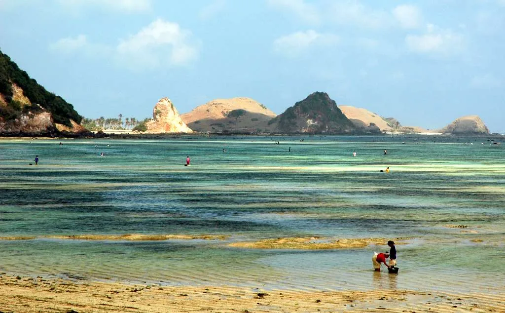
Picking fishes @ Kuta beach, Lombok
Picking fishes @ Kuta beach, Lombok. Used as a geographic witness, not as evidence for an earlier chapter date.
- Visual description
- Picking fishes @ Kuta beach, Lombok
- Nature
- original
- Medium
- Open-licence photograph
- Source
- Wikimedia Commons · CC BY 2.0Locality and subject checked. Named selection, attribution and reuse review remains open.
THE SETTING
Kuta Lombok
Kuta Lombok: the coast, its communities and the making of a sporting place.
Scroll to follow the shoreline through time
Kuta stands on Lombok's southern coast, beside a sequence of bays and headlands.
Sources for this chapter
LIFE AND SETTLEMENT
A place before its sporting image
The town's identity is distinct from Bali's Kuta, despite sharing the same name.
Sources for this chapter
ROUTES AND ACCESS
The journey in
Lombok's international airport changed the journey to the south coast, bringing Kuta close to air arrival.
Sources for this chapter
Open ledger · AOD.WORLD.LOMBOK-KUTA.ACTIVITY · DATA-PLATEClose ledger · AOD.WORLD.LOMBOK-KUTA.ACTIVITY
Ledger AOD.WORLD.LOMBOK-KUTA.ACTIVITY
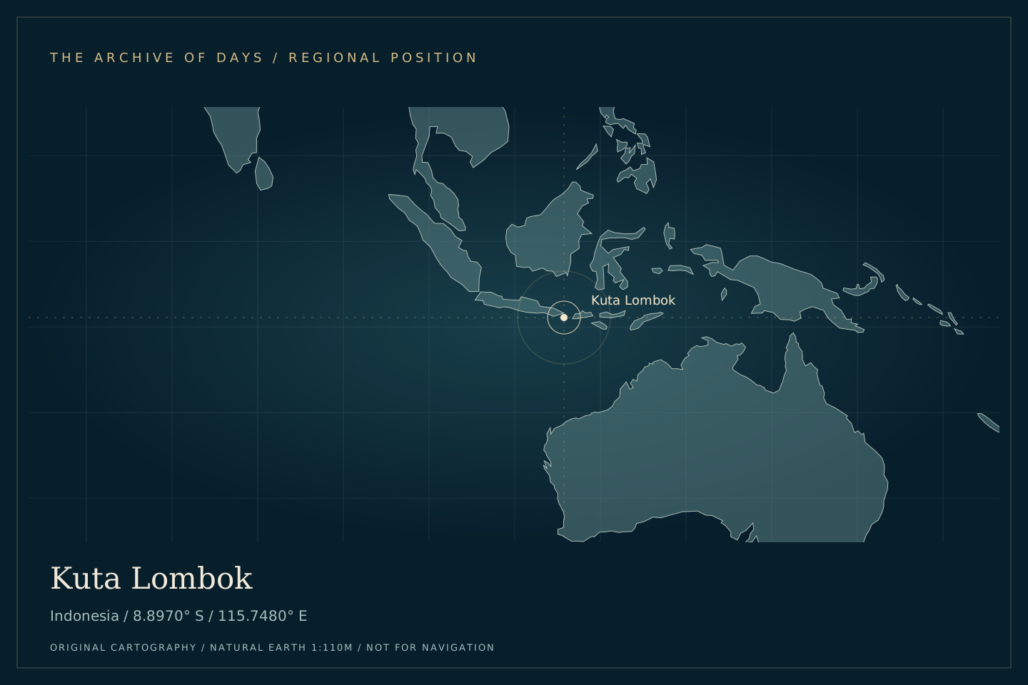
Kuta Lombok: regional position
Original coordinate plate locating Kuta Lombok at -8.8970, 115.7480, with generalised Natural Earth land outlines. Geographic context only; not historical evidence or a navigation chart.
- Visual description
- Original coordinate plate locating Kuta Lombok at -8.8970, 115.7480, with generalised Natural Earth land outlines.
- Nature
- data-plate
- Medium
- Original cartographic data plate
- Source
- PeakWave / Natural Earth · Natural Earth base data: public domain. Original composition: PeakWave.Equirectangular projection centred on the catalogue coordinates. Generalised 1:110m land data, without local terrain, depth or forecast claims. Named visual review remains open.
SPORT TAKES SHAPE
The surfing shore
Nearby surf spots helped turn the town into a base for travelling between separate beaches.
Sources for this chapter
THE LIVING MAP
The mapped place
Kuta Lombok is recorded at 8.897° S, 115.748° E. A surf map fixes a name to one stretch of moving water, but the place changes with tide, swell direction, wind and the shape of the seabed.
Sources for this chapter
Open ledger · AOD.WORLD.LOMBOK-KUTA.PLACE · ORIGINALClose ledger · AOD.WORLD.LOMBOK-KUTA.PLACE
Ledger AOD.WORLD.LOMBOK-KUTA.PLACE
Picking fishes @ Kuta beach, Lombok
Picking fishes @ Kuta beach, Lombok. Used as a geographic witness, not as evidence for an earlier chapter date.
- Visual description
- Picking fishes @ Kuta beach, Lombok
- Nature
- original
- Medium
- Open-licence photograph
- Source
- Wikimedia Commons · CC BY 2.0Locality and subject checked. Named selection, attribution and reuse review remains open.
TODAY
Kuta Lombok today
Tourism growth has made Kuta a major Lombok destination, with the surrounding coast remaining a collection of individual places.
Sources for this chapter
THE LEDGER
Sources and credits
This exhibition is built from local, institutional and sporting records. The source ledger keeps the claims visible and leaves space for correction as further local evidence emerges.
Sources for this chapter
Artefacts in order of appearance
Picking fishes @ Kuta beach, Lombok
AOD.WORLD.LOMBOK-KUTA.PLACE · original · Wikimedia Commons · CC BY 2.0
Kuta Lombok: regional position
AOD.WORLD.LOMBOK-KUTA.ACTIVITY · data-plate · PeakWave / Natural Earth · Natural Earth base data: public domain. Original composition: PeakWave.
Editorial record
Place research draws on the linked locality overview and supplementary records where listed, consulted 2026-10-08. Wikipedia-derived text is adapted under CC BY-SA 4.0. Individual visual records retain their creators and reuse terms.
Original coordinate plates use PeakWave catalogue coordinates and public-domain Natural Earth 1:110m land outlines. They provide geographic context without claiming local terrain, water depth or historical appearance.
This complete Beta edition remains subject to named historical, narrative-source, visual-rights and credits review. No named approval is implied by the research or the original artwork.