
Open ledger · AOD.EU.LES-DEUX-ALPES.V00 · ORIGINALClose ledger · AOD.EU.LES-DEUX-ALPES.V00
Ledger AOD.EU.LES-DEUX-ALPES.V00
ISS059-E-113973 - View of France - French Alps - Grandes Rousses - Alpe d'Huez - Lac de Grand Maison - Le Rissiou - Chaîne de Belledonne - Massif du Taillefer - Lac du Chambon - Les Deux Alpes - Pied Moutet - Grenoble
ISS059-E-113973 - View of France - French Alps - Grandes Rousses - Alpe d'Huez - Lac de Grand Maison - Le Rissiou - Chaîne de Belledonne - Massif du Taillefer - Lac du Chambon - Les Deux Alpes - Pied Moutet - Grenoble. This photograph is used as a geographic witness to the place, not as evidence of the historical date shown in the chapter.
- Visual description
- ISS059-E-113973 - View of France - French Alps - Grandes Rousses - Alpe d'Huez - Lac de Grand Maison - Le Rissiou - Chaîne de Belledonne - Massif du Taillefer - Lac du Chambon - Les Deux Alpes - Pied Moutet - Grenoble
- Nature
- original
- Medium
- Open-licence photograph
- Source
- Wikimedia Commons · Public domain
BEFORE MODERN SPORT
Les Deux Alpes
How settlement, access and winter sport shaped Les Deux Alpes.
Scroll to read the contour through time
Les 2 Alpes (pronounced ) is a ski resort in the French department of Isère, Auvergne-Rhône-Alpes.
Sources for this chapter
BEFORE TOURISM
Work and settlement beneath the snowline
The "two Alps" in the name do not refer to the two facing mountain-sides that comprise the resort, but rather to two adjacent areas of the original mountain pasture on the north-south plateau on which the resort was built.
Sources for this chapter
1091
A route reaches Les Deux Alpes
Access to the resort is by road RD 1091, in Livet-et-Gavet - no road connects the resort to Vénosc down the steep slope to the south, but a gondola connects the two, and there is a footpath passable in summer.
Sources for this chapter
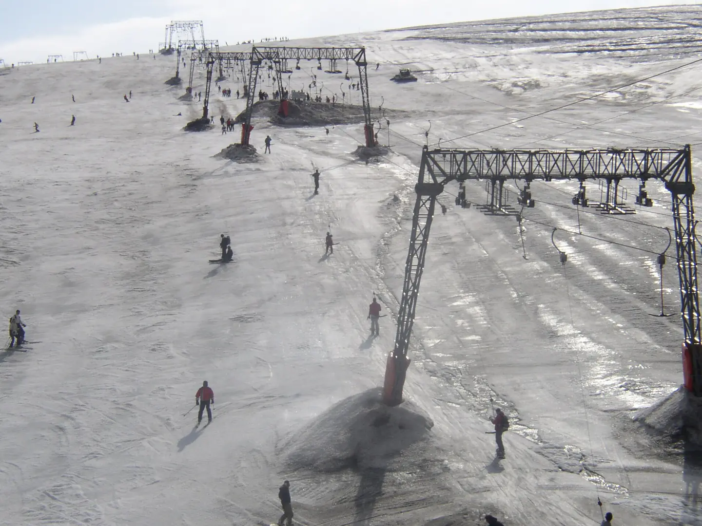
Open ledger · AOD.EU.LES-DEUX-ALPES.V01 · ORIGINALClose ledger · AOD.EU.LES-DEUX-ALPES.V01
Ledger AOD.EU.LES-DEUX-ALPES.V01
Les Deux Alpes lift
Photo of the glacier's lift system at the Les Deux Alpes ski-resort in France. Taken by me with a digital camera. This photograph is used as a geographic witness to the place, not as evidence of the historical date shown in the chapter.
- Visual description
- Photo of the glacier's lift system at the Les Deux Alpes ski-resort in France. Taken by me with a digital camera
- Nature
- original
- Medium
- Open-licence photograph
- Source
- Wikimedia Commons · CC BY 2.0
ORGANISED SPORT
Winter becomes organised
It has the largest skiable glacier in Europe and is France's second oldest ski resort behind Chamonix.
Sources for this chapter
THE LIVING MAP
The mapped place
Les Deux Alpes is recorded at 45.007° N, 6.122° E. Its catalogue reference reaches 3,568 metres. A modern resort map compresses terrain, exposure and access into a diagram. This exhibition keeps the underlying contour visible so the place does not become only a list of facilities.
Sources for this chapter
Open ledger · AOD.EU.LES-DEUX-ALPES.V00 · ORIGINALClose ledger · AOD.EU.LES-DEUX-ALPES.V00
Ledger AOD.EU.LES-DEUX-ALPES.V00
ISS059-E-113973 - View of France - French Alps - Grandes Rousses - Alpe d'Huez - Lac de Grand Maison - Le Rissiou - Chaîne de Belledonne - Massif du Taillefer - Lac du Chambon - Les Deux Alpes - Pied Moutet - Grenoble
ISS059-E-113973 - View of France - French Alps - Grandes Rousses - Alpe d'Huez - Lac de Grand Maison - Le Rissiou - Chaîne de Belledonne - Massif du Taillefer - Lac du Chambon - Les Deux Alpes - Pied Moutet - Grenoble. This photograph is used as a geographic witness to the place, not as evidence of the historical date shown in the chapter.
- Visual description
- ISS059-E-113973 - View of France - French Alps - Grandes Rousses - Alpe d'Huez - Lac de Grand Maison - Le Rissiou - Chaîne de Belledonne - Massif du Taillefer - Lac du Chambon - Les Deux Alpes - Pied Moutet - Grenoble
- Nature
- original
- Medium
- Open-licence photograph
- Source
- Wikimedia Commons · Public domain
TODAY
Les Deux Alpes now
Ski passes in the resort can now be used hands free.
Sources for this chapter
THE LEDGER
Sources and credits
This exhibition is built from local, institutional and sporting records. The source ledger keeps the claims visible and leaves space for correction as further local evidence emerges.
Sources for this chapter
Artefacts in order of appearance
ISS059-E-113973 - View of France - French Alps - Grandes Rousses - Alpe d'Huez - Lac de Grand Maison - Le Rissiou - Chaîne de Belledonne - Massif du Taillefer - Lac du Chambon - Les Deux Alpes - Pied Moutet - Grenoble
AOD.EU.LES-DEUX-ALPES.V00 · original · Wikimedia Commons · Public domain
Les Deux Alpes lift
AOD.EU.LES-DEUX-ALPES.V01 · original · Wikimedia Commons · CC BY 2.0
Editorial record
Full European Beta edition. Place evidence is adapted from the linked Les Deux Alpes overview under CC BY-SA 4.0 and remains subject to named historical and local review. Cartography is generated from the PeakWave location catalogue.