Open ledger · AOD.EU.LES-CONTAMINES.V00 · ORIGINALClose ledger · AOD.EU.LES-CONTAMINES.V00
Ledger AOD.EU.LES-CONTAMINES.V00
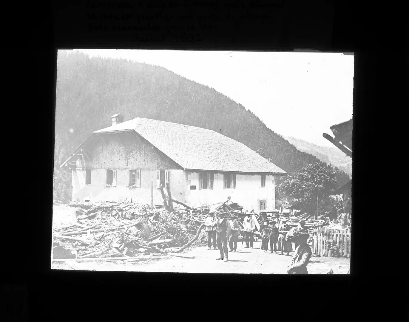
Catastrophe de St Gervais - bois amoncelé par la lave contre la maison d'école de Bionnay (qui a détourné la lave et protégé une partie du village) - btv1b106836166
Sujet : Constructions -- Effets des catastrophes naturelles Haute-Savoie (France) Les Contamines-Montjoie Appartient à l’ensemble documentaire : Inr000 Langue : français. This photograph is used as a geographic witness to the place, not as evidence of the historical date shown in the chapter.
- Visual description
- Sujet : Constructions -- Effets des catastrophes naturelles Haute-Savoie (France) Les Contamines-Montjoie Appartient à l’ensemble documentaire : Inr000 Langue : français
- Nature
- original
- Medium
- Open-licence photograph
- Source
- Wikimedia Commons · Public domain
BEFORE MODERN SPORT
Les Contamines-Montjoie
How settlement, access and winter sport shaped Les Contamines-Montjoie.
Scroll to read the contour through time
Les Contamines-Montjoie is a commune in the Haute-Savoie department in the Auvergne-Rhône-Alpes region in south-eastern France.
Sources for this chapter
BEFORE TOURISM
Work and settlement beneath the snowline
The original name of the village, Les Contamines, is from the word contamines, which in the ancient local dialect meant ploughable land on the estate of the squire.
Sources for this chapter
1952
A route reaches Les Contamines-Montjoie
The first chair lift opened three years later, in 1952, along with a summer attraction at l'Etape.
Sources for this chapter
Open ledger · AOD.EU.LES-CONTAMINES.V01 · ORIGINALClose ledger · AOD.EU.LES-CONTAMINES.V01
Ledger AOD.EU.LES-CONTAMINES.V01
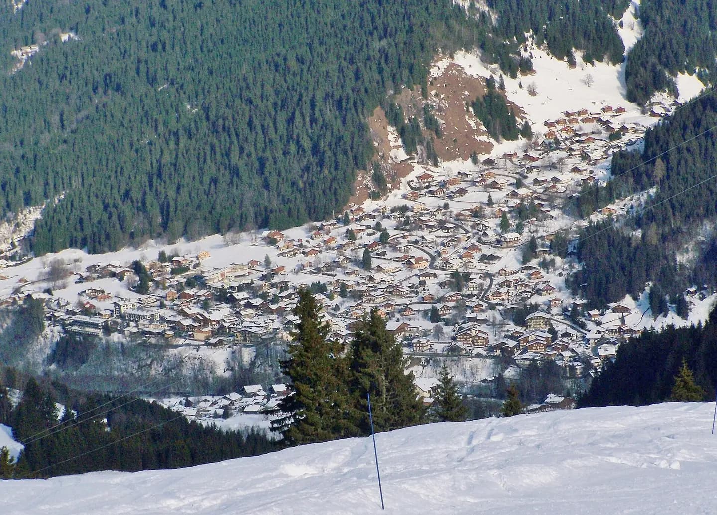
Les Contamines-Montjoie
Sight of French village Les Contamines-Montjoie seen from the heights of the ski resort, in Haute-Savoie. This photograph is used as a geographic witness to the place, not as evidence of the historical date shown in the chapter.
- Visual description
- Sight of French village Les Contamines-Montjoie seen from the heights of the ski resort, in Haute-Savoie
- Nature
- original
- Medium
- Open-licence photograph
- Source
- Wikimedia Commons · CC BY-SA 3.0
1900
Winter becomes organised
Further development surged after 1900, in the form of hotels, restaurants, and, in 1911, a local ski club.
THE LIVING MAP
The mapped place
Les Contamines-Montjoie is recorded at 45.818° N, 6.726° E. Its catalogue reference reaches 2,487 metres. A modern resort map compresses terrain, exposure and access into a diagram. This exhibition keeps the underlying contour visible so the place does not become only a list of facilities.
Sources for this chapter
Open ledger · AOD.EU.LES-CONTAMINES.V00 · ORIGINALClose ledger · AOD.EU.LES-CONTAMINES.V00
Ledger AOD.EU.LES-CONTAMINES.V00
Catastrophe de St Gervais - bois amoncelé par la lave contre la maison d'école de Bionnay (qui a détourné la lave et protégé une partie du village) - btv1b106836166
Sujet : Constructions -- Effets des catastrophes naturelles Haute-Savoie (France) Les Contamines-Montjoie Appartient à l’ensemble documentaire : Inr000 Langue : français. This photograph is used as a geographic witness to the place, not as evidence of the historical date shown in the chapter.
- Visual description
- Sujet : Constructions -- Effets des catastrophes naturelles Haute-Savoie (France) Les Contamines-Montjoie Appartient à l’ensemble documentaire : Inr000 Langue : français
- Nature
- original
- Medium
- Open-licence photograph
- Source
- Wikimedia Commons · Public domain
TODAY
Les Contamines-Montjoie now
There are four sections of the ski area: the Tierces, the Roselette, the Montjoie, and the Hauteluce.
Sources for this chapter
THE LEDGER
Sources and credits
This exhibition is built from local, institutional and sporting records. The source ledger keeps the claims visible and leaves space for correction as further local evidence emerges.
Sources for this chapter
Artefacts in order of appearance
Catastrophe de St Gervais - bois amoncelé par la lave contre la maison d'école de Bionnay (qui a détourné la lave et protégé une partie du village) - btv1b106836166
AOD.EU.LES-CONTAMINES.V00 · original · Wikimedia Commons · Public domain
Les Contamines-Montjoie
AOD.EU.LES-CONTAMINES.V01 · original · Wikimedia Commons · CC BY-SA 3.0
Editorial record
Full European Beta edition. Place evidence is adapted from the linked Les Contamines-Montjoie overview under CC BY-SA 4.0 and remains subject to named historical and local review. Cartography is generated from the PeakWave location catalogue.