Open ledger · AOD.UK.LARGS.V00 · ORIGINALClose ledger · AOD.UK.LARGS.V00
Ledger AOD.UK.LARGS.V00
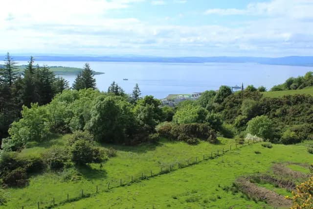
Largs from Haylie Brae Viewpoint
Largs from Haylie Brae Viewpoint. This photograph is used as a geographic witness to the place, not as evidence of the historical date shown in the chapter.
- Visual description
- Largs from Haylie Brae Viewpoint
- Nature
- original
- Medium
- Open-licence photograph
- Source
- Wikimedia Commons / Geograph · CC BY-SA 2.0
- Reviewed
- Josh Wildman
THE FIRTH
Largs
How a Firth of Clyde club became a national centre for Scottish sailing.
Scroll to read the water through time
Largs faces the broad Firth of Clyde, protected from the full Atlantic yet large enough for serious coastal racing.
Islands and headlands make wind direction and route choice part of every course.
Sources for this chapter
1936
A club forms
Largs Sailing Club was founded in 1936.
It began as a local organisation on water already used for Clyde boating and coastal travel.
Sources for this chapter
1964
A permanent base
A Scottish Office grant in 1964 supported new facilities.
Better launching and shore space allowed the club to host more sailors and more ambitious events.
Sources for this chapter
Open ledger · AOD.UK.LARGS.V01 · ORIGINALClose ledger · AOD.UK.LARGS.V01
Ledger AOD.UK.LARGS.V01
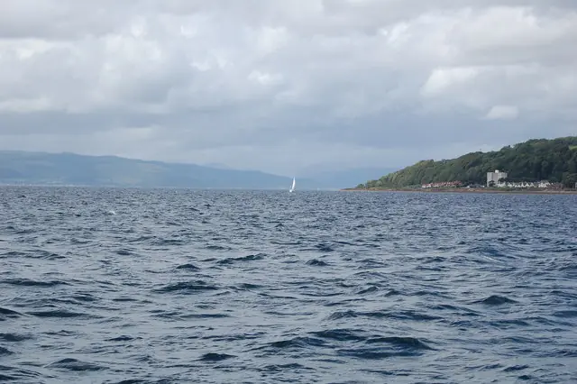
Yachting on the Clyde
Yachting on the Clyde Looking up the Clyde, from the Cumbrae ferry, at a yacht sailing off North Largs. This photograph is used as a geographic witness to the place, not as evidence of the historical date shown in the chapter.
- Visual description
- Yachting on the Clyde Looking up the Clyde, from the Cumbrae ferry, at a yacht sailing off North Largs
- Nature
- original
- Medium
- Open-licence photograph
- Source
- Wikimedia Commons / Geograph · CC BY-SA 2.0
- Reviewed
- Josh Wildman
LATE 20th CENTURY
From local club to national venue
Largs developed a reputation as a Scottish centre for training and competition.
The Firth could accommodate dinghies, keelboats and offshore courses without losing the practical culture of a member-run club.
Sources for this chapter
THE LIVING MAP
The mapped place
Largs is recorded at 55.790° N, 4.870° W as a coastal open venue. A course drawn here is temporary: wind, current, shore and marks determine the water that sailors actually meet.
Sources for this chapter
Open ledger · AOD.UK.LARGS.V00 · ORIGINALClose ledger · AOD.UK.LARGS.V00
Ledger AOD.UK.LARGS.V00
Largs from Haylie Brae Viewpoint
Largs from Haylie Brae Viewpoint. This photograph is used as a geographic witness to the place, not as evidence of the historical date shown in the chapter.
- Visual description
- Largs from Haylie Brae Viewpoint
- Nature
- original
- Medium
- Open-licence photograph
- Source
- Wikimedia Commons / Geograph · CC BY-SA 2.0
- Reviewed
- Josh Wildman
TODAY
A gateway to west-coast sailing
The town now connects club sailing, major events and cruising into the Clyde and islands.
Its importance comes from serving both the first launch and the longer voyage.
Sources for this chapter
THE LEDGER
Sources and credits
This exhibition is built from local, institutional and sporting records. The source ledger keeps the claims visible and leaves space for correction as further local evidence emerges.
Sources for this chapter
Artefacts in order of appearance
Largs from Haylie Brae Viewpoint
AOD.UK.LARGS.V00 · original · Wikimedia Commons / Geograph · CC BY-SA 2.0
Yachting on the Clyde
AOD.UK.LARGS.V01 · original · Wikimedia Commons / Geograph · CC BY-SA 2.0
Editorial record
Full UK edition. Historical claims are linked to the local, public and sporting records used to write the exhibition. Cartography is generated from the PeakWave location catalogue.