Open ledger · AOD.EU.LAHINCH.V00 · ORIGINALClose ledger · AOD.EU.LAHINCH.V00
Ledger AOD.EU.LAHINCH.V00
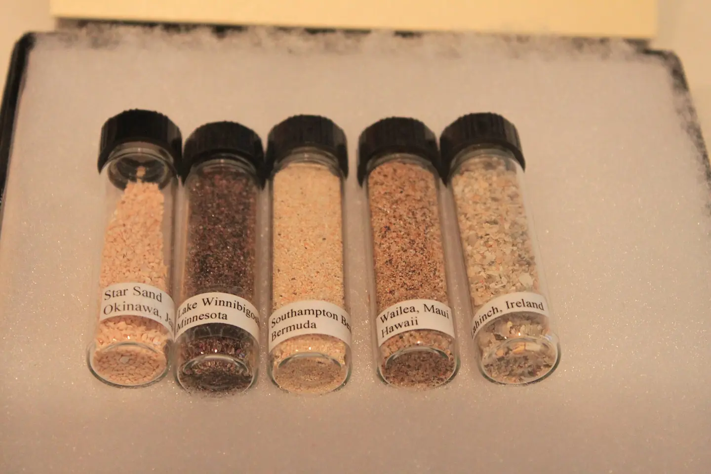
Sands from Lahinch, Ireland; Wailea, Maui, Hawaii; Southhampton Beach, Bermuda; Lake Winnibigoshish, Minnesota; Okinawa, Japan - Science Museum of Minnesota
Taken at the Minnesota Science Museum. Creative Commons licensed photo by ideonexus.com . Please feel free to reuse for any purpose. This photograph is used as a geographic witness to the place, not as evidence of the historical date shown in the chapter.
- Visual description
- Taken at the Minnesota Science Museum. Creative Commons licensed photo by ideonexus.com . Please feel free to reuse for any purpose
- Nature
- original
- Medium
- Open-licence photograph
- Source
- Wikimedia Commons · CC BY 2.0
BEFORE MODERN SPORT
Lahinch
How work, access and surfing shaped Lahinch.
Scroll to follow the shoreline through time
Lahinch or Lehinch (Irish: An Leacht or Irish: Leacht Uí Chonchubhair, meaning 'The Memorial cairn of O'Connor') is a small town on Liscannor Bay, on the northwest coast of County Clare, Ireland.
Sources for this chapter
2020
Work at the water’s edge
In 2020, an ancient monument, believed to be a cliff ring fort created thousands of years ago, was discovered near the coastal area of Lahinch.
Sources for this chapter
1000
The shore becomes reachable
It grew in the 19th century to over 1000 people by 1835, but it was not until later in the century that the infrastructure of the town developed and it became a seaside resort following the opening of the West Clare Railway in 1887.
Sources for this chapter
Open ledger · AOD.EU.LAHINCH.V01 · ORIGINALClose ledger · AOD.EU.LAHINCH.V01
Ledger AOD.EU.LAHINCH.V01
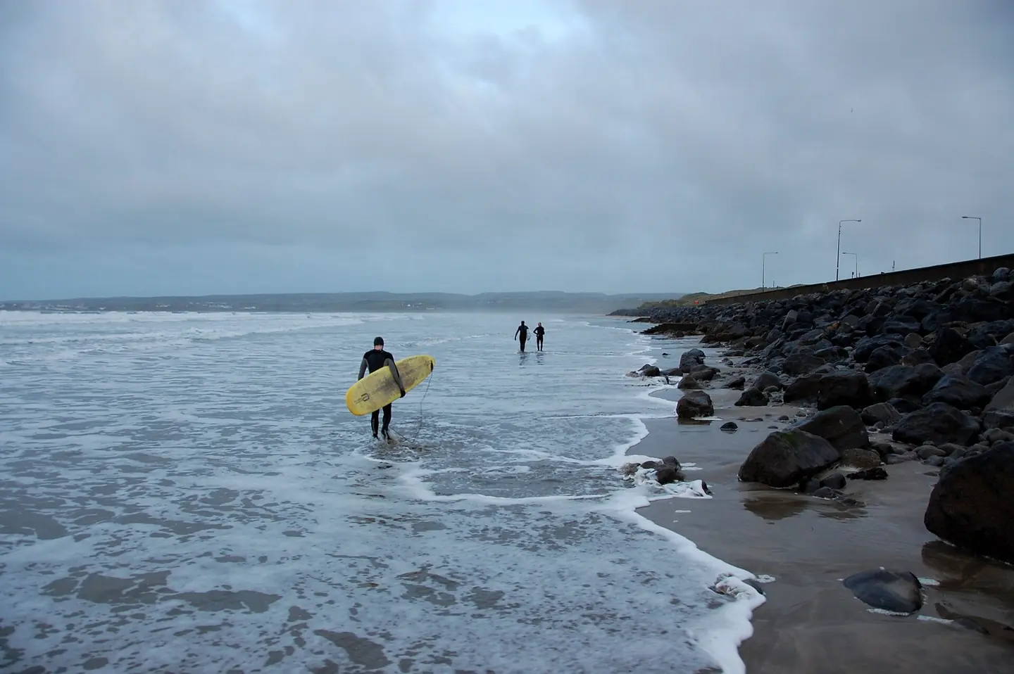
Surfers on their way out to surf Lahinch, December 2012.
Surfers getting ready to catch some waves at Lahinch, December 2012. This photograph is used as a geographic witness to the place, not as evidence of the historical date shown in the chapter.
- Visual description
- Surfers getting ready to catch some waves at Lahinch, December 2012
- Nature
- original
- Medium
- Open-licence photograph
- Source
- Wikimedia Commons · CC BY-SA 3.0
2006
Surfing reads the same coast differently
On 14 May 2006, 44 surfers managed to ride one small wave, setting a new world record.
Sources for this chapter
THE LIVING MAP
The mapped place
Lahinch is recorded at 52.934° N, 9.347° W. A surf map fixes a name to one stretch of moving water, but the place changes with tide, swell direction, wind and the shape of the seabed.
Sources for this chapter
Open ledger · AOD.EU.LAHINCH.V00 · ORIGINALClose ledger · AOD.EU.LAHINCH.V00
Ledger AOD.EU.LAHINCH.V00
Sands from Lahinch, Ireland; Wailea, Maui, Hawaii; Southhampton Beach, Bermuda; Lake Winnibigoshish, Minnesota; Okinawa, Japan - Science Museum of Minnesota
Taken at the Minnesota Science Museum. Creative Commons licensed photo by ideonexus.com . Please feel free to reuse for any purpose. This photograph is used as a geographic witness to the place, not as evidence of the historical date shown in the chapter.
- Visual description
- Taken at the Minnesota Science Museum. Creative Commons licensed photo by ideonexus.com . Please feel free to reuse for any purpose
- Nature
- original
- Medium
- Open-licence photograph
- Source
- Wikimedia Commons · CC BY 2.0
TODAY
Lahinch now
Today the town contains several small cafes and restaurants, a church, a pub, the Lahinch and Shamrock Hotels, a bookstore and a surfing school.
Sources for this chapter
THE LEDGER
Sources and credits
This exhibition is built from local, institutional and sporting records. The source ledger keeps the claims visible and leaves space for correction as further local evidence emerges.
Sources for this chapter
Artefacts in order of appearance
Sands from Lahinch, Ireland; Wailea, Maui, Hawaii; Southhampton Beach, Bermuda; Lake Winnibigoshish, Minnesota; Okinawa, Japan - Science Museum of Minnesota
AOD.EU.LAHINCH.V00 · original · Wikimedia Commons · CC BY 2.0
Surfers on their way out to surf Lahinch, December 2012.
AOD.EU.LAHINCH.V01 · original · Wikimedia Commons · CC BY-SA 3.0
Editorial record
Full European Beta edition. Place evidence is adapted from the linked Lahinch overview under CC BY-SA 4.0 and remains subject to named historical and local review. Cartography is generated from the PeakWave location catalogue.