Open ledger · AOD.EU.LA-PLAGNE.V00 · ORIGINALClose ledger · AOD.EU.LA-PLAGNE.V00
Ledger AOD.EU.LA-PLAGNE.V00
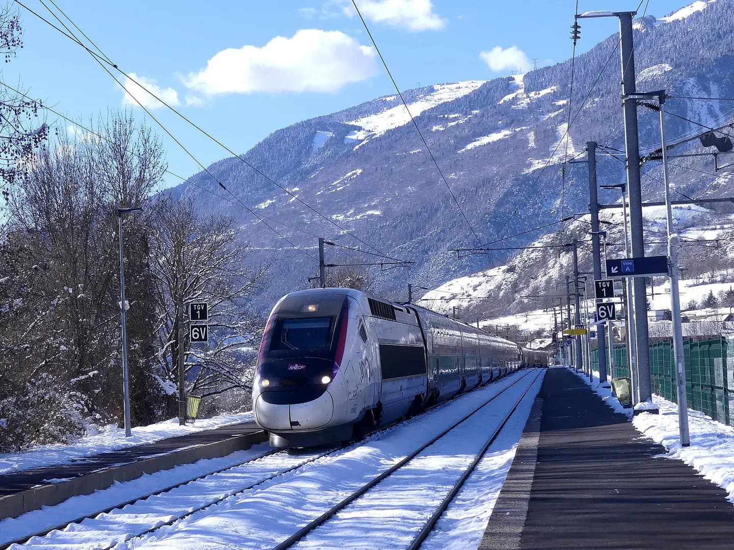
TGV Duplex entrant voie B à Aime-la-Plagne
Sight of French TGVs on winter journeys n° 6429 and 32909 from Paris to Bourg-Saint-Maurice in Tarentaise valley, stopping at Aime-la-Plagne station near its terminus, in Savoie , France. This photograph is used as a geographic witness to the place, not as evidence of the historical date shown in the chapter.
- Visual description
- Sight of French TGVs on winter journeys n° 6429 and 32909 from Paris to Bourg-Saint-Maurice in Tarentaise valley, stopping at Aime-la-Plagne station near its terminus, in Savoie , France
- Nature
- original
- Medium
- Open-licence photograph
- Source
- Wikimedia Commons · CC BY-SA 4.0
BEFORE MODERN SPORT
La Plagne
How settlement, access and winter sport shaped La Plagne.
Scroll to read the contour through time
La Plagne is a French ski area in the alpine valley of the Tarentaise (Savoie).
Sources for this chapter
1982
Work and settlement beneath the snowline
The name of "Plagne Centre" dates from 1982, before which the resort was simply called La Plagne.
Sources for this chapter
2005
A route reaches La Plagne
In December 2005, the first 8-seater chairlift in La Plagne (Arpette Chairlift) was built in Bellecôte.
Sources for this chapter
Open ledger · AOD.EU.LA-PLAGNE.V01 · ORIGINALClose ledger · AOD.EU.LA-PLAGNE.V01
Ledger AOD.EU.LA-PLAGNE.V01
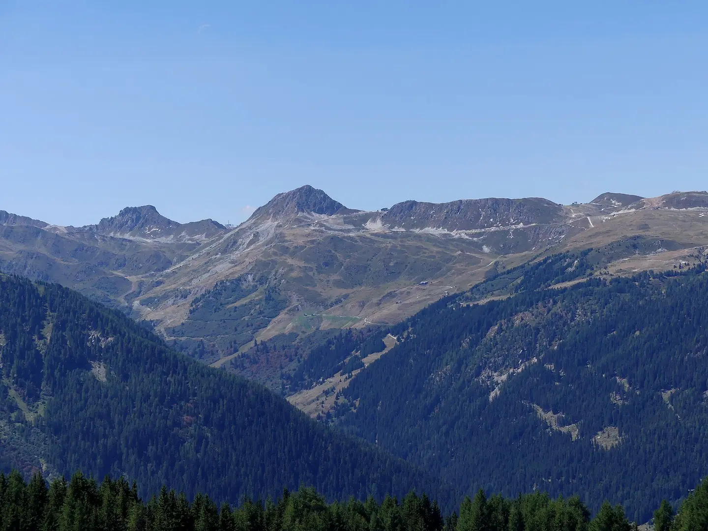
Sommets de La Plagne depuis Vallandry
Sight, from the slopes of Vallandry resort, of the east side of mountains in the surroundings of La Plagne ski area, Savoie , France. This photograph is used as a geographic witness to the place, not as evidence of the historical date shown in the chapter.
- Visual description
- Sight, from the slopes of Vallandry resort, of the east side of mountains in the surroundings of La Plagne ski area, Savoie , France
- Nature
- original
- Medium
- Open-licence photograph
- Source
- Wikimedia Commons · CC BY-SA 4.0
2003
Winter becomes organised
Since 2003, La Plagne and the neighbouring resort of Les Arcs form the Paradiski ski area.
Sources for this chapter
THE LIVING MAP
The mapped place
La Plagne is recorded at 45.510° N, 6.678° E. Its catalogue reference reaches 3,250 metres. A modern resort map compresses terrain, exposure and access into a diagram. This exhibition keeps the underlying contour visible so the place does not become only a list of facilities.
Sources for this chapter
Open ledger · AOD.EU.LA-PLAGNE.V00 · ORIGINALClose ledger · AOD.EU.LA-PLAGNE.V00
Ledger AOD.EU.LA-PLAGNE.V00
TGV Duplex entrant voie B à Aime-la-Plagne
Sight of French TGVs on winter journeys n° 6429 and 32909 from Paris to Bourg-Saint-Maurice in Tarentaise valley, stopping at Aime-la-Plagne station near its terminus, in Savoie , France. This photograph is used as a geographic witness to the place, not as evidence of the historical date shown in the chapter.
- Visual description
- Sight of French TGVs on winter journeys n° 6429 and 32909 from Paris to Bourg-Saint-Maurice in Tarentaise valley, stopping at Aime-la-Plagne station near its terminus, in Savoie , France
- Nature
- original
- Medium
- Open-licence photograph
- Source
- Wikimedia Commons · CC BY-SA 4.0
TODAY
La Plagne now
Opened in 1980 as a satellite to Montchavin, Les Coches is primarily a family resort now located at the centre of the Paradiski circuit and next to the Vanoise Express cable car, also linking into the La Plagne area by a six person high speed chair (Plan Bois).
Sources for this chapter
THE LEDGER
Sources and credits
This exhibition is built from local, institutional and sporting records. The source ledger keeps the claims visible and leaves space for correction as further local evidence emerges.
Sources for this chapter
Artefacts in order of appearance
TGV Duplex entrant voie B à Aime-la-Plagne
AOD.EU.LA-PLAGNE.V00 · original · Wikimedia Commons · CC BY-SA 4.0
Sommets de La Plagne depuis Vallandry
AOD.EU.LA-PLAGNE.V01 · original · Wikimedia Commons · CC BY-SA 4.0
Editorial record
Full European Beta edition. Place evidence is adapted from the linked La Plagne overview under CC BY-SA 4.0 and remains subject to named historical and local review. Cartography is generated from the PeakWave location catalogue.