Open ledger · AOD.EU.KRANJSKA-GORA.V00 · ORIGINALClose ledger · AOD.EU.KRANJSKA-GORA.V00
Ledger AOD.EU.KRANJSKA-GORA.V00
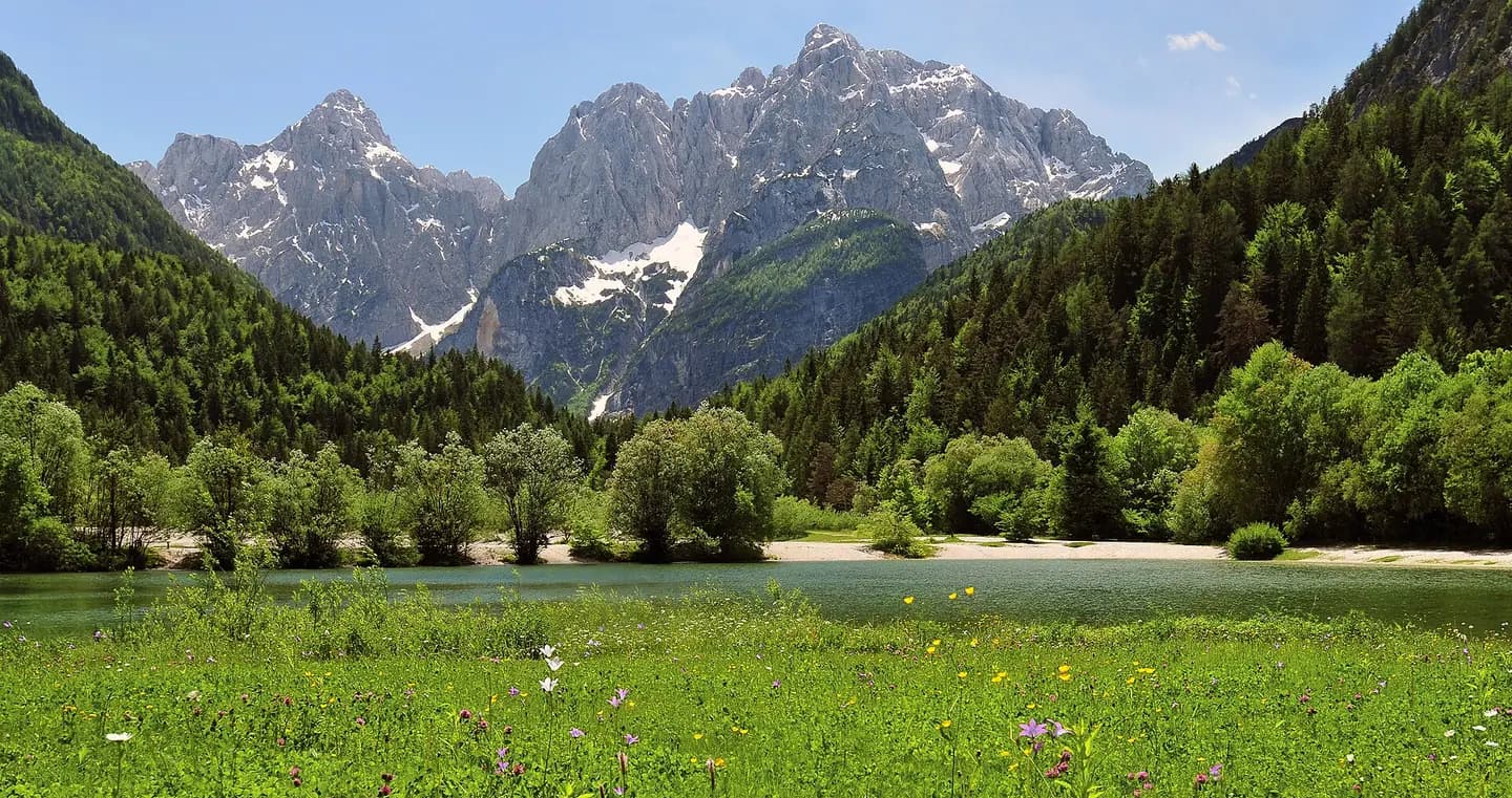
Julian Alps with Prisojnik and Razor
View from the town Kranjska Gora in north-west Slovenia across Lake Jasna to the Julian Alps with Razor (left) and Prisojnik (right). This photograph is used as a geographic witness to the place, not as evidence of the historical date shown in the chapter.
- Visual description
- View from the town Kranjska Gora in north-west Slovenia across Lake Jasna to the Julian Alps with Razor (left) and Prisojnik (right)
- Nature
- original
- Medium
- Open-licence photograph
- Source
- Wikimedia Commons · CC BY 3.0
BEFORE MODERN SPORT
Kranjska Gora
How settlement, access and winter sport shaped Kranjska Gora.
Scroll to read the contour through time
Kranjska Gora (Slovene: ; German: Kronau) is a town in northwestern Slovenia, on the Sava Dolinka River in the Upper Carniola region, close to the Austrian and Italian borders.
Sources for this chapter
1326
Work and settlement beneath the snowline
Kranjska Gora was first mentioned in written sources in 1326 as Chrainow (and as Chrainau and Chrainaw in 1363, as Cranaw and Chranaw in 1390, and as Kraynaw in 1456–61, among other names).
Sources for this chapter
1916
A route reaches Kranjska Gora
During the First World War, in 1916, Russian prisoners of war built a wooden chapel above the settlement commemorating their comrades killed in an avalanche while building a road over the Vršič Pass.
Sources for this chapter
Open ledger · AOD.EU.KRANJSKA-GORA.V01 · ORIGINALClose ledger · AOD.EU.KRANJSKA-GORA.V01
Ledger AOD.EU.KRANJSKA-GORA.V01
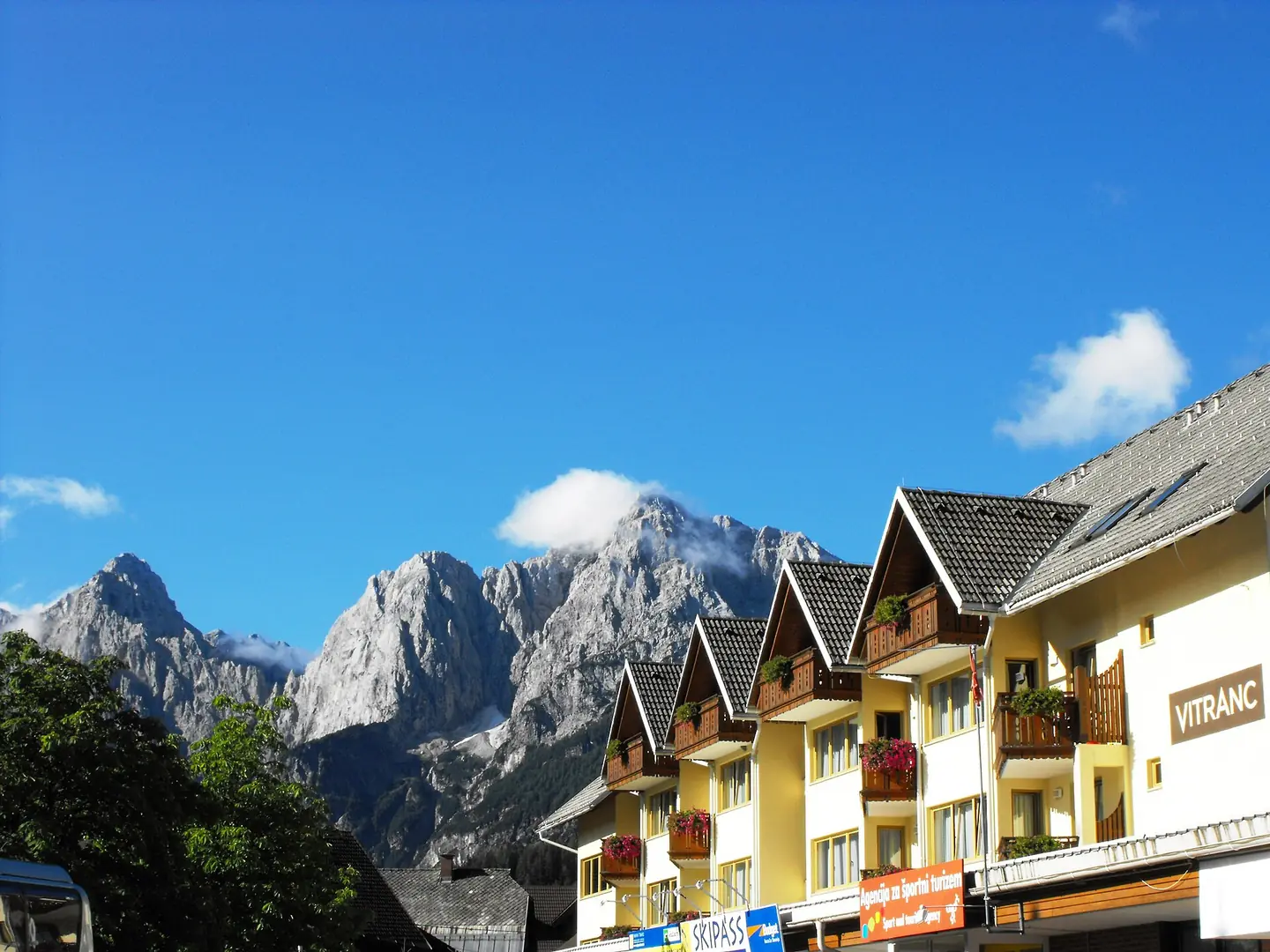
Slovenia - Kranjska Gora
This is a nice ski-resort village just below the Thriglav mountain peaks. This photograph is used as a geographic witness to the place, not as evidence of the historical date shown in the chapter.
- Visual description
- This is a nice ski-resort village just below the Thriglav mountain peaks
- Nature
- original
- Medium
- Open-licence photograph
- Source
- Wikimedia Commons · CC BY 2.0
1949
Winter becomes organised
Various ski lifts were built on Mount Vitranc west of the town in 1949, 1962, 1964, and 1965, and a freight cableway was installed in 1958.
Sources for this chapter
THE LIVING MAP
The mapped place
Kranjska Gora is recorded at 46.484° N, 13.786° E. Its catalogue reference reaches 1,295 metres. A modern resort map compresses terrain, exposure and access into a diagram. This exhibition keeps the underlying contour visible so the place does not become only a list of facilities.
Sources for this chapter
Open ledger · AOD.EU.KRANJSKA-GORA.V00 · ORIGINALClose ledger · AOD.EU.KRANJSKA-GORA.V00
Ledger AOD.EU.KRANJSKA-GORA.V00
Julian Alps with Prisojnik and Razor
View from the town Kranjska Gora in north-west Slovenia across Lake Jasna to the Julian Alps with Razor (left) and Prisojnik (right). This photograph is used as a geographic witness to the place, not as evidence of the historical date shown in the chapter.
- Visual description
- View from the town Kranjska Gora in north-west Slovenia across Lake Jasna to the Julian Alps with Razor (left) and Prisojnik (right)
- Nature
- original
- Medium
- Open-licence photograph
- Source
- Wikimedia Commons · CC BY 3.0
TODAY
Kranjska Gora now
It annually hosts an event in the FIS Alpine Ski World Cup series, also known as the Vitranc Cup, for the slalom and giant slalom events.
Sources for this chapter
THE LEDGER
Sources and credits
This exhibition is built from local, institutional and sporting records. The source ledger keeps the claims visible and leaves space for correction as further local evidence emerges.
Sources for this chapter
Artefacts in order of appearance
Julian Alps with Prisojnik and Razor
AOD.EU.KRANJSKA-GORA.V00 · original · Wikimedia Commons · CC BY 3.0
Slovenia - Kranjska Gora
AOD.EU.KRANJSKA-GORA.V01 · original · Wikimedia Commons · CC BY 2.0
Editorial record
Full European Beta edition. Place evidence is adapted from the linked Kranjska Gora overview under CC BY-SA 4.0 and remains subject to named historical and local review. Cartography is generated from the PeakWave location catalogue.