Open ledger · AOD.EU.KOPAONIK.V00 · ORIGINALClose ledger · AOD.EU.KOPAONIK.V00
Ledger AOD.EU.KOPAONIK.V00
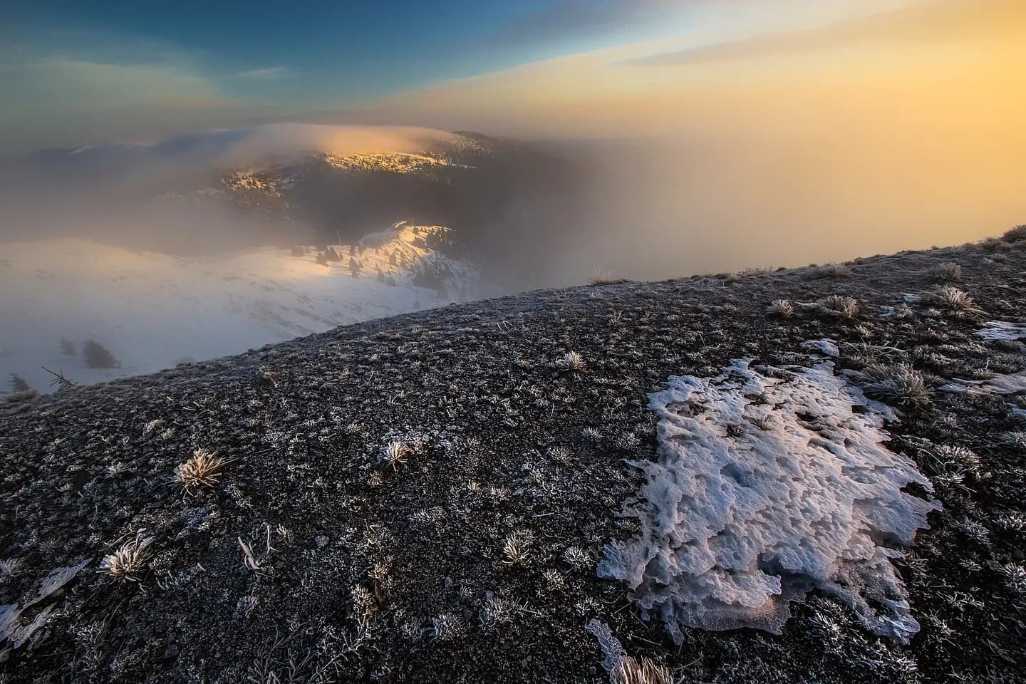
Kopaonik, pogled na Belu Reku
Kopaonik is one of the larger mountain ranges of Serbia. It is located in the central part of Serbia and the northern part of Kosovo. Its highest point, Pančić's Peak, is 2,017 m (6,617 ft) above sea level. This photograph is used as a geographic witness to the place, not as evidence of the historical date shown in the chapter.
- Visual description
- Kopaonik is one of the larger mountain ranges of Serbia. It is located in the central part of Serbia and the northern part of Kosovo. Its highest point, Pančić's Peak, is 2,017 m (6,617 ft) above sea level
- Nature
- original
- Medium
- Open-licence photograph
- Source
- Wikimedia Commons · CC BY-SA 4.0
BEFORE MODERN SPORT
Kopaonik
How settlement, access and winter sport shaped Kopaonik.
Scroll to read the contour through time
Kopaonik (Serbian Cyrillic: Копаоник; Albanian: Kopaoniku) is a mountain range located in Kosovo and Serbia.
Sources for this chapter
2020
Work and settlement beneath the snowline
With several other beech localities in the national parks of Fruška Gora and Tara, beech forest Kozje Stene on Kopaonik have been submitted for the inclusion into the UNESCO World Heritage Site Ancient and Primeval Beech Forests of the Carpathians and Other Regions of Europe in May 2020.
Sources for this chapter
ACCESS CHANGES
A route reaches Kopaonik
The central part of Kopaonik with the tourist centre and ski slopes are linked with the Ibar highway, and the nearest international airport is in Niš.
Sources for this chapter
Open ledger · AOD.EU.KOPAONIK.V01 · ORIGINALClose ledger · AOD.EU.KOPAONIK.V01
Ledger AOD.EU.KOPAONIK.V01
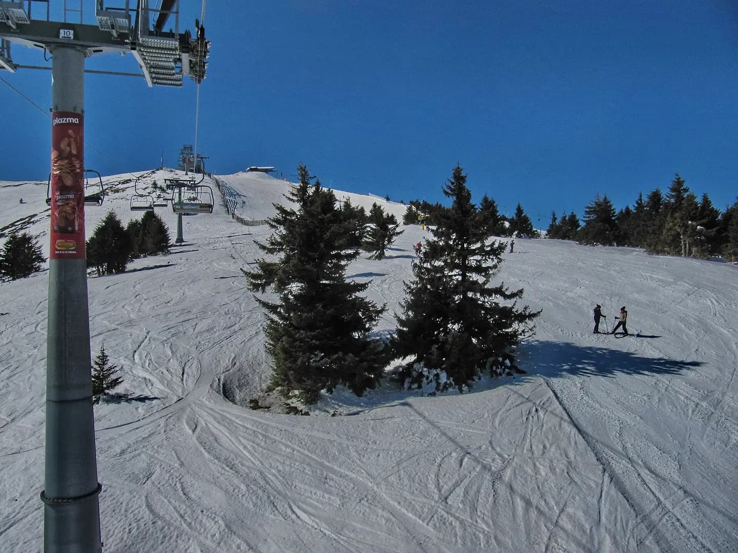
Kopaonik ski staza Duboka - panoramio
Kopaonik ski staza Duboka. This photograph is used as a geographic witness to the place, not as evidence of the historical date shown in the chapter.
- Visual description
- Kopaonik ski staza Duboka
- Nature
- original
- Medium
- Open-licence photograph
- Source
- Wikimedia Commons · CC BY 3.0
2019
Winter becomes organised
A public heliport is located in a military base half a mile north of the resort.
in 2019, the longest artificial ski slope in Europe opened in the resort.
Sources for this chapter
THE LIVING MAP
The mapped place
Kopaonik is recorded at 43.276° N, 20.815° E. Its catalogue reference reaches 2,017 metres. A modern resort map compresses terrain, exposure and access into a diagram. This exhibition keeps the underlying contour visible so the place does not become only a list of facilities.
Sources for this chapter
Open ledger · AOD.EU.KOPAONIK.V00 · ORIGINALClose ledger · AOD.EU.KOPAONIK.V00
Ledger AOD.EU.KOPAONIK.V00
Kopaonik, pogled na Belu Reku
Kopaonik is one of the larger mountain ranges of Serbia. It is located in the central part of Serbia and the northern part of Kosovo. Its highest point, Pančić's Peak, is 2,017 m (6,617 ft) above sea level. This photograph is used as a geographic witness to the place, not as evidence of the historical date shown in the chapter.
- Visual description
- Kopaonik is one of the larger mountain ranges of Serbia. It is located in the central part of Serbia and the northern part of Kosovo. Its highest point, Pančić's Peak, is 2,017 m (6,617 ft) above sea level
- Nature
- original
- Medium
- Open-licence photograph
- Source
- Wikimedia Commons · CC BY-SA 4.0
TODAY
Kopaonik now
On the slopes of the mountain range there is Kopaonik ski resort which is one of the largest in Southeastern Europe.
Sources for this chapter
THE LEDGER
Sources and credits
This exhibition is built from local, institutional and sporting records. The source ledger keeps the claims visible and leaves space for correction as further local evidence emerges.
Sources for this chapter
Artefacts in order of appearance
Kopaonik, pogled na Belu Reku
AOD.EU.KOPAONIK.V00 · original · Wikimedia Commons · CC BY-SA 4.0
Kopaonik ski staza Duboka - panoramio
AOD.EU.KOPAONIK.V01 · original · Wikimedia Commons · CC BY 3.0
Editorial record
Full European Beta edition. Place evidence is adapted from the linked Kopaonik overview under CC BY-SA 4.0 and remains subject to named historical and local review. Cartography is generated from the PeakWave location catalogue.