Open ledger · AOD.UK.KIMMERIDGE.V00 · ORIGINALClose ledger · AOD.UK.KIMMERIDGE.V00
Ledger AOD.UK.KIMMERIDGE.V00
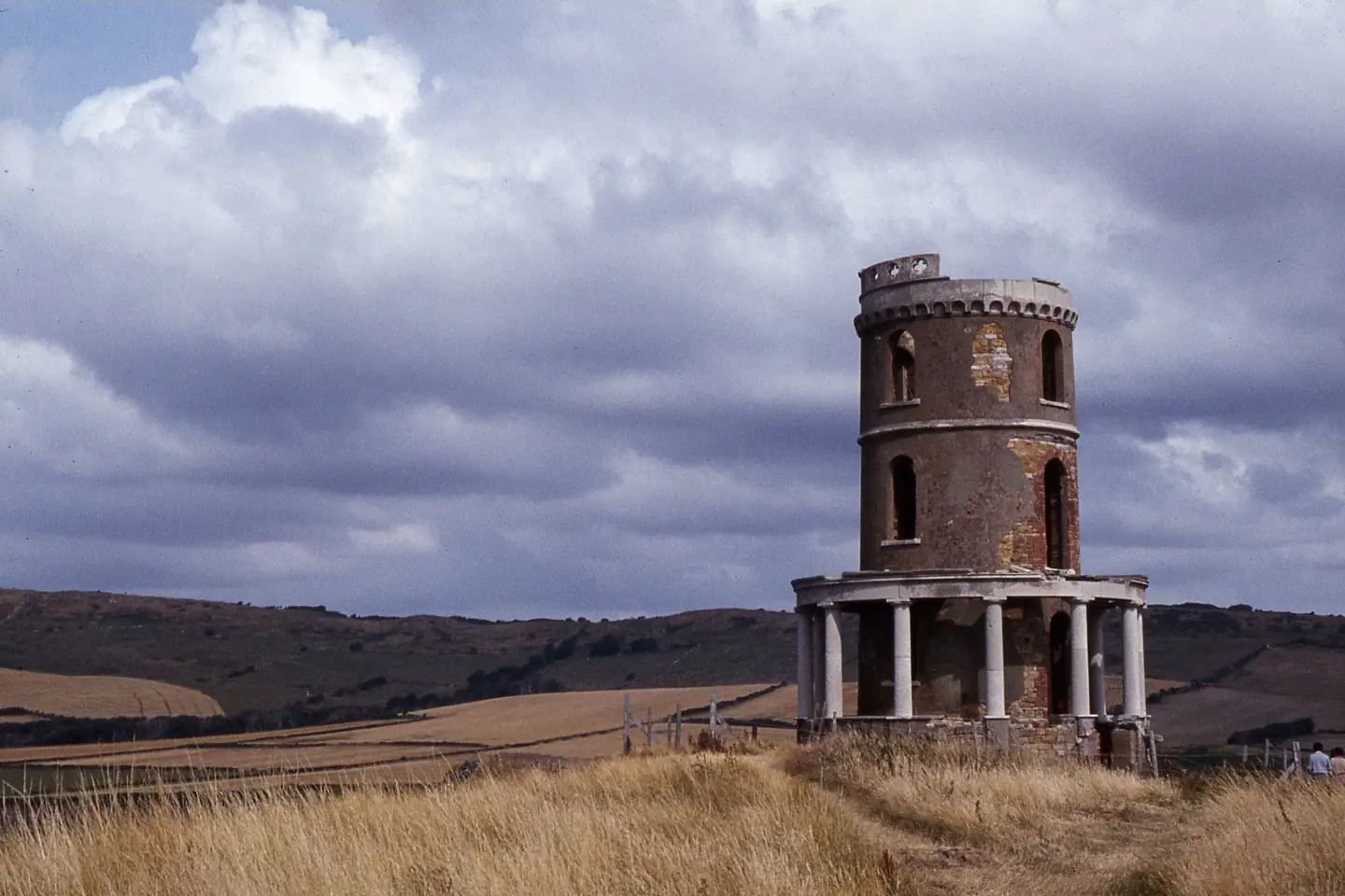
Clavell Tower above Kimmeridge Bay
Clavell Tower above Kimmeridge Bay. This photograph is used as a geographic witness to the place, not as evidence of the historical date shown in the chapter.
- Visual description
- Clavell Tower above Kimmeridge Bay
- Nature
- original
- Medium
- Open-licence photograph
- Source
- Wikimedia Commons / Geograph · CC BY-SA 2.0
- Reviewed
- Josh Wildman
157–152 MILLION YEARS AGO
Kimmeridge Bay
A Jurassic type locality, oil coast and rare Dorset reef break.
Scroll to follow the shoreline through time
Kimmeridge Bay exposes dark, organic-rich mudstone so distinctive that it names the Kimmeridgian stage of the Jurassic.
Flat rock ledges extend from the shore and later became the foundation of its reef waves.
Sources for this chapter
THE WORKED GEOLOGY
Stone, shale and oil
People quarried and experimented with the bituminous shale, while the formation became recognised as a source rock for North Sea oil.
The bay’s industrial history begins in the same geology surfers now wait over.
Sources for this chapter
THE TOLL ROAD
A private road limits the approach
Vehicle access reaches the bay by a privately maintained toll road.
That constrained approach has kept the shore less urbanised than nearby resort beaches.
Sources for this chapter
Open ledger · AOD.UK.KIMMERIDGE.V01 · ORIGINALClose ledger · AOD.UK.KIMMERIDGE.V01
Ledger AOD.UK.KIMMERIDGE.V01
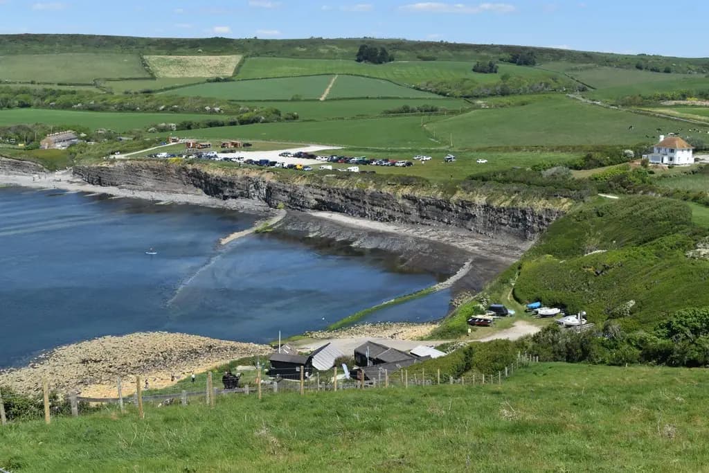
Eastern end of Kimmeridge Bay
Eastern end of Kimmeridge Bay. This photograph is used as a geographic witness to the place, not as evidence of the historical date shown in the chapter.
- Visual description
- Eastern end of Kimmeridge Bay
- Nature
- original
- Medium
- Open-licence photograph
- Source
- Wikimedia Commons / Geograph · CC BY-SA 2.0
- Reviewed
- Josh Wildman
THE SURF YEARS
Broadbench needs a rare alignment
Kimmeridge’s Broadbench reef became Dorset’s reference high-performance wave.
The bay is partly sheltered from Atlantic swell, so the ledge only works at scale when direction, period, wind and tide align.
Sources for this chapter
THE LIVING MAP
The mapped place
Kimmeridge Bay is recorded at 50.605° N, 2.127° W. A surf map fixes a name to one stretch of moving water, but the place changes with tide, swell direction, wind and the shape of the seabed.
Sources for this chapter
Open ledger · AOD.UK.KIMMERIDGE.V00 · ORIGINALClose ledger · AOD.UK.KIMMERIDGE.V00
Ledger AOD.UK.KIMMERIDGE.V00
Clavell Tower above Kimmeridge Bay
Clavell Tower above Kimmeridge Bay. This photograph is used as a geographic witness to the place, not as evidence of the historical date shown in the chapter.
- Visual description
- Clavell Tower above Kimmeridge Bay
- Nature
- original
- Medium
- Open-licence photograph
- Source
- Wikimedia Commons / Geograph · CC BY-SA 2.0
- Reviewed
- Josh Wildman
TODAY
A surf break inside a geological reserve
Kimmeridge supports surfing, diving, snorkelling and marine conservation within the Jurassic Coast.
Its scarcity is part of the experience: the bay rewards waiting and close attention rather than reliable consumption.
Sources for this chapter
THE LEDGER
Sources and credits
This exhibition is built from local, institutional and sporting records. The source ledger keeps the claims visible and leaves space for correction as further local evidence emerges.
Sources for this chapter
Artefacts in order of appearance
Clavell Tower above Kimmeridge Bay
AOD.UK.KIMMERIDGE.V00 · original · Wikimedia Commons / Geograph · CC BY-SA 2.0
Eastern end of Kimmeridge Bay
AOD.UK.KIMMERIDGE.V01 · original · Wikimedia Commons / Geograph · CC BY-SA 2.0
Editorial record
Full UK edition. Historical claims are linked to the local, public and sporting records used to write the exhibition. Cartography is generated from the PeakWave location catalogue.