Open ledger · AOD.US.HONOLUA-BAY.V00 · ORIGINALClose ledger · AOD.US.HONOLUA-BAY.V00
Ledger AOD.US.HONOLUA-BAY.V00
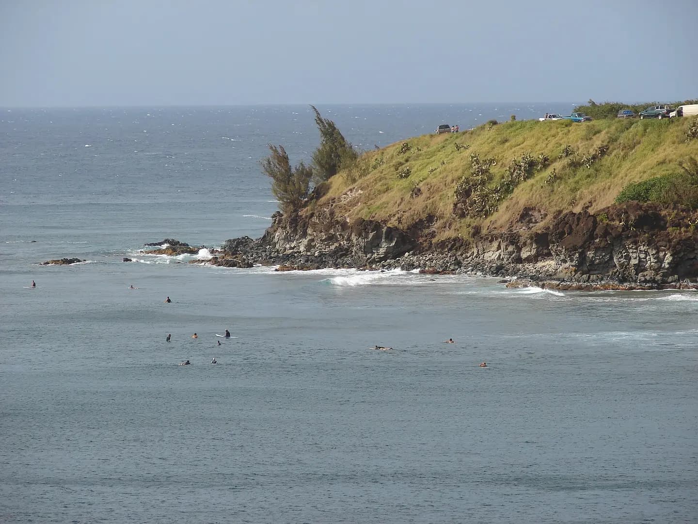
Starr-080314-3418-Casuarina equisetifolia-habit and surfers-Honolua Bay-Maui
Casuarina equisetifolia (Ironwood) Habit and surfers at Honolua Bay, Maui, Hawaii. March 14, 2008 [ http://www.starrenvironmental.com/images/search/?q=080314-3418 #080314-3418</a> Image Use Policy. This photograph is used as a geographic witness to the place, not as evidence of the historical date shown in the chapter.
- Visual description
- Casuarina equisetifolia (Ironwood) Habit and surfers at Honolua Bay, Maui, Hawaii. March 14, 2008 [ http://www.starrenvironmental.com/images/search/?q=080314-3418 #080314-3418</a> Image Use Policy
- Nature
- original
- Medium
- Open-licence photograph
- Source
- Wikimedia Commons · CC BY 3.0 us
BEFORE MODERN SPORT
Honolua Bay
How work, access and surfing shaped Honolua Bay.
Scroll to follow the shoreline through time
Honolua Bay, Mokuleʻia Bay and Lipoa Point are part of an area known as the ahupuaʻa of Honolua, located just north of Kapalua, West Maui in Maui County, Hawaiʻi, United States.
Sources for this chapter
BEFORE TOURISM
Work at the water’s edge
Honolua belongs to an ahupuaʻa, a traditional Hawaiian land division linking upland resources with the bay and reef below.
Sources for this chapter
ACCESS CHANGES
The shore becomes reachable
The coastline at Honolua and Mokuleʻia is rugged and is accessed by trail from a parking lot adjacent to the Honoapiilani Highway above.
Open ledger · AOD.US.HONOLUA-BAY.V01 · ORIGINALClose ledger · AOD.US.HONOLUA-BAY.V01
Ledger AOD.US.HONOLUA-BAY.V01
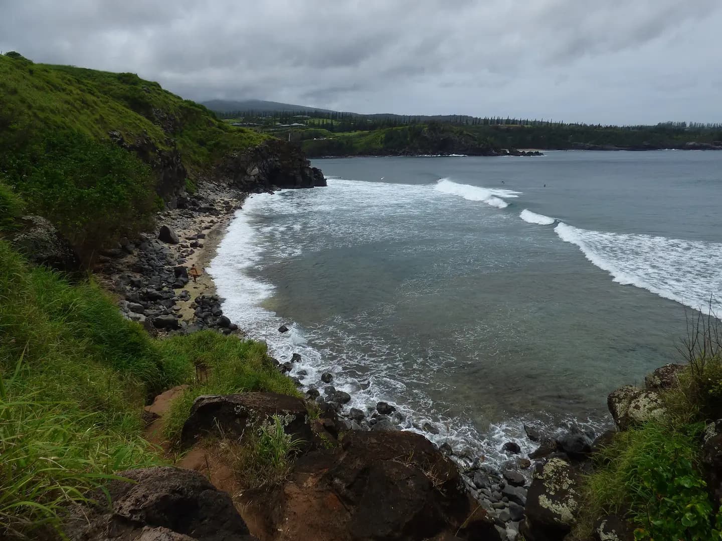
Starr-180421-0016-Megathyrsus maximus-view bay and surf-Honolua Lipoa Point-Maui
Megathyrsus maximus (Guinea grass) View bay and surf at Honolua Lipoa Point, Maui, Hawaii. April 21, 2018 #180421-0016 Image Use Policy Also known as Panicum maximum and Urochloa maxima. This photograph is used as a geographic witness to the place, not as evidence of the historical date shown in the chapter.
- Visual description
- Megathyrsus maximus (Guinea grass) View bay and surf at Honolua Lipoa Point, Maui, Hawaii. April 21, 2018 #180421-0016 Image Use Policy Also known as Panicum maximum and Urochloa maxima
- Nature
- original
- Medium
- Open-licence photograph
- Source
- Wikimedia Commons · CC BY 3.0 us
ORGANISED SPORT
Surfing reads the same coast differently
Honolua Bay consists of a rocky shoreline with small beach, coral reefs in a marine preserve and world-renowned surf break.
THE LIVING MAP
The mapped place
Honolua Bay is recorded at 21.013° N, 156.638° W. A surf map fixes a name to one stretch of moving water, but the place changes with tide, swell direction, wind and the shape of the seabed.
Sources for this chapter
Open ledger · AOD.US.HONOLUA-BAY.V00 · ORIGINALClose ledger · AOD.US.HONOLUA-BAY.V00
Ledger AOD.US.HONOLUA-BAY.V00
Starr-080314-3418-Casuarina equisetifolia-habit and surfers-Honolua Bay-Maui
Casuarina equisetifolia (Ironwood) Habit and surfers at Honolua Bay, Maui, Hawaii. March 14, 2008 [ http://www.starrenvironmental.com/images/search/?q=080314-3418 #080314-3418</a> Image Use Policy. This photograph is used as a geographic witness to the place, not as evidence of the historical date shown in the chapter.
- Visual description
- Casuarina equisetifolia (Ironwood) Habit and surfers at Honolua Bay, Maui, Hawaii. March 14, 2008 [ http://www.starrenvironmental.com/images/search/?q=080314-3418 #080314-3418</a> Image Use Policy
- Nature
- original
- Medium
- Open-licence photograph
- Source
- Wikimedia Commons · CC BY 3.0 us
TODAY
Honolua Bay now
Honolua Bay remains both a marine conservation area and a surf break, so recreation shares the water with the protection of coral and coastal habitat.
THE LEDGER
Sources and credits
This exhibition is built from local, institutional and sporting records. The source ledger keeps the claims visible and leaves space for correction as further local evidence emerges.
Sources for this chapter
Artefacts in order of appearance
Starr-080314-3418-Casuarina equisetifolia-habit and surfers-Honolua Bay-Maui
AOD.US.HONOLUA-BAY.V00 · original · Wikimedia Commons · CC BY 3.0 us
Starr-180421-0016-Megathyrsus maximus-view bay and surf-Honolua Lipoa Point-Maui
AOD.US.HONOLUA-BAY.V01 · original · Wikimedia Commons · CC BY 3.0 us
Editorial record
Full US Beta edition. Place evidence is adapted from the linked Honolua, Hawaii overview under CC BY-SA 4.0 and remains subject to named historical and local review. Cartography is generated from the PeakWave location catalogue.