Open ledger · AOD.UK.HARLYN-BAY.V00 · ORIGINALClose ledger · AOD.UK.HARLYN-BAY.V00
Ledger AOD.UK.HARLYN-BAY.V00
Harlyn Bay (12140801414)
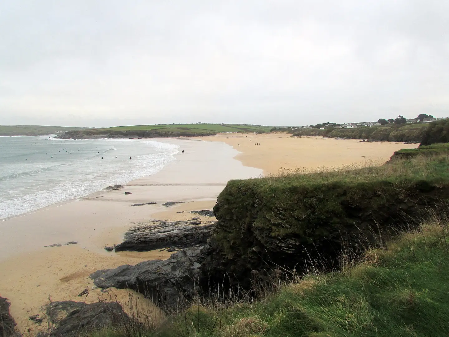
Harlyn Bay. This photograph is used as a geographic witness to the place, not as evidence of the historical date shown in the chapter.
- Visual description
- Harlyn Bay
- Nature
- original
- Medium
- Open-licence photograph
- Source
- Wikimedia Commons · CC BY 2.0
- Reviewed
- Josh Wildman
THE SHELTERED ARC
Harlyn Bay
A sheltered bay where prehistoric burial ground and modern surf school occupy the same coast.
Scroll to follow the shoreline through time
Harlyn’s crescent and headlands shelter it from some of the Atlantic exposure felt on the west-facing beaches nearby.
That difference later made the bay useful for learning when other breaks were too large.
Sources for this chapter
PREHISTORIC HARLYN
People buried their dead above the shore
A rare prehistoric inhumation cemetery survives at Harlyn.
Its graves establish that this beach landscape held social and ceremonial meaning long before its modern recreational identity.
Sources for this chapter
DISCOVERY AND PROTECTION
Archaeology re-entered the record
Development and erosion partly exposed the cemetery, turning ground beside the beach into protected evidence.
Modern access therefore crosses a landscape whose oldest history is still physically present.
Sources for this chapter
Open ledger · AOD.UK.HARLYN-BAY.V01 · ORIGINALClose ledger · AOD.UK.HARLYN-BAY.V01
Ledger AOD.UK.HARLYN-BAY.V01
Harlyn Bay (12140395575)
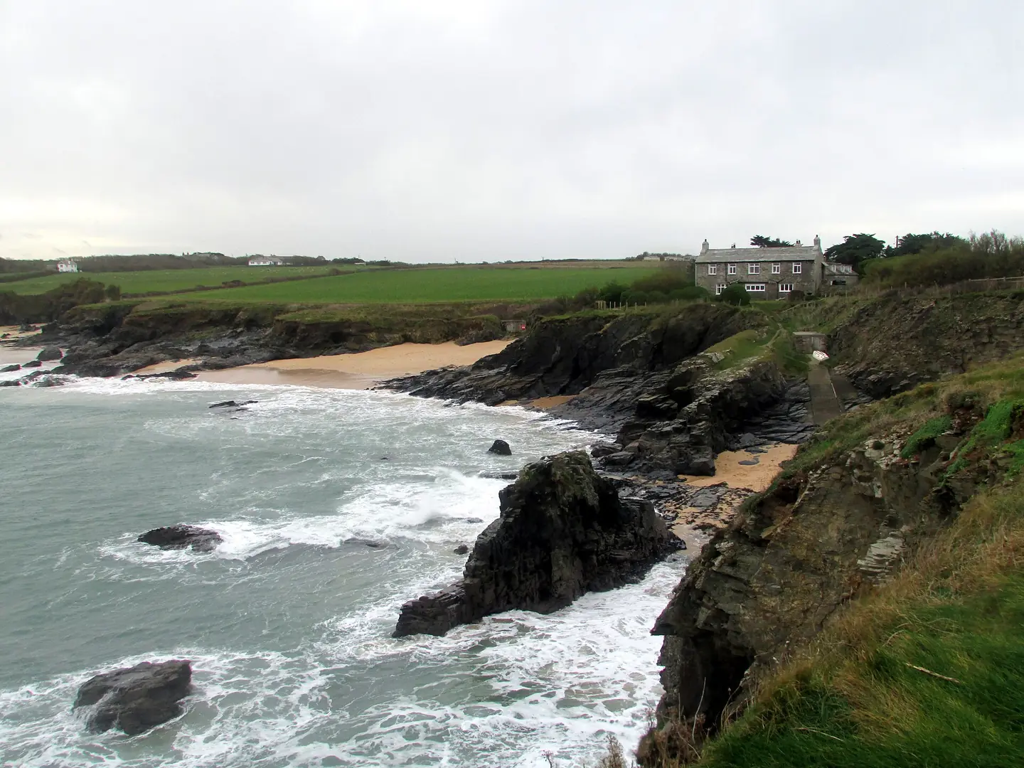
Harlyn Bay. This photograph is used as a geographic witness to the place, not as evidence of the historical date shown in the chapter.
- Visual description
- Harlyn Bay
- Nature
- original
- Medium
- Open-licence photograph
- Source
- Wikimedia Commons · CC BY 2.0
- Reviewed
- Josh Wildman
MORE THAN 30 YEARS
Shelter created a teaching beach
Harlyn developed a long-running surf school and later added coasteering, paddling and instructor training.
Its sporting role is not based on the largest wave, but on offering workable water when more exposed beaches become difficult.
Sources for this chapter
THE LIVING MAP
The mapped place
Harlyn Bay is recorded at 50.553° N, 5.001° W. A surf map fixes a name to one stretch of moving water, but the place changes with tide, swell direction, wind and the shape of the seabed.
Sources for this chapter
Open ledger · AOD.UK.HARLYN-BAY.V00 · ORIGINALClose ledger · AOD.UK.HARLYN-BAY.V00
Ledger AOD.UK.HARLYN-BAY.V00
Harlyn Bay (12140801414)
Harlyn Bay. This photograph is used as a geographic witness to the place, not as evidence of the historical date shown in the chapter.
- Visual description
- Harlyn Bay
- Nature
- original
- Medium
- Open-licence photograph
- Source
- Wikimedia Commons · CC BY 2.0
- Reviewed
- Josh Wildman
TODAY
A family beach with a deeper record
Harlyn is now used for surfing, paddling and beach days while the scheduled cemetery protects an unusually direct connection to prehistoric coastal life.
Both stories depend on the same sheltered ground.
Sources for this chapter
THE LEDGER
Sources and credits
This exhibition is built from local, institutional and sporting records. The source ledger keeps the claims visible and leaves space for correction as further local evidence emerges.
Sources for this chapter
Artefacts in order of appearance
Harlyn Bay (12140801414)
AOD.UK.HARLYN-BAY.V00 · original · Wikimedia Commons · CC BY 2.0
Harlyn Bay (12140395575)
AOD.UK.HARLYN-BAY.V01 · original · Wikimedia Commons · CC BY 2.0
Editorial record
Full UK edition. Historical claims are linked to the local, public and sporting records used to write the exhibition. Cartography is generated from the PeakWave location catalogue.