Open ledger · AOD.UK.HAMBLE-RIVER.V00 · ORIGINALClose ledger · AOD.UK.HAMBLE-RIVER.V00
Ledger AOD.UK.HAMBLE-RIVER.V00
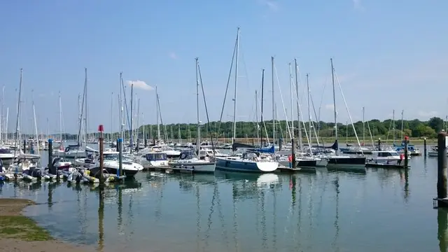
Hamble yachts
Hamble yachts. This photograph is used as a geographic witness to the place, not as evidence of the historical date shown in the chapter.
- Visual description
- Hamble yachts
- Nature
- original
- Medium
- Open-licence photograph
- Source
- Wikimedia Commons / Geograph · CC BY-SA 2.0
- Reviewed
- Josh Wildman
THE RIVER
Hamble River
Boatbuilding, one-design racing and marinas on a short river with an outsized sailing history.
Scroll to read the water through time
The Hamble offers protected berthing within reach of the Solent.
That combination made a short tidal river valuable to working boatbuilders and, later, to sailors seeking sheltered bases for open-water racing.
Sources for this chapter
1827
Boats are built here
The Moody family began boatbuilding on the river in 1827.
The yard linked Hamble’s sporting future to skilled work ashore: boats, maintenance and employment developed together.
Sources for this chapter
1880–1919
Regattas and a local one-design
Regattas were held by the 1880s, a Hamble one-design appeared in 1913 and Hamble River Sailing Club formed in 1919.
The river acquired institutions built around recurring local competition.
Sources for this chapter
Open ledger · AOD.UK.HAMBLE-RIVER.V01 · ORIGINALClose ledger · AOD.UK.HAMBLE-RIVER.V01
Ledger AOD.UK.HAMBLE-RIVER.V01
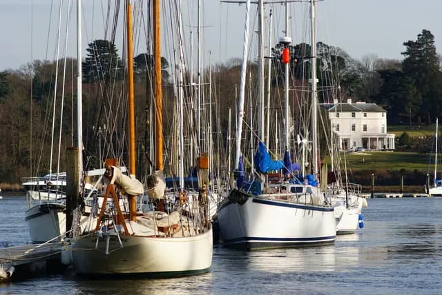
Yachts on the Hamble, Bursledon
Yachts on the Hamble, Bursledon. This photograph is used as a geographic witness to the place, not as evidence of the historical date shown in the chapter.
- Visual description
- Yachts on the Hamble, Bursledon
- Nature
- original
- Medium
- Open-licence photograph
- Source
- Wikimedia Commons / Geograph · CC BY-SA 2.0
- Reviewed
- Josh Wildman
1939–1970
The river fills with clubs and marinas
The Royal Southern arrived in 1939, other clubs followed after the war, fibreglass yacht building began at Moody in 1965 and marinas spread from the early 1960s.
In 1970 a harbour authority was established to manage the growing traffic.
Sources for this chapter
THE LIVING MAP
The mapped place
Hamble River is recorded at 50.870° N, 1.310° W as an estuary venue. A course drawn here is temporary: wind, current, shore and marks determine the water that sailors actually meet.
Sources for this chapter
Open ledger · AOD.UK.HAMBLE-RIVER.V00 · ORIGINALClose ledger · AOD.UK.HAMBLE-RIVER.V00
Ledger AOD.UK.HAMBLE-RIVER.V00
Hamble yachts
Hamble yachts. This photograph is used as a geographic witness to the place, not as evidence of the historical date shown in the chapter.
- Visual description
- Hamble yachts
- Nature
- original
- Medium
- Open-licence photograph
- Source
- Wikimedia Commons / Geograph · CC BY-SA 2.0
- Reviewed
- Josh Wildman
TODAY
A complete sailing economy
The Hamble is now a dense network of clubs, yards, marinas, training and racing.
It is not simply a place to keep a yacht: the river shows how an entire local economy can organise itself around sailing.
Sources for this chapter
THE LEDGER
Sources and credits
This exhibition is built from local, institutional and sporting records. The source ledger keeps the claims visible and leaves space for correction as further local evidence emerges.
Sources for this chapter
Artefacts in order of appearance
Hamble yachts
AOD.UK.HAMBLE-RIVER.V00 · original · Wikimedia Commons / Geograph · CC BY-SA 2.0
Yachts on the Hamble, Bursledon
AOD.UK.HAMBLE-RIVER.V01 · original · Wikimedia Commons / Geograph · CC BY-SA 2.0
Editorial record
Full UK edition. Historical claims are linked to the local, public and sporting records used to write the exhibition. Cartography is generated from the PeakWave location catalogue.