
Open ledger · AOD.EU.GRANDVALIRA.V00 · ORIGINALClose ledger · AOD.EU.GRANDVALIRA.V00
Ledger AOD.EU.GRANDVALIRA.V00
Sky shot on the mountains in Andorra 2006
Sky shot on the mountains in Andorra, 2006. Muflo black slope, in El Tarter, Grandvalira, Andorra. This photograph is used as a geographic witness to the place, not as evidence of the historical date shown in the chapter.
- Visual description
- Sky shot on the mountains in Andorra, 2006. Muflo black slope, in El Tarter, Grandvalira, Andorra
- Nature
- original
- Medium
- Open-licence photograph
- Source
- Wikimedia Commons · CC BY-SA 2.0
BEFORE MODERN SPORT
Grandvalira
How settlement, access and winter sport shaped Grandvalira.
Scroll to read the contour through time
Andorra, officially the Principality of Andorra, is a landlocked country on the Iberian Peninsula, in the eastern Pyrenees in southwestern Europe, bordered by France to the north and Spain to the south.
Sources for this chapter
1419
Work and settlement beneath the snowline
After being ratified by Bishop Francesc Tovia and Count John I, the Consell de la Terra or Consell General de les Valls (General Council of the Valleys) was founded in 1419, the second oldest parliament in Europe.
Sources for this chapter
2014
A route reaches Grandvalira
Under a cooperation agreement first concluded in 2014, the Andorran and Catalan governments coordinate the airport's management, operation and promotion through a joint commission.
Sources for this chapter
Open ledger · AOD.EU.GRANDVALIRA.V01 · ORIGINALClose ledger · AOD.EU.GRANDVALIRA.V01
Ledger AOD.EU.GRANDVALIRA.V01
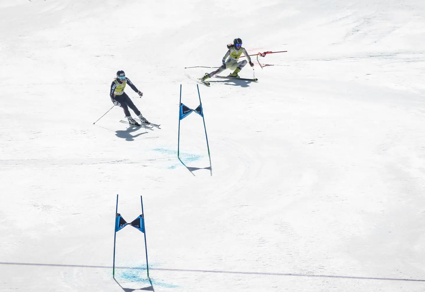
WC Team TP Grandvalira 2023
FIS Alpine Skiing World Cup on the Aliga slope in El Tarter, Grandvalira, 17 March 2023 – Mixed Team Parallel Maria Therese Tviberg (NOR) on the left and Carla Mijares Ruf (AND) on the right – Quarterfinal. This photograph is used as a geographic witness to the place, not as evidence of the historical date shown in the chapter.
- Visual description
- FIS Alpine Skiing World Cup on the Aliga slope in El Tarter, Grandvalira, 17 March 2023 – Mixed Team Parallel Maria Therese Tviberg (NOR) on the left and Carla Mijares Ruf (AND) on the right – Quarterfinal
- Nature
- original
- Medium
- Open-licence photograph
- Source
- Wikimedia Commons · CC BY-SA 4.0
ORGANISED SPORT
Winter becomes organised
Shortly after, activities such as skiing and shopping helped the country become a tourist attraction, with the inauguration of ski resorts and cultural entities in the late 1930s.
Sources for this chapter
THE LIVING MAP
The mapped place
Grandvalira is recorded at 42.555° N, 1.707° E. Its catalogue reference reaches 2,640 metres. A modern resort map compresses terrain, exposure and access into a diagram. This exhibition keeps the underlying contour visible so the place does not become only a list of facilities.
Sources for this chapter
Open ledger · AOD.EU.GRANDVALIRA.V00 · ORIGINALClose ledger · AOD.EU.GRANDVALIRA.V00
Ledger AOD.EU.GRANDVALIRA.V00
Sky shot on the mountains in Andorra 2006
Sky shot on the mountains in Andorra, 2006. Muflo black slope, in El Tarter, Grandvalira, Andorra. This photograph is used as a geographic witness to the place, not as evidence of the historical date shown in the chapter.
- Visual description
- Sky shot on the mountains in Andorra, 2006. Muflo black slope, in El Tarter, Grandvalira, Andorra
- Nature
- original
- Medium
- Open-licence photograph
- Source
- Wikimedia Commons · CC BY-SA 2.0
TODAY
Grandvalira now
Andorra has the largest territory of ski slopes in the Pyrenees (3100 hectares and about 350 km of slopes) and two ski resorts.
Sources for this chapter
THE LEDGER
Sources and credits
This exhibition is built from local, institutional and sporting records. The source ledger keeps the claims visible and leaves space for correction as further local evidence emerges.
Sources for this chapter
Artefacts in order of appearance
Sky shot on the mountains in Andorra 2006
AOD.EU.GRANDVALIRA.V00 · original · Wikimedia Commons · CC BY-SA 2.0
WC Team TP Grandvalira 2023
AOD.EU.GRANDVALIRA.V01 · original · Wikimedia Commons · CC BY-SA 4.0
Editorial record
Full European Beta edition. Place evidence is adapted from the linked Andorra overview under CC BY-SA 4.0 and remains subject to named historical and local review. Cartography is generated from the PeakWave location catalogue.