
Open ledger · AOD.EU.GRAN-CANARIA-CONFITAL.V00 · ORIGINALClose ledger · AOD.EU.GRAN-CANARIA-CONFITAL.V00
Ledger AOD.EU.GRAN-CANARIA-CONFITAL.V00
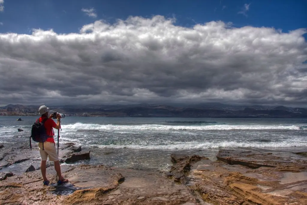
Las palmas gran canaria el confital puesta de sol
Sun putting in El Confital, Las Palmas de Gran Canaria. Canary Islands. This photograph is used as a geographic witness to the place, not as evidence of the historical date shown in the chapter.
- Visual description
- Sun putting in El Confital, Las Palmas de Gran Canaria. Canary Islands
- Nature
- original
- Medium
- Open-licence photograph
- Source
- Wikimedia Commons · CC BY 2.0
BEFORE MODERN SPORT
Gran Canaria/El Confital
How work, access and surfing shaped Gran Canaria/El Confital.
Scroll to follow the shoreline through time
Gran Canaria , also Grand Canary Island, is the third-largest and second-most-populous island of the Canary Islands, a Spanish archipelago off the Atlantic coast of Northwest Africa.
Sources for this chapter
1478
Work at the water’s edge
The capital city of Las Palmas de Gran Canaria was founded on 24 June 1478, under the name "Real de Las Palmas", by Juan Rejón, head of the invading Castilian army.
Sources for this chapter
ACCESS CHANGES
The shore becomes reachable
In the late 20th century, its dual carriageway, among the first in the Canary Islands, were opened and run around Las Palmas de Gran Canaria, and were later extended to the north coast and the airport and subsequently to the south coast in response to increased tourist traffic.
Sources for this chapter
Open ledger · AOD.EU.GRAN-CANARIA-CONFITAL.V01 · ORIGINALClose ledger · AOD.EU.GRAN-CANARIA-CONFITAL.V01
Ledger AOD.EU.GRAN-CANARIA-CONFITAL.V01
10º Islas Canarias Ocean & Earth Pro by Gran Canaria en la playa de El Confital
10º Islas Canarias Ocean & Earth Pro by Gran Canaria en la playa de El Confital. This photograph is used as a geographic witness to the place, not as evidence of the historical date shown in the chapter.
- Visual description
- 10º Islas Canarias Ocean & Earth Pro by Gran Canaria en la playa de El Confital
- Nature
- original
- Medium
- Open-licence photograph
- Source
- Wikimedia Commons · CC BY-SA 2.0
ORGANISED SPORT
Surfing reads the same coast differently
Other important towns are Telde, known among other things for their surf schools in Salinetas, Vecindario (within the municipality of Santa Lucía de Tirajana) and Gáldar, that contains an important diving zone.
Sources for this chapter
THE LIVING MAP
The mapped place
Gran Canaria/El Confital is recorded at 28.163° N, 15.448° W. A surf map fixes a name to one stretch of moving water, but the place changes with tide, swell direction, wind and the shape of the seabed.
Sources for this chapter
Open ledger · AOD.EU.GRAN-CANARIA-CONFITAL.V00 · ORIGINALClose ledger · AOD.EU.GRAN-CANARIA-CONFITAL.V00
Ledger AOD.EU.GRAN-CANARIA-CONFITAL.V00
Las palmas gran canaria el confital puesta de sol
Sun putting in El Confital, Las Palmas de Gran Canaria. Canary Islands. This photograph is used as a geographic witness to the place, not as evidence of the historical date shown in the chapter.
- Visual description
- Sun putting in El Confital, Las Palmas de Gran Canaria. Canary Islands
- Nature
- original
- Medium
- Open-licence photograph
- Source
- Wikimedia Commons · CC BY 2.0
TODAY
Gran Canaria/El Confital now
The district also has some of the best preserved cave dwellings, in the protected area of the Guayadeque ravine, where even the church has been built into the mountainside and visitors can find a number of popular cave restaurants.
Sources for this chapter
THE LEDGER
Sources and credits
This exhibition is built from local, institutional and sporting records. The source ledger keeps the claims visible and leaves space for correction as further local evidence emerges.
Sources for this chapter
Artefacts in order of appearance
Las palmas gran canaria el confital puesta de sol
AOD.EU.GRAN-CANARIA-CONFITAL.V00 · original · Wikimedia Commons · CC BY 2.0
10º Islas Canarias Ocean & Earth Pro by Gran Canaria en la playa de El Confital
AOD.EU.GRAN-CANARIA-CONFITAL.V01 · original · Wikimedia Commons · CC BY-SA 2.0
Editorial record
Full European Beta edition. Place evidence is adapted from the linked Gran Canaria overview under CC BY-SA 4.0 and remains subject to named historical and local review. Cartography is generated from the PeakWave location catalogue.