Open ledger · AOD.UK.GRAFHAM-WATER.V00 · ORIGINALClose ledger · AOD.UK.GRAFHAM-WATER.V00
Ledger AOD.UK.GRAFHAM-WATER.V00
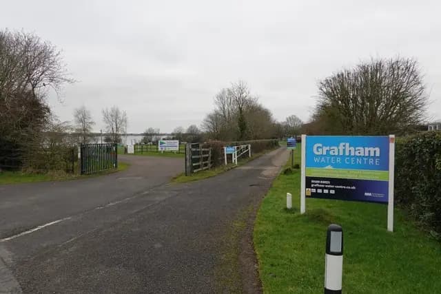
Grafham Water Centre and Sailing Club
Grafham Water Centre and Sailing Club. This photograph is used as a geographic witness to the place, not as evidence of the historical date shown in the chapter.
- Visual description
- Grafham Water Centre and Sailing Club
- Nature
- original
- Medium
- Open-licence photograph
- Source
- Wikimedia Commons / Geograph · CC BY-SA 2.0
- Reviewed
- Josh Wildman
BEFORE IMPOUNDMENT
Grafham Water
How a new reservoir became a major inland sailing and outdoor education centre.
Scroll to read the water through time
Grafham Water was made for public water supply in a rural Cambridgeshire landscape.
Its broad, unobstructed surface later offered something rare inland: room for full racing fleets and long training legs.
Sources for this chapter
A NEW RESERVOIR
The shore is planned for learning
Outdoor education became part of the reservoir’s public role.
The Water Centre developed practical instruction on a lake whose hazards could be managed without pretending they did not exist.
Sources for this chapter
THE 1960s
A club gains open water
Grafham Water Sailing Club formed around the new reservoir, with shoreline, launch space and safety systems designed for a large inland membership.
Sources for this chapter
Open ledger · AOD.UK.GRAFHAM-WATER.V01 · ORIGINALClose ledger · AOD.UK.GRAFHAM-WATER.V01
Ledger AOD.UK.GRAFHAM-WATER.V01
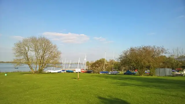
Yachts at Grafham Water Sailing Club
Yachts at Grafham Water Sailing Club. This photograph is used as a geographic witness to the place, not as evidence of the historical date shown in the chapter.
- Visual description
- Yachts at Grafham Water Sailing Club
- Nature
- original
- Medium
- Open-licence photograph
- Source
- Wikimedia Commons / Geograph · CC BY-SA 2.0
- Reviewed
- Josh Wildman
LATE 20th CENTURY
The reservoir becomes a national course
Its size allowed national class meetings and competitive dinghy racing that smaller club lakes could not accommodate.
Marks could be moved to suit the wind, making the course a deliberate design each race day.
Sources for this chapter
THE LIVING MAP
The mapped place
Grafham Water is recorded at 52.290° N, 0.320° W as an inland venue. A course drawn here is temporary: wind, current, shore and marks determine the water that sailors actually meet.
Sources for this chapter
Open ledger · AOD.UK.GRAFHAM-WATER.V00 · ORIGINALClose ledger · AOD.UK.GRAFHAM-WATER.V00
Ledger AOD.UK.GRAFHAM-WATER.V00
Grafham Water Centre and Sailing Club
Grafham Water Centre and Sailing Club. This photograph is used as a geographic witness to the place, not as evidence of the historical date shown in the chapter.
- Visual description
- Grafham Water Centre and Sailing Club
- Nature
- original
- Medium
- Open-licence photograph
- Source
- Wikimedia Commons / Geograph · CC BY-SA 2.0
- Reviewed
- Josh Wildman
TODAY
Training and racing share the water
Grafham now combines club racing, open meetings and outdoor education on an operational reservoir.
The lake’s sporting identity comes from that shared infrastructure rather than a natural maritime past.
Sources for this chapter
THE LEDGER
Sources and credits
This exhibition is built from local, institutional and sporting records. The source ledger keeps the claims visible and leaves space for correction as further local evidence emerges.
Sources for this chapter
Artefacts in order of appearance
Grafham Water Centre and Sailing Club
AOD.UK.GRAFHAM-WATER.V00 · original · Wikimedia Commons / Geograph · CC BY-SA 2.0
Yachts at Grafham Water Sailing Club
AOD.UK.GRAFHAM-WATER.V01 · original · Wikimedia Commons / Geograph · CC BY-SA 2.0
Editorial record
Full UK edition. Historical claims are linked to the local, public and sporting records used to write the exhibition. Cartography is generated from the PeakWave location catalogue.