
Open ledger · AOD.EU.FUERTEVENTURA-COTILLO.V00 · ORIGINALClose ledger · AOD.EU.FUERTEVENTURA-COTILLO.V00
Ledger AOD.EU.FUERTEVENTURA-COTILLO.V00
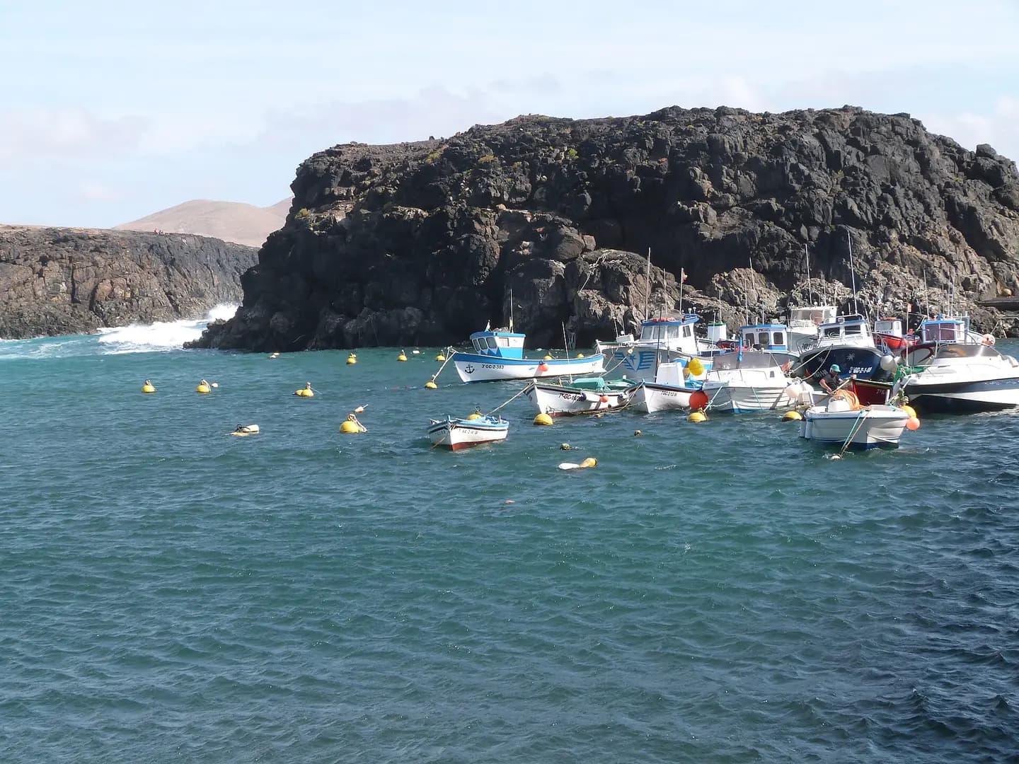
Western coast of Fuerteventura near Punta Mallorquin with El Cotillo in the distance - panoramio
Western coast of Fuerteventura near Punta Mallorquin with El Cotillo in the distance. This photograph is used as a geographic witness to the place, not as evidence of the historical date shown in the chapter.
- Visual description
- Western coast of Fuerteventura near Punta Mallorquin with El Cotillo in the distance
- Nature
- original
- Medium
- Open-licence photograph
- Source
- Wikimedia Commons · CC BY 3.0
BEFORE MODERN SPORT
Fuerteventura/Cotillo
How work, access and surfing shaped Fuerteventura/Cotillo.
Scroll to follow the shoreline through time
Fuerteventura is one of the Canary Islands, in the Atlantic Ocean, geographically part of Macaronesia, and politically part of Spain.
Sources for this chapter
1404
Work at the water’s edge
In 1404, de Bethencourt and de Gadifer founded Betancuria, on the west coast, the first settlement on the island.
Sources for this chapter
1941
The shore becomes reachable
In 1941, began work on a military airfield, just west of Puerto del Rosario on the road to Tindaya, which opened to commercial use in 1950.
Sources for this chapter
Open ledger · AOD.EU.FUERTEVENTURA-COTILLO.V01 · ORIGINALClose ledger · AOD.EU.FUERTEVENTURA-COTILLO.V01
Ledger AOD.EU.FUERTEVENTURA-COTILLO.V01
Port d'El Cotillo
Bateaux de pêche à l'abri, dans le port d'El Cotillo. El Cotillo est un haut lieu du surf. This photograph is used as a geographic witness to the place, not as evidence of the historical date shown in the chapter.
- Visual description
- Bateaux de pêche à l'abri, dans le port d'El Cotillo. El Cotillo est un haut lieu du surf
- Nature
- original
- Medium
- Open-licence photograph
- Source
- Wikimedia Commons · CC BY-SA 3.0
ORGANISED SPORT
Surfing reads the same coast differently
Windsurfing is common around Corralejo and Playas de Sotavento and wave sailing (windsurfing on the waves) on the coast along the northern half of the island.
Sources for this chapter
THE LIVING MAP
The mapped place
Fuerteventura/Cotillo is recorded at 28.713° N, 14.015° W. A surf map fixes a name to one stretch of moving water, but the place changes with tide, swell direction, wind and the shape of the seabed.
Sources for this chapter
Open ledger · AOD.EU.FUERTEVENTURA-COTILLO.V00 · ORIGINALClose ledger · AOD.EU.FUERTEVENTURA-COTILLO.V00
Ledger AOD.EU.FUERTEVENTURA-COTILLO.V00
Western coast of Fuerteventura near Punta Mallorquin with El Cotillo in the distance - panoramio
Western coast of Fuerteventura near Punta Mallorquin with El Cotillo in the distance. This photograph is used as a geographic witness to the place, not as evidence of the historical date shown in the chapter.
- Visual description
- Western coast of Fuerteventura near Punta Mallorquin with El Cotillo in the distance
- Nature
- original
- Medium
- Open-licence photograph
- Source
- Wikimedia Commons · CC BY 3.0
TODAY
Fuerteventura/Cotillo now
The summer Trade Winds and winter swells of the Atlantic make this a year-round surfers' paradise, with more exposed areas on the north and west shores such as Corralejo and El Cotillo proving most popular.
Sources for this chapter
THE LEDGER
Sources and credits
This exhibition is built from local, institutional and sporting records. The source ledger keeps the claims visible and leaves space for correction as further local evidence emerges.
Sources for this chapter
Artefacts in order of appearance
Western coast of Fuerteventura near Punta Mallorquin with El Cotillo in the distance - panoramio
AOD.EU.FUERTEVENTURA-COTILLO.V00 · original · Wikimedia Commons · CC BY 3.0
Port d'El Cotillo
AOD.EU.FUERTEVENTURA-COTILLO.V01 · original · Wikimedia Commons · CC BY-SA 3.0
Editorial record
Full European Beta edition. Place evidence is adapted from the linked Fuerteventura overview under CC BY-SA 4.0 and remains subject to named historical and local review. Cartography is generated from the PeakWave location catalogue.