
Open ledger · AOD.EU.FORNELLS-BAY.V00 · ORIGINALClose ledger · AOD.EU.FORNELLS-BAY.V00
Ledger AOD.EU.FORNELLS-BAY.V00
Cala-d'Aiguablava-Begur 20180717 114120
Boats moored in the marina at Fornells, Begur, Catalonia, Spain. The bay of Aiguablava is beyond, with the anchored boats. This photograph is used as a geographic witness to the place, not as evidence of the historical date shown in the chapter.
- Visual description
- Boats moored in the marina at Fornells, Begur, Catalonia, Spain. The bay of Aiguablava is beyond, with the anchored boats
- Nature
- original
- Medium
- Open-licence photograph
- Source
- Wikimedia Commons · CC BY-SA 4.0
BEFORE MODERN SPORT
Fornells Bay
How working water, access and organised sailing shaped Fornells Bay.
Scroll to read the water through time
Fornells is a village located in a bay in the north of the Balearic island of Menorca, Spain.
Sources for this chapter
BEFORE TOURISM
A working shore
The village was founded to serve a small defensive watch tower, built at the beginning of the 17th century as a defence against the Barbary pirates for whom Fornells Bay provided the perfect safe haven.
Sources for this chapter
ACCESS CHANGES
The route to the water
The surviving overview does not identify one decisive access date for Fornells Bay.
This edition therefore leaves that date open rather than turning gradual change into a false single event.
Sources for this chapter
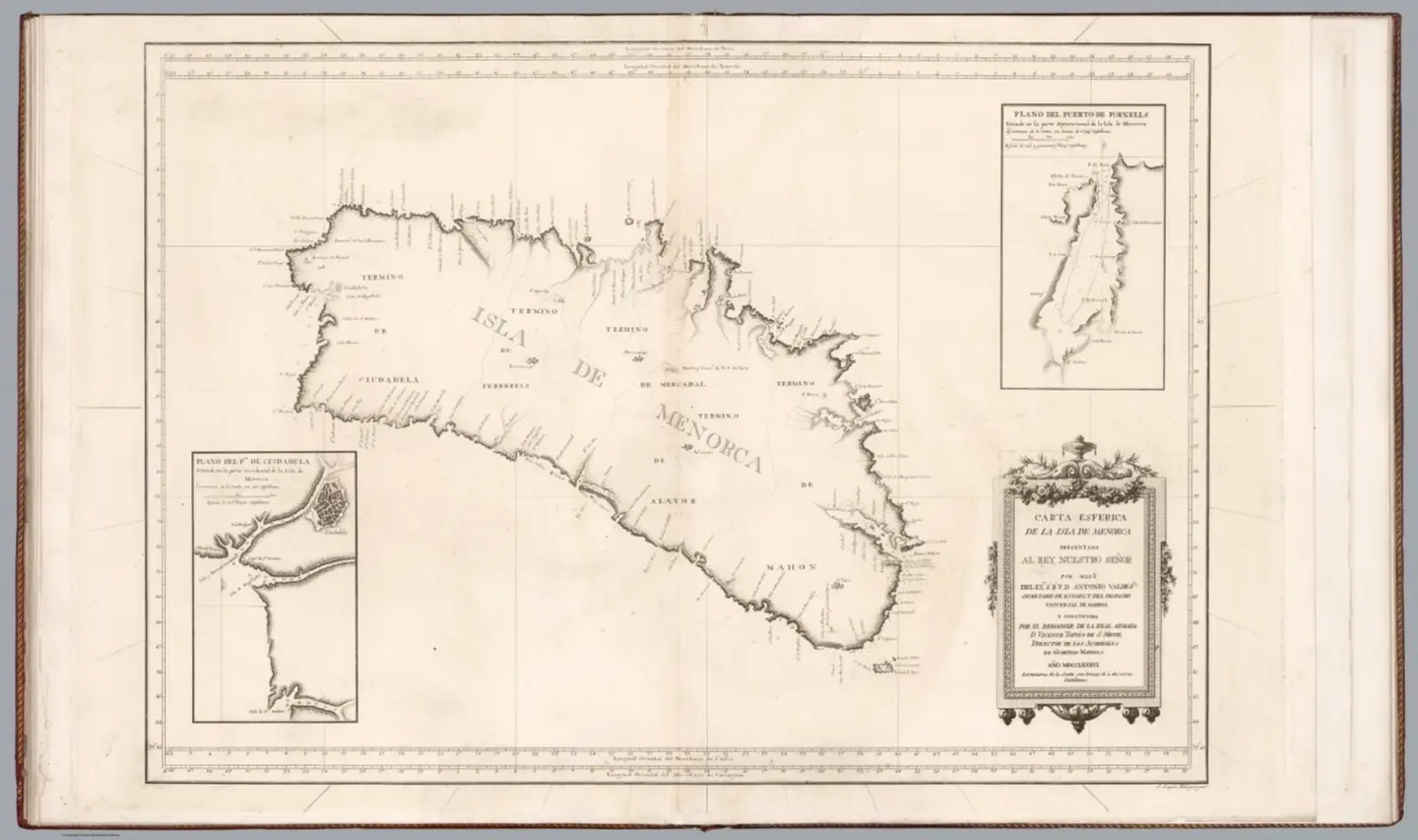
Open ledger · AOD.EU.FORNELLS-BAY.V01 · ORIGINALClose ledger · AOD.EU.FORNELLS-BAY.V01
Ledger AOD.EU.FORNELLS-BAY.V01
Carta esferica de la Isla de Menorca ... Y Construida por el Brigadier de la Rl. Armada D. Vicente Tofino de S. Miguel. Ano
Carta esferica de la Isla de Menorca ... Y Construida por el Brigadier de la Rl. Armada D. Vicente Tofino de S. Miguel. Ano. This photograph is used as a geographic witness to the place, not as evidence of the historical date shown in the chapter.
- Visual description
- Carta esferica de la Isla de Menorca ... Y Construida por el Brigadier de la Rl. Armada D. Vicente Tofino de S. Miguel. Ano
- Nature
- original
- Medium
- Open-licence photograph
- Source
- Wikimedia Commons · Public domain
ORGANISED SPORT
Sailing becomes organised
Fornells Bay is part of PeakWave's sailing catalogue.
The local record used here does not support a single founding date for the sport, so the exhibition treats its sporting identity as an accumulation of use, access and organisation.
Sources for this chapter
THE LIVING MAP
The mapped place
Fornells Bay is recorded at 40.050° N, 4.130° E as a coastal open venue. A course drawn here is temporary: wind, current, shore and marks determine the water that sailors actually meet.
Sources for this chapter
Open ledger · AOD.EU.FORNELLS-BAY.V00 · ORIGINALClose ledger · AOD.EU.FORNELLS-BAY.V00
Ledger AOD.EU.FORNELLS-BAY.V00
Cala-d'Aiguablava-Begur 20180717 114120
Boats moored in the marina at Fornells, Begur, Catalonia, Spain. The bay of Aiguablava is beyond, with the anchored boats. This photograph is used as a geographic witness to the place, not as evidence of the historical date shown in the chapter.
- Visual description
- Boats moored in the marina at Fornells, Begur, Catalonia, Spain. The bay of Aiguablava is beyond, with the anchored boats
- Nature
- original
- Medium
- Open-licence photograph
- Source
- Wikimedia Commons · CC BY-SA 4.0
TODAY
Fornells Bay now
During construction, a small village was formed around the castle, occupied by construction workers and soldiers, this village becoming the basis of modern-day Fornells.
Sources for this chapter
THE LEDGER
Sources and credits
This exhibition is built from local, institutional and sporting records. The source ledger keeps the claims visible and leaves space for correction as further local evidence emerges.
Sources for this chapter
Artefacts in order of appearance
Cala-d'Aiguablava-Begur 20180717 114120
AOD.EU.FORNELLS-BAY.V00 · original · Wikimedia Commons · CC BY-SA 4.0
Carta esferica de la Isla de Menorca ... Y Construida por el Brigadier de la Rl. Armada D. Vicente Tofino de S. Miguel. Ano
AOD.EU.FORNELLS-BAY.V01 · original · Wikimedia Commons · Public domain
Editorial record
Full European Beta edition. Place evidence is adapted from the linked Fornells, Menorca overview under CC BY-SA 4.0 and remains subject to named historical and local review. Cartography is generated from the PeakWave location catalogue.